Starting from Nantes or Angers, the Loire by bike unfolds into two getaways with distinctly different atmospheres. To the west, the river broadens and heads out toward the Atlantic, weaving through ports, canals, marshes and villages of the Pays de Retz. To the east, around Angers, it winds between wine slopes, islands and characterful villages, up to the hilly landscapes of the Layon. Two loops of a few days each to discover the Loire in a different light, taking the time to depart from the main route and venture into the countryside.
How to take the train to the Loire with your bike?
Reaching the Loire by train with your bike, without having to dismantle it and place it in a bag? It’s possible, and not necessarily complicated!
- The TGV to Tours/ Saint-Pierre-des-Corps, Angers and Nantes have limited bike spaces and require a reservation (€10)
- Same for the Intercités (Lyon-Nantes, Paris-Nevers, etc.)
On regional trains, reservation (€1) is sometimes mandatory, depending on the route and the period (summer weekends, for instance)
The site veloabord.fr helps you find and book your itinerary.
Note that there is also a Loire à Vélo train offering up to 50 bicycle places running between Orléans and Nantes. Reservation is required on weekends and public holidays, and every day from May to September.
From Nantes to the Sea: Where the Loire Takes on Estuary Mien
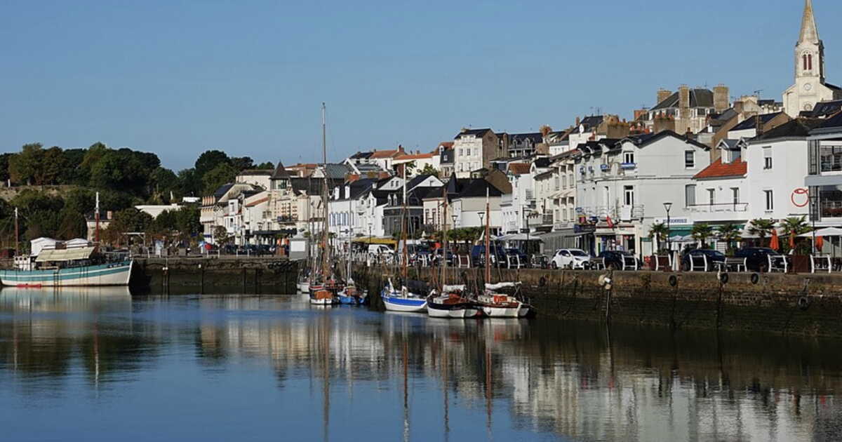
This loop goes around the Pays de Retz, this stretch of land between the Loire and the Atlantic. From the city of the Dukes of Brittany, you first pedal along the northern bank of the river, the scenery more pleasant. In Couëron, a free ferry links to the southern bank. The route heads toward the ocean by following the canal of the Martinière up to Paimboeuf, a former port with colorful façades. A few kilometers farther, after the Saint-Nazaire Bridge (we simply pass at its foot!), there is the Atlantic. The Loire à Vélo ends here, at the gaping maw of the Serpent d’océan, a work by Huang Yong Ping installed in 2012 as part of the festival Estuaire.
From there, the Velodyssée, the cycle route along the Atlantic coast, begins. After Saint-Michel-Chef-Chef, the tip of Saint-Gildas is a prime stop for a night by the sea. Or one can opt for Pornic, the “pearl of the Jade Coast,” with its grand villas overlooking the shore. From Bourgneuf-en-Retz, a departmental cycle route returns to Bouguenais, near Nantes, via Machecoul. A stop at Grand-Lieu Lake is a must to watch the birds (herons, storks…). And another stop at the gates of Nantes, in the village of Trentemoult, an adorable tangle of lanes with multicolored houses, where a few café terraces invite one last contemplation of the river.
Practical
Length: 175 km
Duration: 4 to 5 days
What to see along the way: the port of Paimboeuf, Saint-Brevin-les-Pins, the point of Saint-Gildas, Pornic, Machecoul and its castle, Grand-Lieu Lake, the village of Trentemoult…
South of Angers: Nose to the Wind Between the Maine and the Layon
Leaving Angers station to the west, the city quickly fades from view. You cross the Maine to access the towpath along the Bouchemaine embankment, which threads between a lake and the river amid urban bustle. Once on the Loire’s north bank, the first stop is on the Savennières hills, a village that lends its name to a famous white wine with notes of lilac, peach and honey. A short detour is recommended to Béhuard Island, just opposite, a must-see for its lanes and its 15th-century church perched on a rock.
In Chalonnes-sur-Loire, the excursion changes course. The designated route “Anjou vineyard and villages” leads to an old railway line converted into a greenway, which climbs the Layon and winds along its meanders, in the heart of steep vineyards. A small climb up the Anjou corniche allows a picnic with an exceptional view of the Loire. In Thouarcé, head north toward the Brissac Castle, the tallest in France, towering above the Aubance river by 50 meters. From here, you reach Les Ponts-de-Cé, south of Angers, then Sainte-Gemmes-sur-Loire (visit its gardens), Bouchemaine and the train station. Or you can head straight for the station, shaving about ten kilometers.
Practical
Length: 105 km
Duration: 2 to 3 days
What to see along the way: Savennières and its vineyards, Béhuard Island, Saint-Aubin-de-Luigné, the Brissac Castle, the gardens of Sainte-Gemmes-sur-Loire…
➤ Article published in GEO HS magazine no.134, “Grandes évasions à petite vitesse,” August–September 2026.
➤ If you love GEO, then to make sure you don’t miss anything, explore our subscription plans to receive GEO at home every month with ease.