Stepping over the gate of the private farm that leads to the Slope Point trail, the untamed character of these lands draws visitors into an enigmatic realm. Amidst sheep and trees bent by the wind, the spray of waves crashing violently at the foot of the cliffs lashed the face. Twenty minutes of walking are enough to reach the photogenic yellow sign marking the southernmost point of New Zealand (excluding Stewart Island): 5,140 km from the equator and 4,803 km from the South Pole, the sign states.
Slope Point is located in the tranquil Catlins region, home to about 1,500 inhabitants. “You mainly find small coastal villages, a few farms and two or three schools”, details Lloyd Esler, a teacher, tour guide and former city councilor of Invercargill, the largest nearby town. 75 kilometers away. In the Catlins, proximity is relative.
Southern Lights, Dolphins and Penguins
“Each year, around 30,000 people stop here. It’s an estimate; we don’t have precise tracking,” notes the teacher. Beyond this unique feeling of being at the edge of the world, as author Mélissa Da Costa so well describes in her book The Women at the End of the World, visitors come to this site for its dramatic scenery. “It’s a place highly appreciated by photographers, much like the Catlins as a whole”, explains Lloyd Esler. From the top of the cliff, with eyes fixed to the south, at dusk one can glimpse the aurora australis in the sky.
“It’s regular, but you have to be patient and lucky. The sky must be clear and you sometimes have to stay up late. Just last week, a very beautiful aurora was seen at Slope Point.” The southernmost point of New Zealand is also an ideal observatory for rare species: albatrosses, Antipodean penguins, Hector’s dolphins or more commonly fur seals and giant petrels glide around the unsteady waters of Foveaux Strait, which stretches from the Southland region to Stewart Island.
But they are not the only ones. Near the gate leading to the trail lies a commemorative plaque. Subtle, almost imperceptible, it pays tribute to men who fell at sea. “Every year there are accidents”, recounts the former councilor. The most infamous wreck is that of the Tararua in 1881: 131 lives lost and 20 survivors. It is the second-deadliest in the history of New Zealand. The SS Tararua wrecked on Otara Reef, at the foot of Slope Point and Waipapa Point.
Extreme Weather Conditions
All you have to do is look at the twisted trees leaning over the cliff to imagine the conditions under which sailors take to the sea below. Foveaux Strait is “renowned for its extreme weather and strong currents. It has long been a place both dangerous and of deep cultural importance. The Māori have navigated these waters for generations, and European seal and whaling hunters followed them in the early 19th century”, one can read on the region’s website.
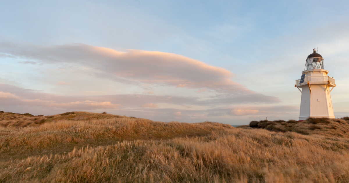
In response to the tragic wreck of 1881, a string of lighthouses was built along the Southland coast, including the famed Waipapa Lighthouse, located about 20 kilometers from Slope Point. “Today, sailors are more vigilant. There is better communication at sea and they know how to situate themselves”, says Lloyd Esler with satisfaction. More than just a postcard backdrop, this majestic site reminds us of a truth we often prefer to ignore. Nature, as beautiful as it may be in its wild and uncontrollable aspect, can also be a source of suffering if its power is underestimated.