On Pacific maps, the name of a tiny island state could soon be not quite the same. The change is official and will gradually ripple through administrative documents, international databases, and certain materials used by travelers. Yet, in this country of only 21 square kilometres, the chosen name is nothing new, as it has long been used by the local population. A decision that aims in particular to align the country’s international name more closely with its history and language.
An Ancient Name Reclaiming Its Official Place
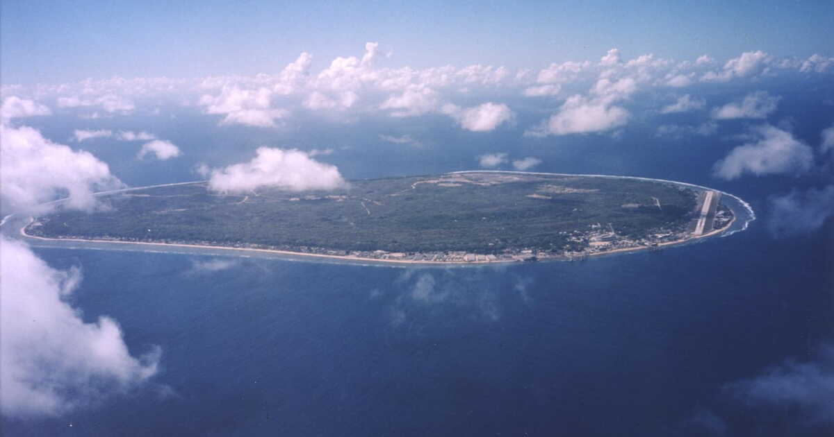
Situated northeast of Australia, in the Pacific, Nauru is one of the smallest countries on the planet. Its territory consists of a single coral island covering nearly 21 square kilometres, where around 12,000 people live. While its name is today well known in a form inherited from the colonial history, the inhabitants have long used another designation in their national language: Naoero.
It is precisely this latter form that has just been officialized: the country is now the Republic of Naoero. The government explains that the previous international form had mainly taken hold because foreign speakers had difficulty pronouncing the traditional name correctly. Over time, it would thus have evolved to give the form “Nauru,” which has become familiar to outsiders. The difference concerns more than spelling. The pronunciation traditionally used outside the country, “Now-roo,” now gives way to the pronunciation of Naoero, “Now-ero.”
The president David Adeang had championed this evolution when he proposed officially changing the country’s name. He stated in an official release that this decision would allow us to “more faithfully honor the heritage, language and identity of our nation”. “Today, we have the opportunity to bring our name home”, he also declared.
The move sits within a broader aim of strengthening the use of the indigenous language and reaffirming a distinct national identity. The island has indeed experienced several periods of foreign domination: annexed by Germany at the end of the 19th century, later placed under administration led notably by Australia, before attaining independence in 1968.
The name Naoero, for its part, already appeared on the national coat of arms. It should now progressively replace the old designation in official documents, national symbols, on aircraft and ships. The inhabitants themselves will adopt the official designation, and will henceforth be called “dei-Naoero”.
Travelers will have to get used to seeing two names on maps
For visitors, this change should however not provoke a radical shift. One should mainly expect a transition period during which both appellations may appear simultaneously. Airlines, booking platforms, maps, travel guides and international databases will indeed need to update their information gradually.
One of the more tangible changes concerns the international code assigned to the country. It will move from NRU to NRO. Travelers should not expect their plane tickets or baggage tags to change in the same way, as Naoero International Airport will retain its IATA code INU.
The aviation sector is also beginning to adopt the new terminology. A government communication published in August 2026 thus designates the national airline as “Naoero Airlines,” although the designation Nauru Airlines remains in use during the transition period.
This shift is not an isolated case. Several states have recently requested that their international name correspond more closely to their own language or national identity. In 2018, Swaziland officially adopted the name Eswatini. Four years later, the United Nations and other international organizations began to use Türkiye instead of Turkey, at the request of Turkish authorities.
Comparable efforts have also affected place names tied to colonial history in the United States. In Alaska, the town of Barrow reclaimed its traditional name Utqiaġvik in 2016. In Yellowstone National Park, Mount Doane was renamed First Peoples Mountain in 2022, while Mount Evans in Colorado became Mount Blue Sky in 2023 after several years of consultations.