Kyrgyzstan: An Extraordinary Hike Reveals 90,000 Prehistoric Petroglyphs

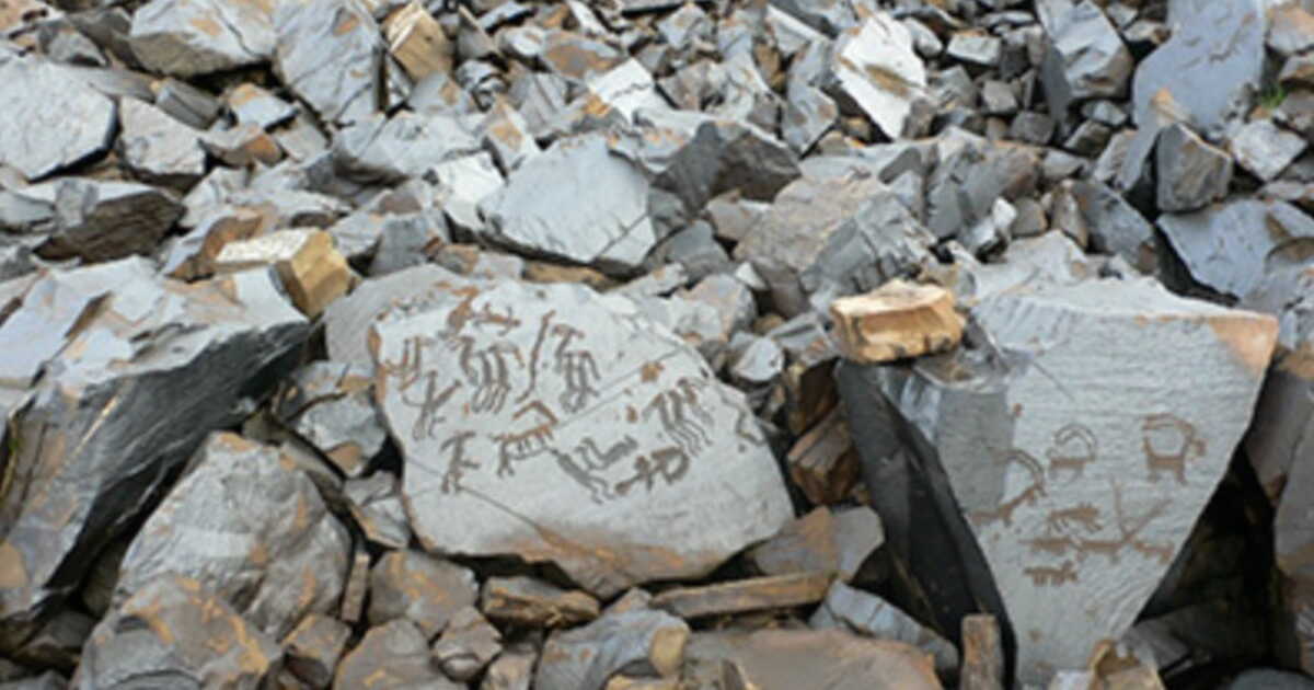
Lost in the Tian Shan mountains, in Kyrgyzstan, Saimaluu Tash holds a real treasure: nearly 90,000 petroglyphs carved on around 10,000 rocks. Some date back to the Bronze Age, about 4,000 years ago, bearing witness to a ritual occupation that lasted for nearly three millennia. Hunts, wars, animals, and scenes tied to the Sun’s cult follow one another on the blocks of volcanic basalt. But to discover this open-air art gallery, one must first tackle a particularly demanding route, accessible only a few weeks each year.

A 4,000-Year-Old Art Gallery

Saimaluu Tash, whose name means “Embroidered Stones” in Kyrgyz, sits more than 2,000 meters above sea level, in a glacial valley isolated within the Tian Shan. The site is regarded as one of the largest and most remote high-altitude petroglyph complexes in the world. The earliest engravings appear to have emerged in the Bronze Age, before later populations continued the work in the Iron Age, then during the era of the early Turkic peoples, up to around 900 CE.

The thousands of carvings etched into the basalt offer a rare glimpse into nomadic societies whose material traces are sometimes hard to trace. Notably visible are hunters, animals such as ibex, scenes of conflict, and depictions associated with the Sun. These images were presumably linked to the beliefs and ritual practices of the peoples who frequented the valley.

Before Islam arrived in Central Asia in the 8th century, Tengriism held a central place in the region’s beliefs. This tradition accorded a central role to the forces and spirits of nature, particularly through shamanic practices. Saimaluu Tash would thus have served as a place of worship for about 3,000 years, before gradually fading into oblivion.

The site was rediscovered only in 1902 by the Russian military cartographer Nikolai Khloudov. Archaeological investigations, however, did not truly begin there until the late 1940s. Since then, its isolation has paradoxically helped preserve it: looting and vandalism have remained limited, while the thick winter snow cover protects the rocks from significant temperature swings.

A Spectacular Site Yet Accessible Only for a Few Weeks

The discovery of Saimaluu Tash is well earned. From the Tian Shan’s mountains, the path winds over rocky terrain and notably crosses a temporary snow bridge. This access gate largely determines whether the site can be reached. Too early in the season, the petroglyphs are still buried under snow; too late, the passage may have melted away. The window during which the complex is accessible typically lasts about six weeks, from July to September.

After nearly three hours of walking, the first carved blocks come into view. For Altynai Kudaibergenova, a guide based in Bishkek, the ancient inhabitants would already have undertaken a true expedition to reach this sacred place. “Ancient peoples had to carefully plan their journey and face all kinds of difficulties to come here, year after year, for centuries”, she told CNN. “They had to travel along trails that skirt steep slopes and over ice-plateaus that linger in the shade and refuse to melt under the midsummer sun.”

The guide also notes the site’s particular position, set in a pass that links the Ferghana Valley with the interior of the Tian Shan. “It is the largest petroglyph site in Central Asia, left by different peoples across four millennia”, she says. Even today, Saimaluu Tash’s isolation remains part of the experience. Here there are no crowds or major tourist infrastructures, only the roughly 10,000 carved rocks sprinkled along the valley’s slopes. A tranquility that could become rarer as Kyrgyzstan grows more accessible as a tourist destination.
Mount Lure: A Hike Through Giono’s Lands of Freedom

“Hill after hill, you rise on one side and descend on the other, but each time you descend less than you have climbed. Thus, little by little, the earth lifts you up without pretending.”

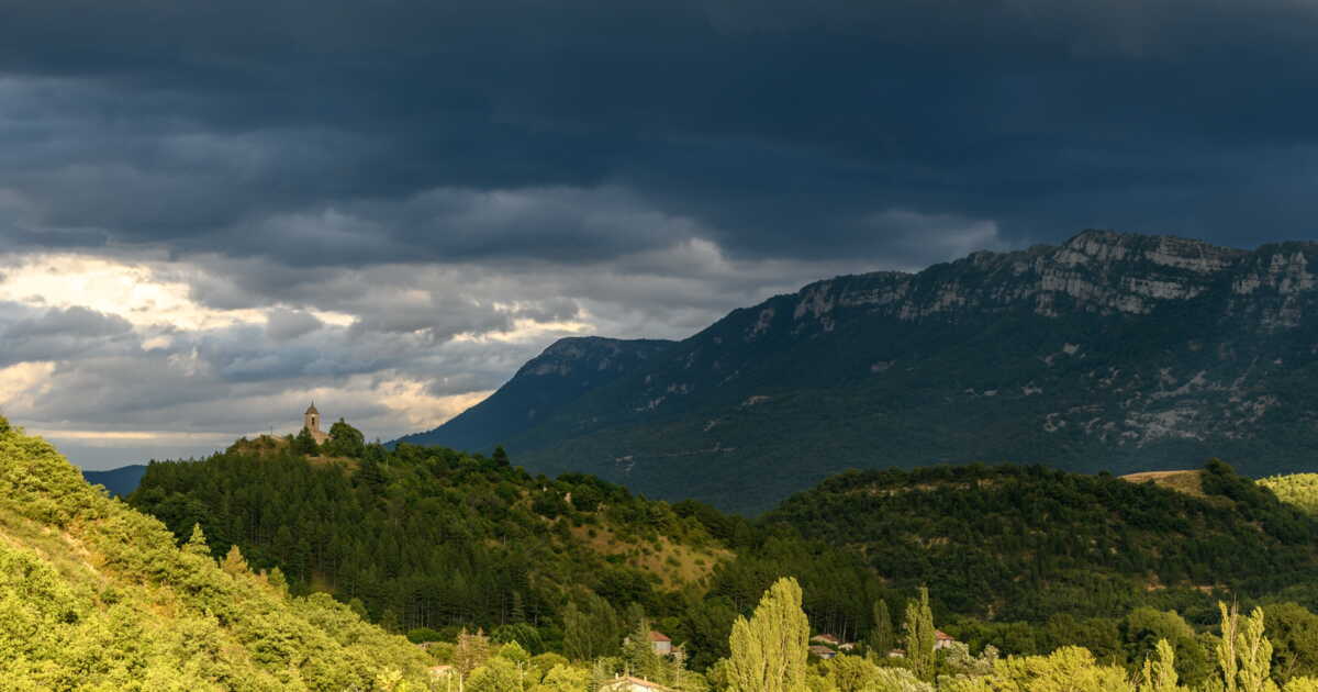
Thus, Giono describes a journey from Manosque heading north, in Regain, one of his early novels (1930). The mountain that fuels the writer’s heart is the Lure, a massif of the Southern Prealps rising to 1,825 m.

The land of free men

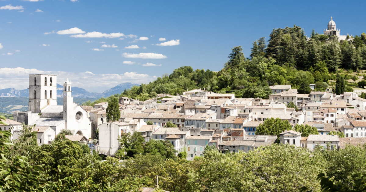
The Hills of Forcalquier: A Hike Through Giono’s Peasant Country

Approximately twenty kilometers north of Manosque, the country of Forcalquier plays a central role in Giono’s work. Not so much for the ancient county town, though splendid, which clings to its limestone spur like ivy to an old trunk. But rather for the surrounding countryside, which inspired him with numerous scenes of rural life.

The atmosphere of a rural Provence

La Gomera: Spectacular Roques Hike in the Canary Islands’ Volcanic Heartland


La Gomera : randonnée spectaculaire des Roques au cœur de l’île volcanique des Canaries - Photo JFR

Top of Travel


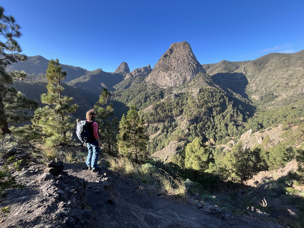
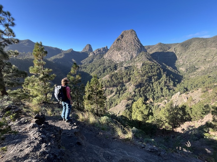
A hands-on geography lesson and a major physical exercise. It is by paying with one’s body that one will best enjoy one of the most impressive mountainous landscapes of La Gomera: The Roques, four volcanic spires rising above semi-arid slopes dotted with shrubs and conifers.

In almost 6 hours of walking, this looped itinerary begins and ends at La Laja, fifteen kilometers from San Sebastián, the main town of La Gomera.


Randonnée : la Laja, hameau niché dans un ravin

Beyond the last houses of this hamlet perched in a ravine, the path climbs steeply into the terrain toward the El Bailadero viewpoint.

Rapidement, la nature volcanique du terrain s’impose. Quelques dizaines de mètres plus loin se dresse, à droite du chemin, un haut mur naturel de pierre brun rouille.

Dans le langage local, on l’appelle un taparucha, une petite colonne de remontée de magma solidifiée et dégagée par l’érosion.


Filons verticaux et paysages volcaniques

Geologically, this is a dyke. Some have detached from the substrate, like this one. Others are enclosed in the rocks and form vertical veins, “rayant” the landscape.

As the trail climbs — one sometimes has to orient oneself by the cairns, small piles of stones marking the route — the view opens onto the first roque.

This is a bullet-shaped, conical rock; it is Ojila. Perched at 1,171 meters above sea level, it is made of trachybasalt. A remnant of the island’s ancient activity as well, two million years ago, this sugarloaf is in fact an old and wide eruption chimney eroded by the wear of the softer rocks that surrounded it.


La Gomera : repos bienvenue à El Bailadero

This hike confirms the volcanic origin of La Gomera. The peaks and slopes were subsequently shaped by water erosion and covered with vegetation that varies according to exposure to winds and sun. After 2 hours and nearly 500 meters of cumulative ascent, fatigue begins to set in.

Into a silence barely disturbed by the ringing of sheep bells rising from the valley floor, the El Bailadero viewpoint, at an altitude of 1,050 m, offers a welcome rest.

All visible to the south, the four roques undoubtedly constitute one of the most beautiful viewpoints of the hike: Ojila, Agando, La Zarcita and Carmona stand out against the azure sky.


Vue sur le Teide, point culminant de l’Espagne

What follows is a fairly long trek through the humid forest before reaching the summit of the hike, at nearly 1,250 meters above sea level. The Teide peak, towering over the neighboring island of Tenerife, looms on the horizon. This active volcano, perched at 3,715 meters, serves as the backdrop to multiple panoramas of La Gomera. It is the highest point in Spain.

After another pause at the belvedere of the roque d’Agando, the highest of the four (1,251 meters above sea level), the route descends into the La Laja valley, a quick plunge into a forest of Canary pines that leaves behind the four most famous sugarloaf peaks of La Gomera.