

The new Winter 2026-2027 brochure from Mondial Tourisme is now being distributed to travel agencies and is available online.
For this new season, the tour operator continues to develop its in-house clubs while expanding its long-haul offerings and the options for departures from the provinces.
But before addressing the winter schedule, Mondial Tourisme also draws a few lessons from the summer of 2026.
While Tunisia and the Canary Islands stood out as some of the best-performing destinations, the summer period was mainly characterized by a shift in customer behavior.
According to Laure Chevrinais, head of communications at Mondial Tourisme, the traditional July-August peak is losing ground to the shoulder seasons. “We are increasingly realizing that July-August is no longer the peak season as we used to know it“, she explains.
The summer of 2026 was also marked by geopolitical tensions and concerns about air travel.
Announcements about possible fuel supply difficulties or flight disruptions may have contributed to delaying decision-making. Some customers reportedly favored waiting to book later, pushing more bookings to the last minute.
For this new season, the tour operator continues to develop its in-house clubs while expanding its long-haul offerings and the options for departures from the provinces.
But before addressing the winter schedule, Mondial Tourisme also draws a few lessons from the summer of 2026.
While Tunisia and the Canary Islands stood out as some of the best-performing destinations, the summer period was mainly characterized by a shift in customer behavior.
According to Laure Chevrinais, head of communications at Mondial Tourisme, the traditional July-August peak is losing ground to the shoulder seasons. “We are increasingly realizing that July-August is no longer the peak season as we used to know it“, she explains.
The summer of 2026 was also marked by geopolitical tensions and concerns about air travel.
Announcements about possible fuel supply difficulties or flight disruptions may have contributed to delaying decision-making. Some customers reportedly favored waiting to book later, pushing more bookings to the last minute.
Three New Mondi Clubs in the Canaries
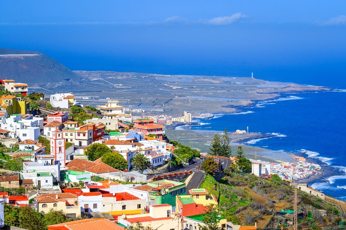
For the winter, one of the main development axes focuses on the Canaries. Mondial Tourisme unveils three new Mondi Clubs, bringing the brand’s total number of properties on the archipelago to seven.
In Lanzarote, the operator offers notably the Mondi Club Galeon Playa 3*, labeled Relax and available on a half-board basis, as well as the Mondi Club Beatriz Playa & Spa 4*, in all-inclusive format. In Tenerife, the Mondi Club Grand Muthu Golf Plaza 4* completes this new lineup.
This expansion follows a logic of growth in a destination capable of operating beyond the mere summer season.
“The Canary Islands are indeed a destination that works year-round, both in summer and in winter. That’s why we want to strengthen a little more in this destination“, emphasizes Laure Chevrinais.
With these new addresses, Mondial Tourisme aims to consolidate a destination already well established in its portfolio and to offer more choices to agencies and clients.
In Lanzarote, the operator offers notably the Mondi Club Galeon Playa 3*, labeled Relax and available on a half-board basis, as well as the Mondi Club Beatriz Playa & Spa 4*, in all-inclusive format. In Tenerife, the Mondi Club Grand Muthu Golf Plaza 4* completes this new lineup.
This expansion follows a logic of growth in a destination capable of operating beyond the mere summer season.
“The Canary Islands are indeed a destination that works year-round, both in summer and in winter. That’s why we want to strengthen a little more in this destination“, emphasizes Laure Chevrinais.
With these new addresses, Mondial Tourisme aims to consolidate a destination already well established in its portfolio and to offer more choices to agencies and clients.
Tunisia Remains the Operator’s Leading Destination
Tunisia remains the Mondial Tourisme’s main market. The tour operator claims more than 100,000 passengers per year to the destination, which is one of its historical focal points.
For the winter 2026-2027, the operator notably expands its lineup with the Welcome Meridiana 4* in Djerba. Already present in Mondial Tourisme’s programming, the property is now part of the Mondi Club range after several renovations.
The destination also benefits from a positioning particularly suited to the winter season, with a long-stay offer allowing travelers to chase sunshine a few hours from France.
For the winter 2026-2027, the operator notably expands its lineup with the Welcome Meridiana 4* in Djerba. Already present in Mondial Tourisme’s programming, the property is now part of the Mondi Club range after several renovations.
The destination also benefits from a positioning particularly suited to the winter season, with a long-stay offer allowing travelers to chase sunshine a few hours from France.
Egypt Aims to Confirm Its Restart
Another market under close watch for the upcoming season is Egypt. Mondial Tourisme broadens its program with a new seven-night package titled “Treasures of the Nile to the Pyramids of Cairo“.
The product combines Cairo sightseeing and a Nile cruise, in a shorter format than the nine-night package “From the Pyramids to the Red Sea” that is offered elsewhere. The stay is marketed from €1,289 per week.
For Mondial Tourisme, Egypt had been one of the destinations showing signs of recovery before the recent slowdown linked to geopolitical context.
“Before the conflict, it was really a destination that was rebounding very well. There was a small pause, but we hope it will start up again“, says Laure Chevrinais.
The choice of a new seven-night format should particularly help meet clients looking to combine several experiences without devoting too long to the trip.
The product combines Cairo sightseeing and a Nile cruise, in a shorter format than the nine-night package “From the Pyramids to the Red Sea” that is offered elsewhere. The stay is marketed from €1,289 per week.
For Mondial Tourisme, Egypt had been one of the destinations showing signs of recovery before the recent slowdown linked to geopolitical context.
“Before the conflict, it was really a destination that was rebounding very well. There was a small pause, but we hope it will start up again“, says Laure Chevrinais.
The choice of a new seven-night format should particularly help meet clients looking to combine several experiences without devoting too long to the trip.
Lapland: Regional Departures Reconfirmed
The Lapland is also among Mondial Tourisme’s bets for the winter.
Building on the success of the previous season, the operator is renewing departures to Finnish and Swedish Lapland from several French cities. Flights are scheduled from Deauville, Nantes, Lille, Strasbourg, Lyon, Toulouse, Bordeaux and Marseille, in addition to Paris.
The Mondi Club Sodankylä in Finnish Lapland remains at the heart of the program, with stays that incorporate the main Arctic experiences: dogsledding, snowmobiling, meeting reindeer, ice fishing, and the aurora borealis.
This regional departure strategy already appears to be paying off. “We can already see that it’s working very well“, confirms Laure Chevrinais.
Building on the success of the previous season, the operator is renewing departures to Finnish and Swedish Lapland from several French cities. Flights are scheduled from Deauville, Nantes, Lille, Strasbourg, Lyon, Toulouse, Bordeaux and Marseille, in addition to Paris.
The Mondi Club Sodankylä in Finnish Lapland remains at the heart of the program, with stays that incorporate the main Arctic experiences: dogsledding, snowmobiling, meeting reindeer, ice fishing, and the aurora borealis.
This regional departure strategy already appears to be paying off. “We can already see that it’s working very well“, confirms Laure Chevrinais.