Norway’s Border with Russia Under Surveillance Draws Hikers

At the extreme northeast of Norway, trails allow walkers to approach the Russian border as closely as possible. But behind the landscapes of boreal forests and tundra, hikers discover a territory where cameras, lookout posts, and military patrols remind how sensitive the place is. For several years now, this 198-kilometer border has drawn more visitors, notably cruise ship passengers. A tourist curiosity that takes on a very particular dimension here.

A border turned into a tourist attraction

In Kirkenes, a small town near the meeting point of Norway, Finland, and Russia, the border has become one of the curiosities offered to travelers. Several operators run guided walking excursions in the area, notably along the Pasvik River. One route lasts about three hours and leads to Russehøgda, a summit overlooking the Storskog border post, the only land crossing allowed between the two countries.

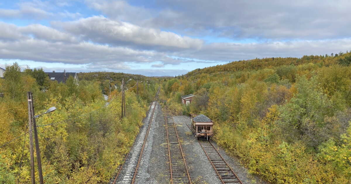
The hike first passes through a birch and conifer forest before reaching a cleared forest belt eight meters wide. This strip marks the border area and visitors are not allowed to venture into it. Yellow boundary posts on the Norwegian side and red ones on the Russian side mark the international boundary.

Security has tightened since Russia invaded Ukraine in 2022. Visitors may notice cameras installed in trees, observation posts, and military patrols. Some rules are particularly strict: it is notably forbidden to photograph soldiers, to touch or climb the border posts, or to throw objects toward Russia. Hikers must also carry their passports with them.

For Henrik Hoffmann, a guide stationed in Kirkenes since 2021, this particular atmosphere is part of what makes the excursion appealing. “Many older travelers are especially interested because they remember the Cold War and have followed the relations between Europe and Russia for decades,” he told the BBC. According to him, the hike also helps visitors grasp concretely what it means to live near this border.

The interest of visitors, in fact, has grown in recent years, after an initial decline in tourism following Russia’s invasion of Ukraine. Havila Voyages has offered excursions in this region since 2000, while Hurtigruten also organizes a border visit, which includes, among other things, a World War II-era anti-aircraft shelter.

In the Footsteps of a Turbulent History

Yet this border is not limited to its present surveillance measures. Across the Kirkenes region, traces of a long-shared history among Norwegians, Finns, and Russians remain visible.

In the town, some streets indeed bear signs in both Norwegian and Russian. A monument also commemorates the liberation of Kirkenes by the Red Army in 1944, after the Nazi occupation. At the Borderland Museum, visitors can discover the relations that have shaped this border region over generations.

Further on, the Pasvik River winds a sinuous course before skirting the Boris Gleb Orthodox Church. Dating from the 12th century, the building played a role in defining the modern border, established about two centuries ago.

From the heights of Russehøgda, the contrast is striking. Tundra and forests spread around the hiker, while the facilities of the Storskog post appear in the distance. A few vehicles continue to cross the border daily, even if recreational crossings have diminished.

And despite the increasing crowd of visitors, fewer locals seem to take these paths. “You don’t see many Norwegians here,” notes Henrik Hoffmann, before suggesting that this might be a classic case of a population that explores less of its own surroundings.

The hike therefore offers much more than a stroll through Arctic landscapes. Just meters from the posts that separate Norway and Russia, the scenery constantly reminds us that this part of Europe is also a space where history and geopolitical tensions remain very concretely visible.
Yunnan’s Giant Elevator That Helps Schoolchildren Also Draws Tourists

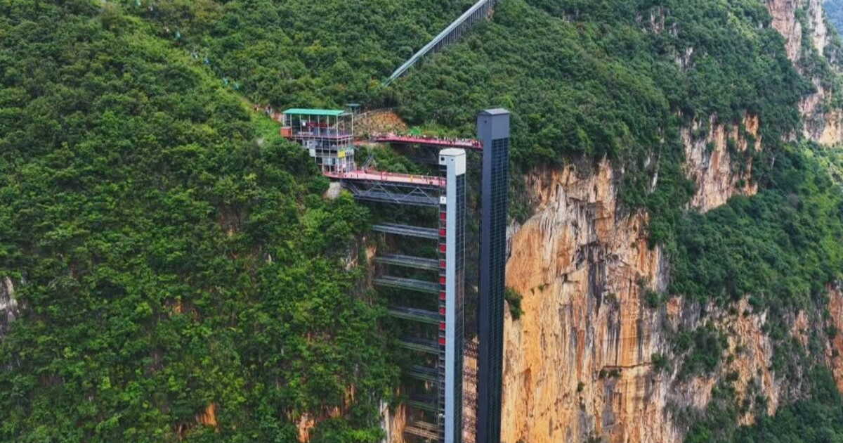
No longer needing to rise at dawn. The lives of about twenty Chinese children have become much simpler thanks to a simple elevator. Until now, these inhabitants of Yunnan province in the southwest of the country had to plan for a three-hour trek to reach their school, perched at the top of the Nizhuhe Grand Canyon. With the installation of an elevator called Fuyao and built by the Chinese company Ningbo Hongda Elevator, the journey now takes only half an hour, according to Interesting Engineering.

This glass cabin, which can accommodate up to 81 people at a time, makes it possible to ascend the roughly 288 meters separating the village of Nizhuhe from the other communities in the city of Xuanwei, at the canyon’s edge, in just 50 seconds. To reach Guanzhai School, at an altitude of 1,650 meters, residents must, after exiting the elevator, ride a cable car for 30 minutes.

Tourists also greatly benefit from the new elevator

In 2022, already, a steel elevator named Qingyun had been erected along the canyon’s rock to facilitate journeys. Building a second one was not easy, particularly due to the logistical constraints of installing an elevator in the middle of a canyon that is heavily affected by humidity and fog. But it is now fully functional and complementary to the previous one.

The opening of Fuyao was not only designed to accommodate the handful of exhausted schoolchildren who faced six hours of walking each day to study. It is also a way to attract tourists. Since its inauguration, authorities estimate welcoming up to 15,000 visitors per day.

In China, altitude is no joke

The Chinese are no strangers to elevator feats. In Zhangjiajie National Forest Park sits the Bailong Elevator. It is regarded as the tallest outdoor elevator in the world, capable of climbing up to 326 meters amid the mountains that served as the backdrop for the film Avatar.

To draw in tourists, Chinese authorities are also rolling out even more spectacular attractions: glass bridges and suspended ladders have proliferated in recent years across the country. A way to scare oneself and make a splash on social media… to entice others to visit.

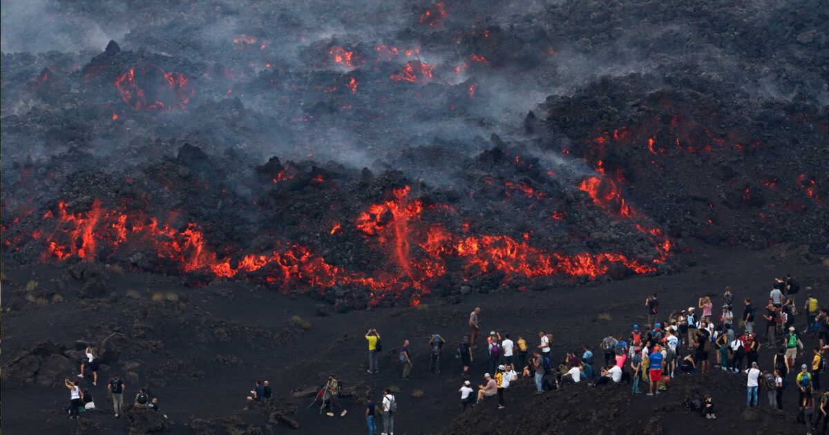
Etna Eruption Draws Record Crowds, Dismaying Local Guides

Spectacular images of lava flows racing down the slopes of Mount Etna during an eruption have drawn crowds of tourists to the Italian volcano, much to the dismay of local guides. As Europe’s highest active volcano, Etna has been spewing ash and lava for several days, forcing the closure of the nearby Catania airport, a major entry point for visitors to Sicily.

An ascent that cannot be improvised

The companies organizing nighttime hikes to allow participants to observe the eruption up close say they are overwhelmed with calls. “Everyone wants to come see”, Daniele Perricelli, 41, a local guide, told AFP on Wednesday.

Perricelli’s group, “Etna Guide,” leads a few dozen visitors onto the volcano each evening, but is currently receiving about 300 requests per day, three times as many as a typical summer day, he said.

Ernesto Maria Magri, another local guide, dubbed the event a “tourist eruption”, noting that many residents of the region were also climbing to see the lava “sometimes in an unruly fashion”.

For lack of being able or willing to hire a guide, many attempt the ascent on their own. A risky practice, according to Mr. Perricelli, who explains that the volcano is unstable. “Up to 2,000 people make the ascent each evening: the trails are crowded”, he lamented. “Yesterday, we even saw some in flip-flops”, he added, calling on authorities for greater vigilance.

Certain hikers, including Italian television presenter Diletta Leotta, were criticized on social media for taking photos while seeming too close to the incandescent lava.

Nevertheless, guides emphasize that it is possible to approach within a few meters of the lava flow in the lower-altitude zones where the lava has already cooled.

Under current rules, visitors may ascend by themselves up to around 2,400 meters, but must be accompanied by a guide to go higher.

The summit reaches 3,324 meters. Italy’s Civil Protection Agency issued a yellow alert for Etna — the second level on a four-tier scale ranging from green to red — signaling frequent eruptions and potential explosions.

Giant Swing Over the Void in Switzerland Draws Visitors

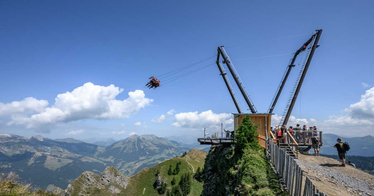
As the chairlift nears the summit of Grand Chamossaire, in Switzerland’s alpine village of Villars, screams mixing fear and exhilaration echo above the drop. Perched atop the mountain at an altitude of 2,110 meters, a towering V-shaped structure supports a giant swing that propels its passengers toward a breathtaking alpine panorama.

“There’s a little knot in the stomach for sure, but once you’re up there it’s incredible: you feel like a bird,” says Alexandra Henchoz, 37, who came to test the ride with her husband and their 10-year-old daughter.

Adapting to Climate Change

Opened at the start of the month, the Grand Chamossaire swing is the latest move by alpine resorts to attract summer visitors and monetize their lifts, as snow reliability becomes more uncertain due to climate change. “We are really looking to diversify our offering,” explains to AFP Martin Deburaux, director of the Villars-Gryon-Diablerets ski area.

This new 12-meter-tall swing, similar to others already installed in Megève or La Clusaz in France, “finally gives us an attraction that can operate irrespective of snow conditions,” he notes.
Mr. Deburaux recalls that the resort saw record footfall over the past two winter seasons, as skiers who typically visited lower-altitude areas turned to higher, better-snowed resorts.

“Nevertheless, we’re facing climate change. We’ve also conducted a study on the snow potential we’ll have in 2050, and we’re simply preparing for less snow or more irregular snowfalls,”

Mountain Resorts Bet on Summer

Today, the resort hosts more than 700,000 visitors in winter, versus only 100,000 in summer. Its goal is to triple summer attendance in the coming years, Martin Deburaux explains, noting that this will come through a multiplication of available activities. He also adds that the swing was deliberately placed in an already busy area in order to preserve the wilder parts of the domain for nature lovers.

Nearby, hikers traverse the green trails, while helmeted and protected mountain bikers sprint down a steep dirt track. The route runs alongside an ephemeral land art mural created on a mountainside by French artist Saype, depicting a child in the act of drawing.

Accessible to anyone with a ski-lift pass, the swing can accommodate up to three people at a time. Each rider sits astride a saddle mounted on a metal frame resembling an Alpine ibex. Securely strapped in, they grip a handlebar. A clever system of cables and pulleys then lifts the riders to a 90-degree angle, leaving them suspended face-down.

When the safety cable is suddenly released, the swing tips into the void. The cries of excitement, mingled with a few curses, accompany the descent, before suddenly giving way to a spectacular view of the valley, with the rocky, lightly snow-dusted summits in the backdrop.

Marc Truffer, 70, recalls feeling both terrified and excited at the prospect of testing the attraction. “Well, it’s scary, as I expected, and then I was speechless, I didn’t even shout,” he tells AFP. “The descent takes your breath away, and afterward the view is magnificent.”

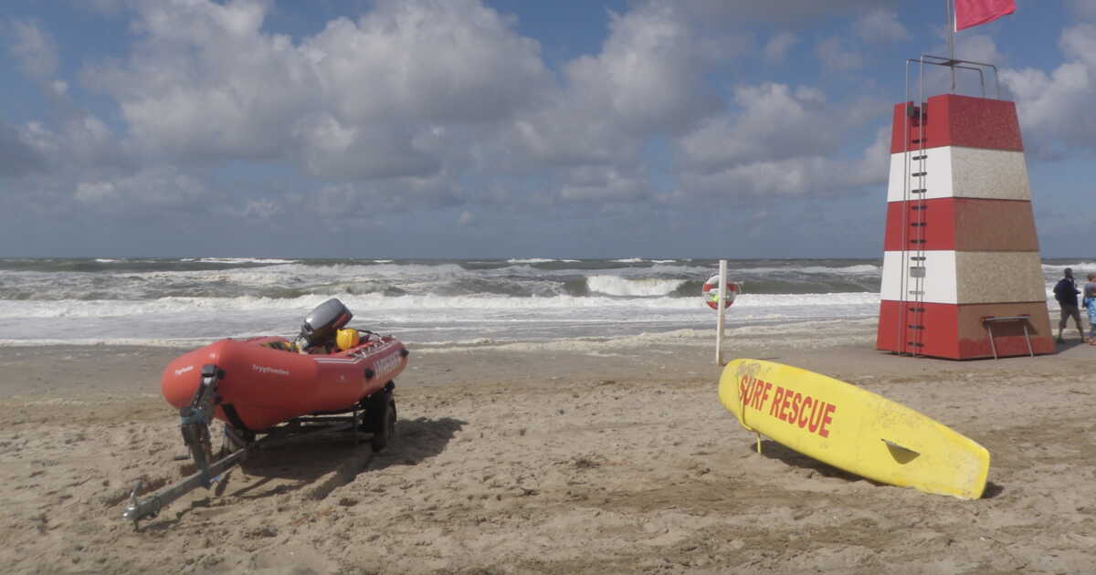
Europe’s Coast Nicknamed Cold Hawaii Draws More Visitors

At first glance, there is nothing about this coast that sets it apart from any other North Sea shoreline battered by wind. Yet, for about thirty years, it has built a solid reputation among surfing enthusiasts. Today, this region is undergoing a new metamorphosis: alongside wind-surfing schools and wild beaches, there are now Michelin-starred restaurants, contemporary art galleries, and even an outpost of the National Gallery of Denmark.

An evolution that makes “Cold Hawaii,” in Denmark’s Jutland, one of the most remarkable destinations in Northern Europe.

Waves That Changed the Destiny of This Danish Coast