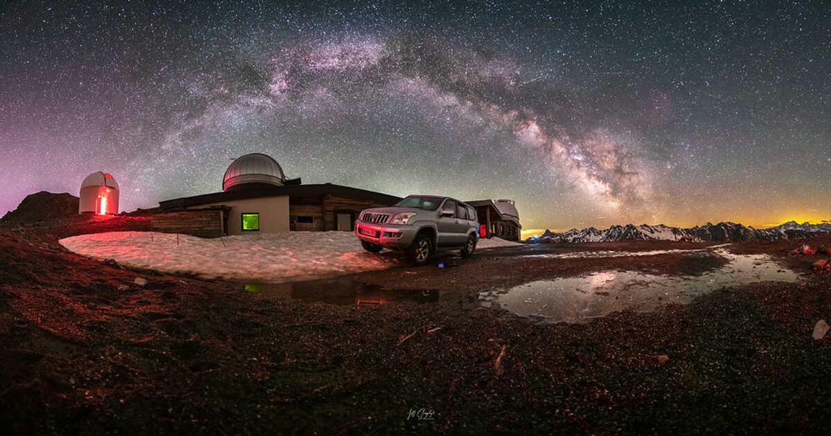
To witness the most beautiful night sky of the Hautes-Pyrénées, this is where you must go. The first French territory to earn the label “International Dark Sky Reserve,” the IDSR of the Pic du Midi de Bigorre safeguards a 3,000 km² area between Lourdes and Saint-Lary-Soulan, where everything is done to reduce light pollution. At the heart of this darkness, in the darkest zone of the reserve, stands the Pic du Midi Observatory. A landmark in astronomy where, if you plan ahead, you can sleep there. And it serves as the starting point for a very beautiful nocturnal hike. An unforgettable descent, with the stars as your only guide.
Practical
Itinerary : from La Mongie, take the last cable car of the day up to the peak. Then follow the trail toward the Col du Tourmalet.
Duration : 4 hours to complete 7 km and 760 m of descent.
Tip : guided trips with the local agency Acumpanyat Expériences. acumpanyat.com
A Little Closer to the Firmament
With its three domes perched on a promontory at an altitude of 2,930 meters, the Saint-Véran Observatory, in the Hautes-Alpes, is one of the highest in Europe. Year-round, it welcomes amateur astronomers drawn as much by its state-of-the-art equipment as by the exceptional weather conditions offered by this part of the Queyras (300 days of sunshine per year). The observatory is also open to hikers who love the stars, who climb there in the late afternoon, then descend at dawn after a full night to greet the celestial bodies.
Practical
Itinerary : from the Maison du Soleil et de l’astronomie of Saint-Véran, cross the ski runs and then take the ridge path (yellow markings).
Duration : about 4 hours of walking (900 m of elevation).
No need to climb peaks to escape light pollution. Between Figeac and Cahors, in the Causses du Quercy Regional Natural Park (Lot), there is a plateau area enjoying extraordinary natural darkness. With 55 communes labeled “Starry Towns and Villages Territory,” this Black Triangle of the Quercy offers a fantastic playground for night hikers… regardless of their knowledge of astronomy.
Practical
Itinerary : for a gentle introduction, we recommend the night trail starting from the village of Corn. A way to rediscover the landscape, thanks in particular to phosphorescent panels.
Duration : two hours, taking your time on this easy 4 km path.
Advice : the astronomy clubs of Gramat and Gigouzac offer guided night walks all summer.
➤ Article appeared in GEO HS magazine no. 133, “France, our favorite walks for the summer”, June-July 2026.
➤ Do you love GEO? Then to miss nothing, discover our subscription plans to receive GEO every month at your home with ease.
6. Immerse yourself in the atmosphere at Kermel Market and Sandaga Market
7. Explore the Mamelles Lighthouse
8. Observe the biodiversity of the Madeleines Islands
9. Discover the Soumbédioune Artisan Village
10. Join an organized excursion
11. HLM Market: an authentic immersion in the heart of local life
12. Village des Arts: a haven of contemporary creation
13. Explore the Lompoul Desert from Dakar: a natural escape within easy reach by road
In Dakar, each day can take on a different hue: cultural in the morning, seaside in the afternoon, festive as night falls. Between iconic sites, natural getaways, and immersion in local life, the Senegalese capital offers a multitude of experiences to discover Senegal in a different way.
1. Visit Gorée Island and the House of Slaves
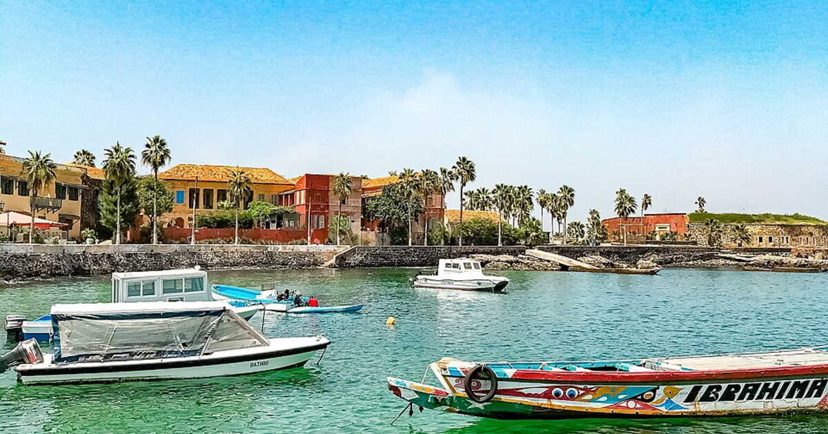
Classified as a UNESCO World Heritage Site, Gorée Island is a crucial stop to understand the history of the slave trade in Africa. Accessible by a short ferry ride from the Port of Dakar, the island houses the famous House of Slaves, a poignant museum that recounts the suffering and resilience of a dark era. Beyond its historical past, Gorée captivates with cobbled streets, colorful houses, and panoramic views of the Atlantic Ocean.
2. Discover the African Renaissance Monument
The African Renaissance Monument is one of the most striking sculptures on the African continent. Standing 49 meters tall, it overlooks the city and offers a breathtaking panorama over Dakar and its surroundings. Inaugurated in 2010, this modern monument symbolizes Africa’s renewal, and the ascent to the summit includes a small exhibition about Senegal and its future aspirations.
3. Explore the Museum of Black Civilizations
Inaugurated in 2018, the Museum of Black Civilizations marks a turning point in the preservation and diffusion of African culture. This museum offers a range of permanent and temporary exhibitions, illustrating African heritage in all its forms. It is essential for anyone wishing to understand the richness and diversity of African civilizations throughout history.
4. Relax on the beaches of Ngor and Yoff
Dakar is home to several beaches ideal for relaxing or water activities. The Ngor and Yoff beaches are among the locals’ and visitors’ favorites. Whether you simply want to soak up the sun, go surfing, or enjoy a fresh seafood meal with an ocean view, these beaches offer multiple possibilities.
5. Stroll around the Rose Lake (Lac Retba)
The Rose Lake, officially named Lac Retba, is famous for its spectacular pink color, caused by microalgae that produce a red pigment. This natural phenomenon draws many tourists and is particularly photogenic at sunset. Pair your visit with a tour to discover traditional salt-extraction methods, a pillar of the region’s economy.
6. Immerse yourself in the atmosphere at the Kermel Market and the Sandaga Market
For a total immersion into Dakar life, a visit to the local markets is a must. The Kermel Market, renowned for its colonial architecture, offers a wide range of local products, from spices to seafood. The Sandaga Market, meanwhile, is the ideal place to find artisanal souvenirs and admire Senegalese crafts.
7. Explore the Mamelles Lighthouse
Located on the second of the two twin hills that form the Mamelles, the Dakar Lighthouse is an iconic spot to admire the sunset. Once at the summit, you’ll have a breathtaking view of the city, the ocean, and the surrounding area. It is also a good spot for hikers of easy to moderate difficulty.
8. Observe the biodiversity of the Madeleines Islands
Just a short boat ride from Dakar, the Madeleines Islands is a national park where nature reigns. You’ll find spectacular rocky landscapes and diverse birdlife. It’s an ideal day trip for nature lovers looking to explore a still-wild and pristine environment.
9. Discover the Soumbédioune Artisan Village
For a plunge into Senegalese craftsmanship, head to the Soumbédioune Artisan Village. You can watch artisans at work and discover a wide range of handcrafted creations, from jewelry to wooden sculptures. Interacting with the artisans will also offer a deeper glimpse into local culture and know-how.
10. Join an organized excursion
To visit distant sites or combine several activities in a day, consider booking an excursion with a local guide. There are many options to explore the Rose Lake, Gorée Island, and other attractions, while easing logistical travel around the region.
11. HLM Market: an authentic immersion in the heart of local life
The HLM Market is one of the most iconic places to understand Dakar’s daily life. Located in a lively district of Dakar, it stands out for the variety of its stalls, colorful fabrics, and its organized vibe. This market is a perfect spot for crafts and direct exchanges with vendors, often recommended by any comprehensive travel guide. Easily reachable by yellow taxis, it complements an urban exploration focused on authenticity and the experiences of this journey.
12. Village des Arts: a haven of contemporary creation
The Village des Arts stands as a haven for peace dedicated to contemporary creation in Dakar. This site brings together studios, exhibitions, and artist residencies, offering a current view of Senegal’s cultural scene. Located away from the busiest routes, it allows a more intimate experience, often included in recommendations from any travel guide. This visit nicely complements the more institutional circuits of the city center, revealing another facet of the capital.
13. Explore the Lompoul Desert from Dakar: a natural escape within easy reach by road
About 140 km from Dakar (a little over two hours by car), the Lompoul Desert offers a striking contrast to urban bustle. Accessible via the Dakar road, this natural site features dunes, campsites, and quiet, making it an ideal extension to an urban stay. Often included in the experiences of this trip, Lompoul charms with its isolated character and immersive ambiance. This excursion, frequently mentioned in any comprehensive travel guide, helps broaden Senegal’s discovery beyond the capital.
In conclusion, Dakar is a city with many facets that offers visitors a compelling blend of historical, cultural, and natural discoveries. Whether you have one day, a weekend, or several days to spend there, there is always something to explore. To deepen your experience, consider related topics such as Senegalese cuisine or the local music scene, which add yet another unique dimension to this unforgettable destination.
Is Dakar an expensive city? Understanding prices and the cost of living in the Senegalese capital
Asking whether Dakar is an expensive city comes down to analyzing a contrasted reality common to any major metropolis in West Africa. Prices vary widely depending on the district of the city of Dakar, the type of accommodation chosen — hotel room, guesthouse room, or room in a house — and the time of stay.
The city center and the Plateau, near the presidential residence, generally show higher prices than other Dakar districts. The best rates are often found by booking in advance or by venturing away from the most frequented Dakar road.
On transport, yellow taxis remain affordable for short trips across a few kilometers of Dakar, while the air travel options, notably via Air France on the Paris-Dakar route, help plan the overall budget. Dakar thus offers an experience adaptable to different spending levels, without compromising the richness of the experiences of this journey.
What to do in Dakar at night? Restaurants, the Corniche, and nightlife experiences
In the evening, Dakar reveals a lively and welcoming atmosphere, especially along Dakar’s Western Corniche, now a must-visit gathering spot. Here you’ll find numerous seaside restaurants, seafood joints, and restaurant-bars offering views of the Dakar skyline.
The Pointe des Almadies, loved by surf enthusiasts, hosts a vibrant nightlife, while the Mamelles Lighthouse is a popular vantage point at sunset. Getting around is easy with taxis, typically yellow taxis, quickly linking the different centers of the downtown. These evenings contribute to a colorful experience, perfectly integrated with the experiences on this page, blending relaxation, gastronomy, and urban discovery.
What to do in Dakar this weekend? Must-see itineraries and experiences
A weekend in Dakar allows you to combine heritage, nature, and culture within a compact area. On Saturday, exploring the IFAN Museum, the Independence Square, and the Notre-Dame Cathedral provides an essential introduction to the city’s history, marked by the slave trade and the legacy of Léopold Sédar Senghor.
On Sunday, a trip to the Western Corniche or the Pointe des Almadies provides a breath of sea air, while nearby nature reserves offer a tranquil haven. These routes, outlined in any comprehensive travel guide, let you fully experience the trip’s highlights in a concise but rich timeframe.
What to do in Dakar with family or children? Accessible and educational activities
Traveling to Dakar with children is particularly fitting thanks to a varied range of cultural and outdoor activities. Walks along the Western Corniche, the beaches at the Pointe des Almadies, or spaces set up for outdoor fitness trails provide relaxing moments accessible to all.
Educational visits such as the IFAN Museum or the Dakar Cathedral of the African Memorial allow for a structured approach to the country’s history. Getting around by yellow taxis makes short trips easy, and the availability of family rooms in guesthouses or in hotel rooms ensures a comfortable stay.
Dakar thus stands as a perfect destination for a rewarding multi-generational trip.
What to do in Dakar in the Plateau neighborhood? Exploring the institutional and historical heart
The Plateau, located in the very heart of the downtown, concentrates Dakar’s institutional and historical symbols. Here you’ll find the presidential residence, buildings related to the Governor of Dakar, and Independence Square, the city’s nerve center.
The stroll continues toward the Notre-Dame Cathedral, the colonial-era buildings, and the major administrative arteries. This neighborhood, easily reachable by taxis, is a key stop in any travel guide, offering a clear understanding of Dakar’s political and urban organization.
What to do in Dakar when it rains? Museums, markets, and culture indoors
When weather limits outdoor activities, Dakar still offers a wide range of cultural options. Museums, notably the IFAN Museum, allow you to discover West African art and history indoors. The HLM Market also provides a sheltered immersion into the local experience, ideal for purchasing crafts. Cafés, restaurants, and restaurant-bars in the city center offer warm venues to extend the discovery. These alternatives are an integral part of the experiences on this page, illustrating Dakar’s versatility in any weather.
This article was written with the help of artificial intelligence, then corrected, expanded, and validated by the editors of the desk.
They say all roads lead to Rome, and for these five, that’s precisely true. At a moment when hiking is gaining popularity — nearly 30 million French people report having practiced it in the last 12 months, making it the most widespread physical activity — here are five itineraries rich in history and culture, to walk in order to discover Italy differently. From nature trails to villages, the “Antichi cammini d’Italia” (Ancient Paths of Italy) unfold several hundred kilometers across the country, and even beyond to the heart of Europe. All converge on Latium and Rome, and all share the common aim of revealing a preserved Italy.
1/ The Via Francigena, one of the oldest medieval pilgrimage routes
A thousand kilometers through some of the most beautiful landscapes in Italy: a dream come true! The Via Francigena is one of Europe’s most attractive cultural routes. While it links Canterbury to Rome, it is its Italian section that enchants walkers from all over the world the most. From the Grand-St-Bernard Pass to the Eternal City, the Italian stretch, about 1,000 kilometers long in 45 stages, reaches its experiential heart in Latium, through the Tuscia of Viterbo. In Bolsena, on the shores of the eponymous lake, the Eucharistic miracle of 1263 inspired the feast of Corpus Domini; Montefiascone houses the Rocca dei Papi, the papal fortress; Viterbo, an ancient papal city, preserves one of the largest medieval districts in Italy; Sutri offers its Roman amphitheater entirely carved in tuff. At the end of the path, La Storta, the final stop before Saint Peter.
Basilica di Santa Margherita a Montefiascone
2/ The Saint Francis Way: between forests, villages and sanctuaries
This route, both athletic and spiritually infused, connects the most emblematic places of Saint Francis of Assisi’s life. It consists of two branches that converge on Assisi: the North Way, about 190 kilometers from La Verna where Francis received the stigmata in 1224, and the South Way, about 300 kilometers in 13 stages, which traverses Latium entirely from Rome to Assisi. In the heart of Latium, in the Valle Santa of Rieti, four Franciscan sanctuaries concentrate the memory of decisive moments in the Saint’s life: Greccio, where in 1223 Francis made the first crib in history; Fonte Colombo, where the Rule of the Order was dictated; La Foresta, the site of the grape miracle; and Poggio Bustone, where he received the revelation of the forgiveness of sins. Upon arrival in Assisi, pilgrims receive the Testimonium.
3/ The Benedictine Way: on foot, by horse or by bike through the villages of Umbria and Latium
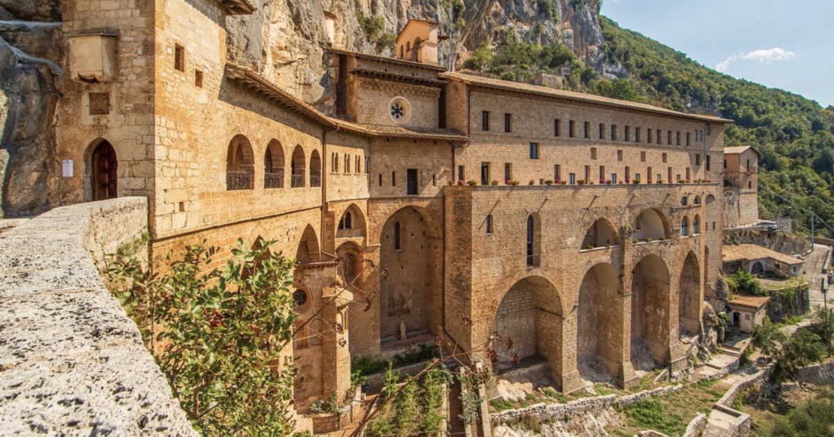
From Norcia in Umbria to Montecassino in Latium, this route exudes a singular spiritual and cultural depth. The itinerary runs about 300 kilometers in 16 stages — and it is in Latium that the longest stretch unfolds, across the Aniene Valley and the central valleys of the Apennines. In Subiaco, the Sacro Speco houses the cave where Saint Benedict lived as a hermit for more than thirty years, while the Abbey of Santa Scolastica hosted in 1465 the first active printing press in Italy. From there the path continues via Trevi nel Lazio, Casamari with its Cistercian abbey, Arpino (birthplace of Cicero), Roccasecca (linked to Thomas Aquinas) and the Melfa Gorges, before culminating at Montecassino, where around 529 Benedict founded the abbey that remains the heart of the Order. Patron of Europe since 1964.
Ponte di San Francesco,Subiaco
4/ The Romea Strata: on the traces of pilgrims from Central and Eastern Europe
The complete route follows the tracks of medieval pilgrims for over 4,700 kilometers across seven countries, from the Baltic and Central-Eastern Europe to Rome. Recognized as a Council of Europe Cultural Route on June 17, 2025, the Romea Strata comprises 245 stages and more than fifty UNESCO sites along its journey. Its Italian section spans about 1,000 kilometers in 47 stages and touches, in Latium, Bolsena, Montefiascone, Viterbo and San Martino al Cimino before reaching Rome as the culmination of the voyage. Since 2024, thanks to mapping work by a network of volunteers, the final stretch no longer joins the Via Francigena: the Romea Strata now has an autonomous entry into Rome, which defines its identity.
5/ The Via Romea Germanica: from Germany to Saint Peter in Rome, following the path of a 13th-century abbot
The Via Romea Germanica retraces the route of Abbot Albert of Stade, who walked in the 13th century from Lower Saxony to Rome. The Italian section measures about 1,050 kilometers from the Brenner Pass to Rome and joins, in Latium, the Via Francigena at Montefiascone. From that point, the two paths merge and together cross the Tuscia of Viterbo: Bolsena, Viterbo — where every September 3 the Macchina di Santa Rosa takes place, recognized by UNESCO as intangible cultural heritage of humanity —, Vetralla, Sutri and the Veio Regional Park, up to La Storta. A northern variant in Latium also passes through Civita di Bagnoregio, the famous “dying city” perched on a tufaceous spur in the heart of the Tuscia.
Along the Antichi Cammini d’Italia, each stage offers a plunge into an Italy still preserved, where history, nature and contemplation blend harmoniously. At the end of these long marches, in Rome and in Latium, it is the living heart of the country that speaks.
Mausoleo di Romolo, Roma
To learn more
Projet financé par l’Union européenne – Next Generation EU « Antichi cammini d’Italia »,
PNRR – Mission M1C3 Investissement 4.3 Intervention 274 – maître d’ouvrage MINISTÈRE DU TOURISME ITALIEN, Agence d’exécution ENIT SpA
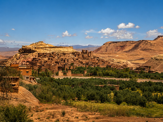
With our presence in Marrakech and Ouarzazate, we are ideally positioned to craft stays that fit every desire: cultural discovery, nature, adventure, wellness, or incentive travel.
Our team flawlessly masters the diverse regions of Morocco and carefully selects accommodations, transport, and activities to guarantee each client a personalized experience.
Trips and Tours for All
NAGA TRAVEL offers:
Private and escorted tours across Morocco;
Stays in charming hotels, guesthouses, and riads;
Trips to the Sahara desert with bivouacs at Erg Chegaga;
Day trips starting from Marrakech;
Themed stays: wellness, yoga, gastronomy, photography, or adventure;
School trips and associations/groups travel;
Tailor-made programs for European travel agencies.
Marrakech and Its Must-Do Experiences
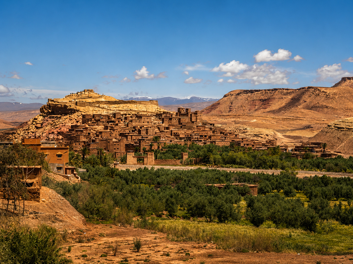
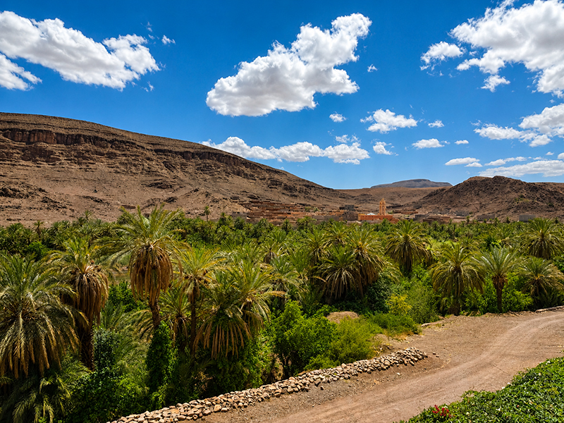
A few kilometers from Marrakech, travelers can discover the spectacular landscapes of the Agafay Desert, the green valleys of Ourika, and the Berber villages of the High Atlas.
To enrich their stay, we also offer a wide range of activities:
Moroccan cooking classes;
Hikes and walks in the Atlas Mountains;
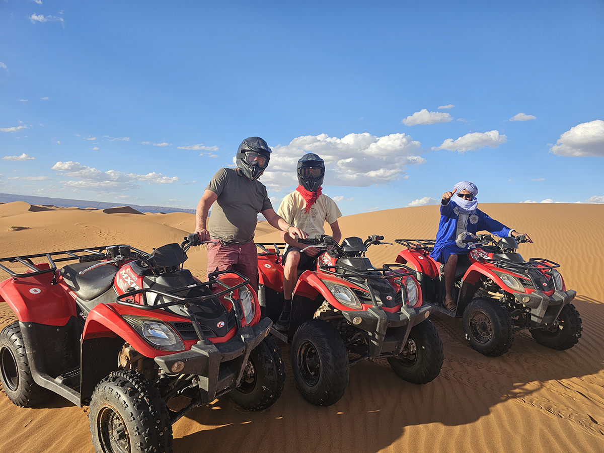
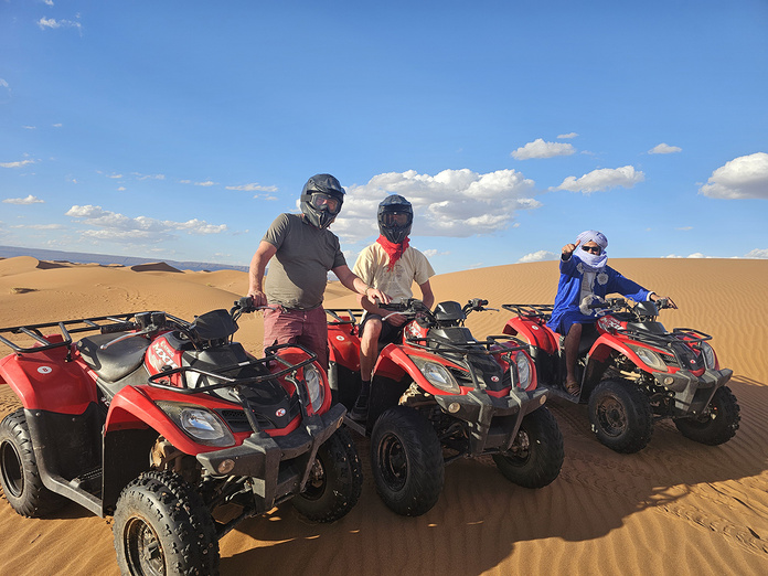
Quad and buggy excursions;
Hot air balloon flights over Marrakech and the High Atlas;
Traditional evenings and authentic cultural experiences.
Business-Oriented Solutions for Companies
NAGA TRAVEL also assists companies in organizing incentive stays, seminars, reward trips, team-building activities, and professional events.
Whether it’s a work meeting in Marrakech, an immersive experience in the Agafay Desert, or a cohesion-focused stay in the High Atlas, our team designs programs tailored to the objectives of each company.
A Team Closer to Its Clients
At NAGA TRAVEL, human connection lies at the heart of our work. Our team listens to every project and supports clients at every step of the organization.
We remain available by phone, by email, or during professional meetings in Europe to collaboratively build bespoke journeys that meet the most demanding expectations.
Geologists call this a “free-tipped littoral arrow.” In other words: a sediment spit anchored to the land at one end, the other extending into the sea. Named the Talbert Furrow, the one found north of Paimpol is among the most impressive in Europe. It forms a 3 km long tongue of sand and pebbles, emerging into the English Channel, which you can traverse with the sensation of gliding atop the water. At the end of the walk, among the sea kale (wild cabbages) and the many birds (82 species), you reach the northernmost point of continental Brittany.
Practical
Starting point: from the Maison du sillon, Pleubian.
Distance : about 6 km round trip.
Tip : to see the sites at their best, start your walk two hours after high tide.
Extend the walk : visible to the east and accessible by ferry, the island of Bréhat is a paradise for hikers.
Everything is Chaos on This Side
On land, a dense forest, carpeted with mosses and ferns, where one moves among striking blocks of rock in pastel and orange-red tones. At sea, the same famed mineral formations gleaming in the sun that have earned this stretch of the Pink Granite Coast its reputation. The walk linking, in the town of Perros-Guirec, the rocky chaos of the Traouïero valley to that of Ploumanac’h will show you countless colors.
Practical
Itinerary : from Kergomar, descend to the valley floor, then follow along to the sea. Continue on the GR 34, along the coast.
Distance : about 5 km.
Extend the walk : to the west, the Plounéour-Trez circuit (7.5 km) lets you discover a coastline that is more rocky.
Utopia in the Dunes
At the dawn of the 19th century, the utopian Louis Rousseau purchased 300 hectares of marshland at Goulven (Finistère) to convert them into farmland. He had a dike built and stabilized the dunes. Named Keremma (the village of Emma, his wife), this place now hosts Brittany’s largest dune belt. A distinct ecosystem, protected by the Conservatoire du littoral, where it is possible to stroll between hills planted with marram grass and deserted beaches.
Practical
Starting point : from the Keremma Dunes House, Tréflez.
Distance : 4 km for the loop at Penn ar C’hleuz point.
Extend the walk : to the west, the Plounéour-Trez circuit (7.5 km) allows you to discover a coastline that is even more rugged.
On the Roof of Brittany
Centuries of erosion may have shaved them down, but the Arrée Mountains are, from a geological standpoint, genuine mountains. One of the best ways to see this is to take the Roc’h circuit, south of Morlaix. It lets you rise above the moorland to reach the crest, and along the route you’ll encounter shale ridges that will confirm it for you: even if you stay below 400 meters in elevation, you’re standing on the roof of Brittany!
Practical
Itinerary : from the commune of Plounéour-Ménez, the classic loop (16 km) passes by Roc’h Trédudon
(385 m) and Roc’h Trévezel (384 m).
Variant : to reach the true high point, take the path toward Roc’h Ruz (385 m).
Extend the walk : south of Plounéour-Ménez, near Huelgoat, you’ll find magnificent rocky chaos.
Notably that of the River Argent.
A “Sea” with a Canada-L-like Air
Mist at dawn, banks that retreat, a wild atmosphere. Nestled among the wooded hills of the Armorican Massif, Lake Guerlédan bears the vibe of a tiny Canada. While it is artificial in origin (the lake owes its existence to a dam completed in 1930 on the Blavet), Brittany’s largest body of water (3 km2 in area) is above all the ideal place for nature walks, along the roughly hundred kilometers of trails surrounding it.
Practical
Itinerary : seven starting points are possible for those who want to circle the lake, following the white-green markings (detailed map at morbihan.com)
Distance : 40 km for the full circuit.
Tip : surprising for Brittany, but the trail has a fair amount of elevation gain. Don’t hesitate to break it into two, or even three days of walking.
This Isthmus That Holds on by a Thread
About twenty meters. That is, at its narrowest, the width of the coastal strip that links Quiberon to the mainland. Just enough for a road and a railway to pass—and for Brittany’s Morbihan town to lose its island status. This isthmus, which finally joined the mainland in the 11th century, has certainly made the territory more accessible. But it has not erased its natural beauties. A walk along the path that runs, to the west, along Quiberon’s Wild Coast reveals rocky coves, pine forests, and shores battered by the swell… A grand outdoor stroll, with Groix and Belle-Île on the horizon.
Practical
Starting point : at Fort Penthièvre, which controls access to the isthmus.
Itinerary : follow the coast to Pointe du Percho, then continue to Porz Stang.
Extend the walk : you can also complete the full circuit of the peninsula via the GR 34. Plan for a 30 km trek.
➤ Article appeared in GEO HS magazine No. 133, “France, our favourite walks for the summer,” June–July 2026.
➤ Do you love GEO? Then to make sure you don’t miss anything, discover our subscription options to receive GEO at home every month with ease.