What to Do on Easter Island: 11 Must-Do Activities on Rapa Nui

Easter Island, also known as Rapa Nui, is a captivating destination thanks to its enigmatic history and its unique cultural heritage. Nestled in the heart of the Pacific Ocean, the island attracts travelers from all over the world with its renowned Moai, those monumental statues that punctuate the volcanic landscapes. Visiting Easter Island means embarking on an adventure that blends discovery, exploration, and cultural immersion. To fully enjoy this singular place, here is a list of activities and sites not to miss during your visit.

1. Explore the Moai Quarry at Rano Raraku

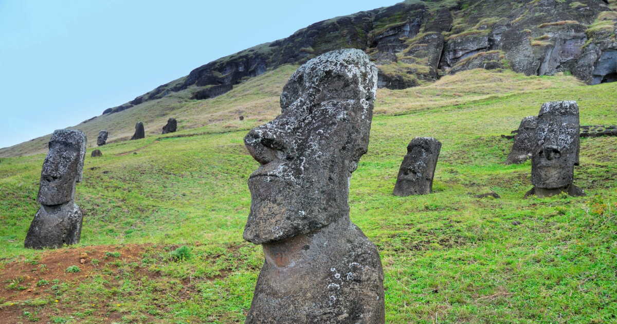
Delving into Rano Raraku means immersing yourself in the technical and symbolic history of the Easter Island. This quarry of yellowish stones is the cradle of the famous Moai, sculpted directly from the volcano’s rock. Each hike from the parking leads to a unique vantage over the island’s sites, revealing unfinished statues frozen in time. The island journey here takes on an almost archaeological dimension, feeding the traveler’s imagination as they encounter these giants partially buried. Located near the Poike Volcano and accessible by the island’s bike, the area is well signposted with information panels, and access requires presenting a valid entry ticket for the entire park—a ticket of modest value yet essential for preserving the site.

2. Watch the sunrise at Ahu Tongariki

The sunrise at Ahu Tongariki, with its 15 Moai lined up facing the Pacific Ocean, remains one of the most striking moments of a trip to the island. The traveler’s excitement reaches a peak as the first light breaks, illuminating the statues and highlighting the grandeur of the site. This moment, often associated with Easter Day for its symbolic significance, offers a rare spectacle that is easily reachable by electric bike or car from Hanga Roa. On site, guided tours enrich the experience, while the marked hiking trails invite autonomous discovery. The subtropical climate ensures pleasant weather, especially during the best period from April to November.

3. Relax at Anakena Beach

At the sandy Anakena Beach, the island’s sole white-sand shore, the traveler can pause between cultural explorations. Located in the northern part of the island, it hosts the ancient village and the restored Moai of the Ahu Nau Nau, visible after a half-day of travel from Hanga Roa. The peaceful atmosphere, nearby food options under the palms, and the opportunity to swim in temperate waters provide an ideal setting for relaxation. Access is via an entrance ticket, already included in the overall passage price. Easily reachable by biking around the island, it’s a recommended stop to balance culture and leisure.

4. Discover the ceremonial village of Orongo

The ceremonial village of Orongo, perched high on the slopes of the Rano Kau volcano, unveils the intricate world of the Birdman cult. This island site, accessible via a pedestrian-friendly path for a hiking tour, offers a spectacular view of the southeast coast and the Motu Nui, Motu Iti, and Motu Kao Kao islets. The stone houses ruins, the information panels about ancient rites, and the inclusion of the site in the guided tours available in Hanga Roa enrich the experience. Plan for a half-day for this excursion, which is part of the complete tour accessible with a valid entrance ticket. The island climate, mild and changeable, adds to the atmosphere of this remote extremity.

5. Enjoy sunsets at Ahu Tahai

The site of Ahu Tahai, just a short walk from Hanga Roa, stands as one of the most accessible spots to witness an unforgettable sunset over the Pacific Ocean. The Moai, including one with reconstructed eyes, silhouette against a blazing sky, making this moment a must on any trip to the island. Whether walking there, riding an electric bike, or joining a guided tour, this starting or ending point perfectly captures the island’s peaceful ambiance. It also integrates easily into a comprehensive tour or a simple walk around the town.

6. Visit the Père Sébastien Englert Anthropological Museum

The Père Sébastien Englert Anthropological Museum, located in Hanga Roa, is a must-stop to understand the roots of Rapa Nui. It presents highly valuable artifacts tracing the history of the old village, the techniques used to construct the Moai, and the beliefs of the Pascuan people. This interpretive space, easily reachable on foot or by bike around the island, supplements the guided visits of the island’s sites by providing a scientific perspective. The entrance fee, usually included in the island price, sits within a commitment to high-quality educational experiences.

7. Venture to the summit of Rano Kau

The summit of Rano Kau is reached via one of the island’s most spectacular hiking trails. This trek toward the interior, often starting at dawn, allows visitors to observe a majestic crater where vegetation contrasts with volcanic rock. The island’s climate here is a touch cooler, making the walk pleasant even for a half-day outing. Along the way, the traveler discovers native flora, a trail accessible to various difficulty levels, and breathtaking views of the world’s edge that Easter Island represents. The ascent is included in many complete tours and guided visits.

8. Scuba dive at Motu Nui

For underwater enthusiasts, diving near Motu Nui, close to Easter Island, offers a rare experience. In the clear waters of the Pacific Ocean, the traveler can explore rich biodiversity, observe tropical fish, and, depending on conditions, encounter a submerged Moai. Local operators provide high-quality gear, and diving trips can be combined with land-based activities like on-foot hikes. This activity complements the island’s journey by presenting another angle on its mysteries, between submerged legends and pristine nature.

9. Discover Ahu Akivi

The Ahu Akivi, located inland, is notable for housing seven Moai facing the Pacific Ocean, a rare orientation on the island. This site of the island, associated with the legend of explorers sent by Hotu Matu’a, is ideally visited on foot or by bike around the island, via a marked accessible path. It offers an open setting that attracts photographers and fans of local legends. Access is included in the valid multi-day entrance ticket. The spot lends itself to a half-day visit, often combined with the nearby site of Puna Pau, where the red stone used for the Moai headdresses was quarried.

10. Explore Hanga Roa and the spirit of Rapa Nui

Hanga Roa, the capital and sole urban center of Easter Island, concentrates all essential services for the traveler: accommodations, cuisine on site, transportation, and quick access to the island’s sites. From this port town, near the Mataveri airport, one can embark on a hike, rent bikes or an electric bike, or organize guided tours.

The peaceful ambiance is reinforced by the proximity to the Pacific Ocean, the cultural information panels, and local artisans who keep a unique know-how alive. This is also where you can secure the best price for an entrance ticket, a flight ticket, or a complete island tour. Accessible via direct flights from the Chilean capital, Hanga Roa serves as the starting point for all on-foot or bike explorations.

11. Hike on the Poike volcano

The Poike volcano, on the east of the island, marks a major stop for lovers of outdoor hiking in pristine nature. Less frequented than other sites, it is reached via a parking hike at the site’s entrance, along an accessible path though demanding. The panorama of the southeast coast, the red stone formations, and the sense of complete isolation heighten the traveler’s excitement for solitude. The site, often explored on foot, can also be included in a complete island tour, with or without a guide. To access it, a multi-day entry ticket is required, a modest ticket that helps preserve this exceptional heritage.

The Easter Island is a voyage through time and culture. Between the mysterious Moai, the volcanic landscapes, and the living traditions of the Rapa Nui, every activity on the island offers an opportunity to learn and be amazed. Whether you are passionate about history, an adventure seeker, or simply curious, Easter Island provides a unique and unforgettable experience. Make the most of every moment on this singular island and respect its heritage so that future generations can discover it as well.

How long does it take to visit Easter Island?

Planning a trip to Easter Island requires a good estimate of the time to allocate on site. For a comprehensive discovery of the island’s main sites, it is recommended to allow around 4 to 5 days on the island. This period allows alternating between guided tours and autonomous exploration, on foot or by electric bike, following the hiking trails or starting from a more accessible point thanks to a vehicle.

A hike from the Poike parking offers an immersion into the island’s interior, along a accessible path that follows the southeast coast. Each day reveals a little more of the island’s unique atmosphere, from sunset over the Pacific Ocean to breaks in old villages and the discovery of the Puna Pau crater, famed for its red stone. Whether in a half-day or a complete tour, the high quality of the local infrastructure makes the experience smooth and enriching for any traveler.

Where is Easter Island located? Geographic discovery of a Pacific outpost

Easter Island, or Rapa Nui, lies in the very heart of the Pacific Ocean, more than 3,500 kilometers west of the Chilean capital, Santiago. Its subtropical climate and peaceful atmosphere contrast sharply with continental bustle. This volcanic island is among the most isolated inhabited territories on the planet, which has long fueled travelers’ imaginations. Situated at the crossroads of major oceanic tectonic plates, it stands as a distant landmark for enthusiasts of ancient civilizations and on-foot hiking through preserved landscapes. This exceptional location fully justifies its nickname of the “edge of the world.”

Which country does Easter Island belong to? A Chilean land with a unique identity

Although geographically distant, Easter Island politically belongs to Chile. It is administered as a special province of the Valparaíso region, with governance that recognizes its cultural heritage and territorial particularities. This situation gives travelers access to air tickets at the best price from the mainland, often departing from the Chilean capital, via direct flights to the Mataveri airport, the most distant airport on the globe. Once on site, the history of colonization and the close ties between Hanga Roa, the island’s sole town, and continental Chile unfold through the information panels and the testimonies of a people shaped by the duality between Polynesian traditions and state affiliation.

How to reach Easter Island? Itinerary to a world-ending isle

Joining the Easter Island requires planning your route in advance. The only access is by air, via direct flights from Santiago to the Mataveri airport, often offered at a price for your tickets that varies with the best time of year. Once there, bicycles, electric bikes, and rental vehicles allow you to explore the hiking paths, which can be walked in half-day segments or tackled as a complete island tour. This journey begins the moment you board: the traveler’s excitement is tangible, heightened by the destination’s rarity and the promise of immersion in a world apart.

This article was written with the help of artificial intelligence, then corrected, expanded and validated by the publication’s journalists.
This Spanish Island Could Be One of Europe’s Best-Kept Secrets

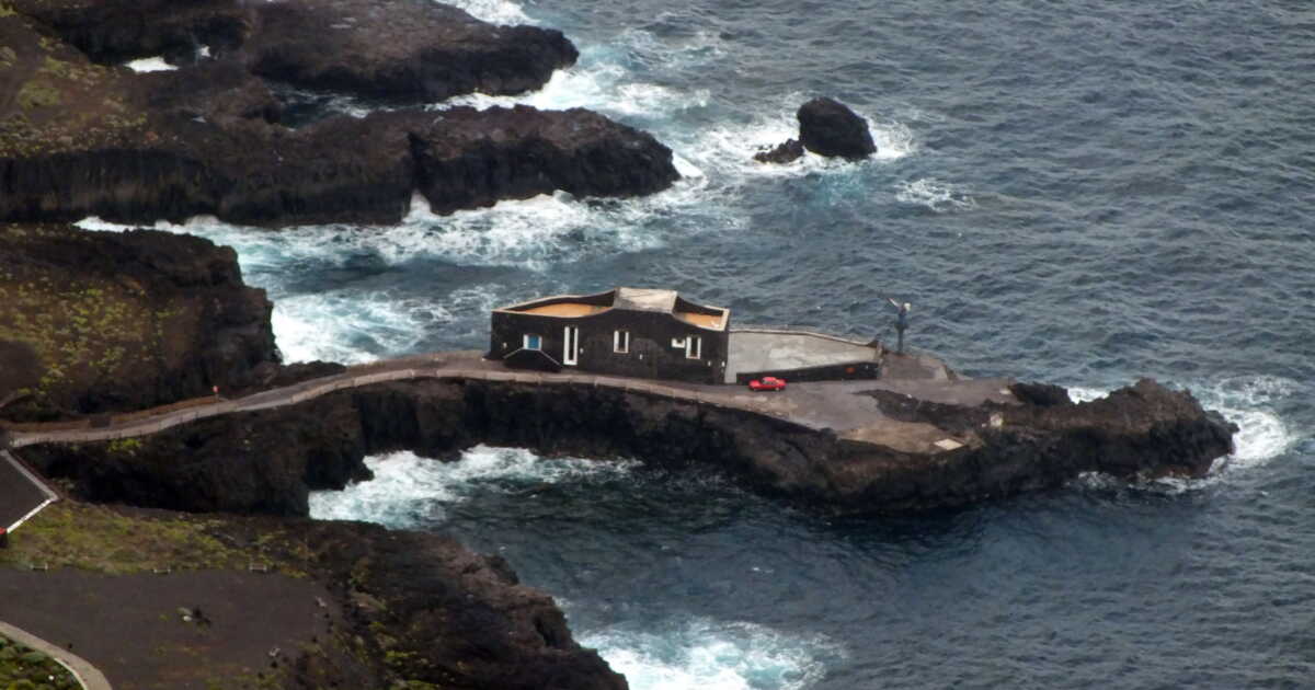
While some European destinations are bursting with visitors, a small Spanish island keeps living away from the crowds. Located at the western edge of the Canary Islands, El Hierro preserves its discreet charm with limited tourism, dramatic landscapes, and a preserved way of life. Between volcanic scenery, age-old traditions, and ecological ambitions, this isolated territory draws travelers in search of authenticity. A uniqueness that helps explain why it remains largely unknown to the general public, as CNN notes.

A volcanic land preserved away from the major tourist circuits

At a moment when Tenerife, Lanzarote, or Gran Canaria welcome millions of visitors each year, El Hierro stands out as an exception. For instance, more than six million international tourists visited Tenerife in 2024, compared with only 4,100 to El Hierro. This gap is largely explained by its limited accessibility. The island has no direct international flight connections and no large hotel complexes.

With its roughly 12,000 inhabitants, El Hierro presents a face radically different from the Canary Islands’ seaside resorts. Nicknamed “the island of a thousand volcanoes,” it hosts nearly 500 visible volcanic craters and around 300 more buried beneath younger lava flows. These geological phenomena have shaped a dramatic landscape where, within just a few kilometers, one encounters varied sceneries and a remarkable diversity of microclimates, despite a land area of a little over 260 square kilometers: black cliffs plunging into the ocean, pine forests perched in the clouds, and natural pools carved into volcanic rock.

This particular geography has also fostered the development of an original agriculture. In the El Golfo valley, a vast natural depression 1,500 meters deep formed by an ancient landslide, crops play a major role in the local economy. Alongside traditional productions, farmers are now experimenting with coffee, cocoa, and even dragon fruit using permaculture techniques adapted to the island’s conditions.

El Hierro also stands out for its winemaking heritage. The island’s isolation helped preserve certain grape varieties that disappeared elsewhere in Europe after the late-19th-century phylloxera crisis. Vineyards remain an integral part of the island’s landscapes and stand as a testament to an old agricultural tradition deeply rooted in local culture.

The island’s isolation likewise safeguarded varieties that vanished elsewhere in Europe—such as Baboso Negro—following the phylloxera crisis at the end of the 19th century. As proof of the drink’s importance to island culture, Alfredo Hernández Gutierrez, head of La Casa del Aguardiente, tells CNN: “There was a time, not so long ago, when we drank wine produced at home because it was more available and cheaper than water.”

An island looking to the future without renouncing its heritage

If El Hierro protects its natural heritage, it also strives to safeguard its cultural traditions. One of the most remarkable is Silbo Herreño, a whistled language inherited from the island’s first inhabitants, the Bimbaches. Used for centuries to communicate across long distances through the rugged terrain, it nearly disappeared in the 1990s. In response to the decline, local authorities established free courses for younger generations. To this day, workshops are organized in schools and at the island’s markets.

The coastline of El Hierro is another major asset. Off the village of La Restinga, the Mar de las Calmas marine reserve is renowned for its volcanic seabeds, coral reefs, and underwater visibility of up to about thirty meters. Local fishermen continue to practice artisanal fishing there in order to preserve biodiversity.

But it is mainly in the energy sector that El Hierro has gained international recognition. The island aims to run on renewable energy. Its Gorona del Viento installation combines five wind turbines, each 60 meters tall, with a hydraulic system that uses two reservoirs carved into former volcanic craters. In 2019, this setup set a world record by powering the island for more than 24 consecutive days without resorting to fossil fuels.

This ecological strategy is now accompanied by a desire to develop a more sustainable form of tourism. New museums, vineyard visits, cheese-making workshops, and experiences of traditional fishing should be offered to visitors.

For residents, however, this growth must be kept in check. As one resident told CNN, “we are happy that more people come to visit us, but preserving our simple way of life is the most important thing.” She adds: “The pace of life here gives you the time and space you need to discover yourself. In this complicated and turbulent era, it is something incredibly rare.”.

Nordic Island With Caribbean Vibes Becomes a Timeless Zone Every Summer

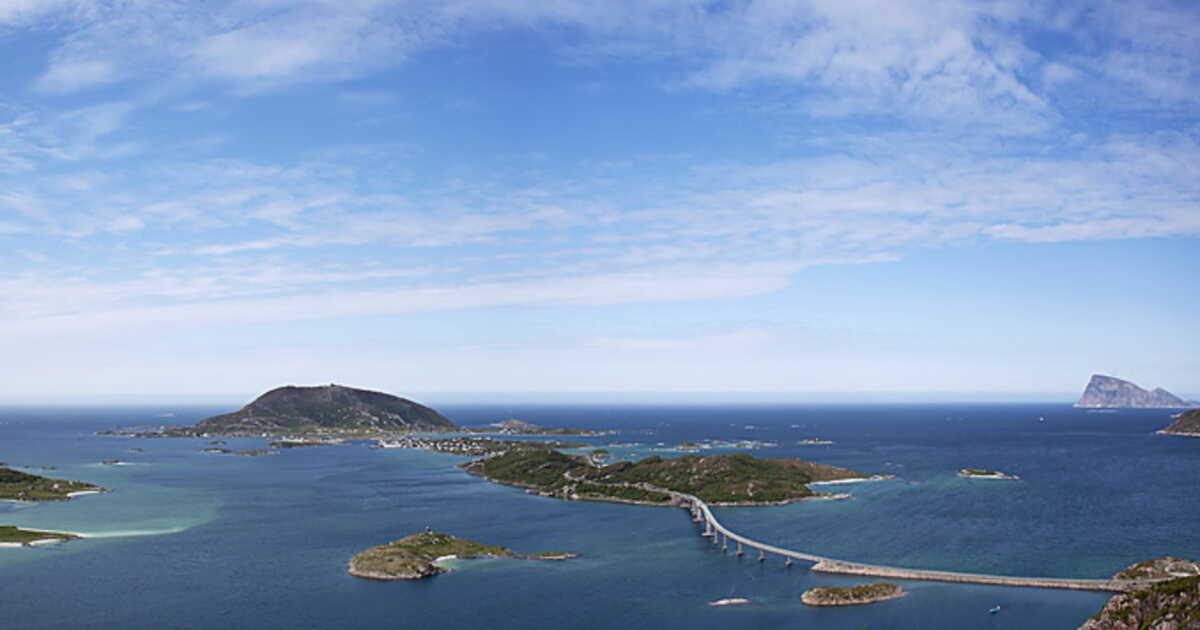
While Norway often evokes rugged fjords, snow-covered mountains, and Arctic landscapes, a small island in the north of the country defies all clichés. Located above the Arctic Circle, Sommarøy surprises with its white-sand beaches and turquoise waters, earning it the nickname of the “Caribbean of the North.” But this unexpected scenery is not its only asset. Each summer, a spectacular natural phenomenon transforms the daily life of its inhabitants and offers visitors an extraordinary experience.

An Arctic Island That Resembles the Tropics

About thirty kilometers west of Tromsø, often considered the gateway to the Norwegian Arctic, Sommarøy has only a few hundred inhabitants. Yet this small fishing community attracts more and more travelers intrigued by its singular landscape. Here, the pristine beaches contrast with the usual image of the High North.

The origin of this scenery is very different from that of classic tropical beaches. In the Caribbean, the sand is mainly composed of crushed quartz. But on Sommarøy, it comes from the accumulation, over thousands of years, of fragments of shells and calcareous algae. This particular composition gives the seabed a very light color. Since the waters around the island are shallow, sunlight reflects off this white bottom and creates these turquoise and emerald hues that recall tropical destinations.

The very name of the island also means “summer island.” Historically, fishermen would come to this place during the good season to exploit the abundant shoals of herring present in the surrounding waters. Today, while fishing remains important, tourism occupies an increasing place in the local economy.

When the Sun No Longer Sets

If Sommarøy is today known far beyond the borders of Norway, it is in large part thanks to an initiative that earned worldwide attention in 2019. The inhabitants proposed turning the island into a kind of “time-free zone,” or “hourless” area, during the summer. An idea inspired by the midnight sun: for 69 consecutive days, the sun never sets.

In this light-filled, day-and-night landscape, usual benchmarks fade away. A midnight hike, a night-time kayak excursion, cycling, paddling between islets, or a late swim become perfectly ordinary activities. The residents summed up this mindset by saying they wanted “do what we want, when we want”.

Subsequently, it became clear that the proposal to remove schedules was never intended to be applied in practice. The operation was in fact part of a promotional campaign aimed at making the island known internationally. A staging that nonetheless rested on a tangible reality: in Sommarøy, the midnight sun allows enjoying the scenery and activities at any hour of the day or night.

Note that the winter period offers an equally impressive spectacle. When the sun disappears for long weeks, the northern lights take over and regularly illuminate the sky. The island’s terrain also enables skiing with a view of the ocean.

To extend the experience, travelers can stay at a local hotel equipped with large bay windows opening onto the surrounding landscapes. The cuisine highlights Arctic resources, notably seafood, reindeer meat, mushrooms, and wild berries. A way to discover another facet of this surprising island.

AI Is Entrusted with Power on a Philippine Island, and It Could Backfire

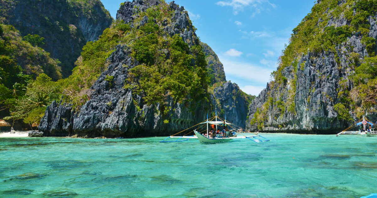
What if an entire territory were steered not by elected officials, but by artificial intelligences inspired by the great figures of history? This is the captivating and unsettling bet proposed by British entrepreneur Dan Thomson, founder of Sensay, who asserts that he has acquired an island in Palawan province, Philippines, to establish a micronation governed by bots.

A year after the announcement, the project continues to provoke curiosity, skepticism and questions that go far beyond the tech world. Between the promise of supposedly objective governance and fears of AI missteps, this real-life experiment raises questions that could, tomorrow, extend beyond the borders of this small tropical island.

Cruises Stop on an Island That Doesn’t Exist

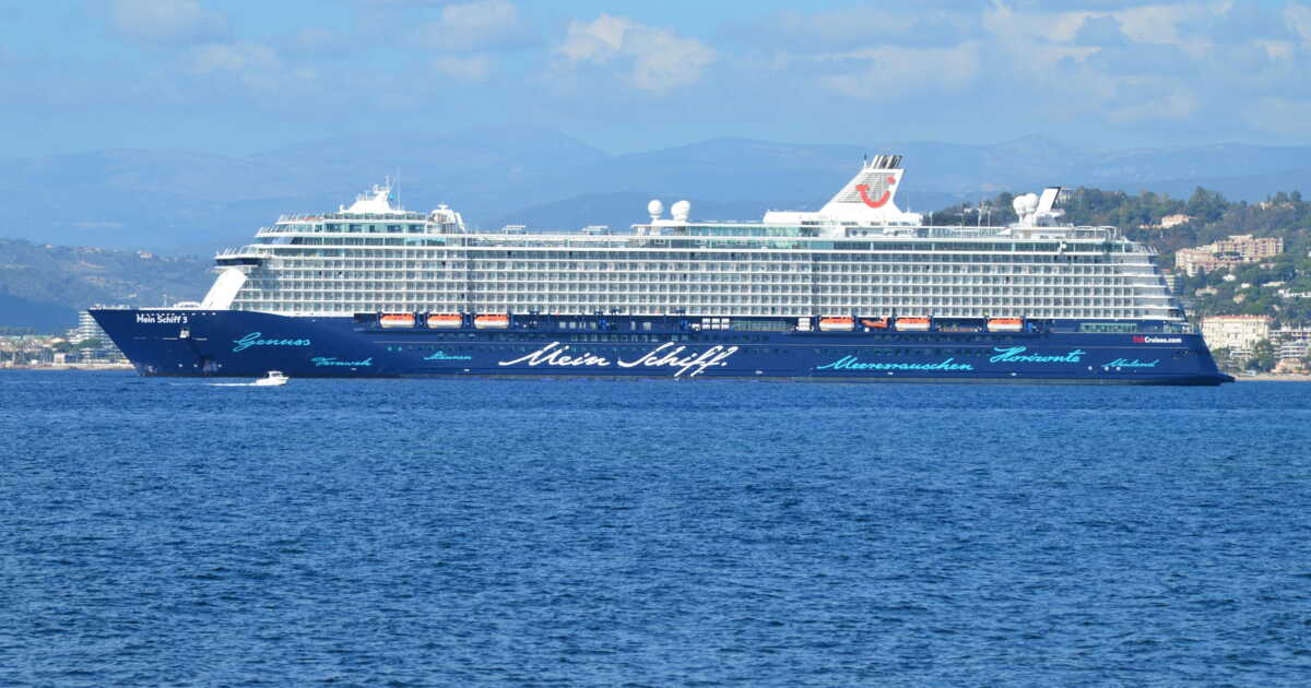
Have you ever heard of Null Island? This fictional island lies at 0° latitude and 0° longitude, in the Gulf of Guinea, at the precise point where the equator intersects the Greenwich meridian. As surprising as it may seem, this phantom place ranks among the most visited locations in the world. Some cruise lines even stop there for the sheer delight of their passengers, even though there is nothing to see.

Russell and Gail Lee were aboard a Viking World Cruise 2023-2024 when they discovered this atypical spot. They later agreed to recount their experience to CNN travel. “Everyone had pulled out their cameras, and the countdown displayed… 0.01… 0.005… 0.0001”, Gail Lee first recalled before continuing: “we were all comparing our phones. The one who captured the selfie closest to zero earned the right to boast.” The couple then explained that there was nothing to see at the site, except the ocean endless in every direction.

The Astonishing Story of Null Island

Null Island was born out of mapping errors before gradually being adopted by geomatics professionals. Over the years, all sorts of missing or misreported geolocation data—ranging from Strava routes to Airbnb listings, hotels, or even police reports—have ended up associated with these coordinates. The island began to surface in the geographic information systems community around 2008. A phantom destination that has generated genuine fascination among travelers, especially on cruises.

Just a few weeks ago, Holland America announced its plan to include Null Island among the stops on its 129-day world tour in 2028, following an initial call during its 2024 voyage. “There is nothing there. There is really nothing. Just the ocean, stretching to the horizon. But you are among the rare people on Earth who have ever visited this place, and it is truly exceptional,” explained Russell Lee to our colleagues.

An Imaginary Island Perceived as the ‘Highlight’ of a Cruise

“Visiting the 0, 0 Island and Null is a major event”, said Gail Lee. She then added: “much like crossing the Arctic Circle, the Equator, or the date line, it’s another imaginary place you’ve visited.” Her husband, for his part, indicated: “we never would have imagined being able to do this. For many of us, it turned out to be one of the voyage’s highlights.”

Meanwhile, Levente Juhász, co-author of an academic article on Null Island, discovered that this place contains all sorts of things, from “misplaced photos or ghost companies mapped to the same coordinates”. That is why he views Null Island as a kind of digital lost and found service.

Réunion Island: 6 Accessible Trails to Explore Differently

Summary


  • 1/ The lunar landscape of Réunion


  • 2/ The spray along Réunion’s wild southern coast


  • 3/ Through the primary forest


  • 4/ Tackling the high-altitude maquis


  • 5/ Mafate, the inhabited heart


  • 6/ Dusk on the savanna

We have selected, from the thousands of kilometers of marked trails that make up this island-world, Réunion, a few of the most beautiful segments… but also the most accessible. To allow everyone to walk, as the saying goes here, “from the beating of the waves to the summit of the mountains.”

1/ The lunar landscape of Réunion

  • Very easy
  • From 3 to 12 km, depending on your inclination (30 min to 4 hours)
  • 100 m of ascent and the same amount of descent

Where did the trees go? After about thirty kilometers of road from Saint-Pierre through lush vegetation, we find ourselves for our first stroll facing a mineral desert. A vast brown-reddish plain, surrounded on one side by cliffs, on the other by ravines, and cut by a straight track leading to a curious rounded mountain, the piton Chisny. It is via this path that one enters the fabulous volcanic world of the piton de la Fournaise. But first we must cross the Plain des Sables, a tiny plateau (3 km by 2 km) that reveals all its beauty at 2,260 m above sea level. This place tells a volcanic story. From the heights above it, you can discern the piton des Neiges (3,070 m), the island’s highest point and a dormant volcano, the origin of its troubled geography. Starting from the belvedere of the Pas des Sables, two trails (one toward Piton Langevin, the other toward Sainte-Thérèse Oratory) allow you to skirt the plateau along its ramparts.

From there, one clearly understands its origin through a succession of collapses and a long period of torrential erosion. Over time, volcanic activity shifted toward the craters Bory and Dolomieu, the summits of the piton de la Fournaise, which can be observed from the road terminus, five kilometers farther. As you traverse the plain itself, you can opt to stray from the marked trails. On this bare surface, with little relief, the view extends so far that it is unlikely to go astray. That is, until the fog arrives without warning. In mid-morning, the mist tears open. The plain, previously bathed in light, reveals the delicate tones of browns and ochers, up to a vivid red. With the crunch of footprints on the ground, you realize that it is not sand but lapilli, tiny porous stones expelled during explosive eruptions. Here and there, resilient plants have found a crack to carve out a niche.