Ningaloo Reef: Australia’s Other Great Barrier Reef Where Whale Sharks Swim

On the west coast of Australia, a vast coral reef stretches just a few meters from the shore, in waters of spectacular clarity. Much less known than the Great Barrier Reef that borders Queensland, Ningaloo Reef is by no means a supporting act: listed as a UNESCO World Heritage site, it harbors exceptional marine biodiversity and hosts each year some of the planet’s largest animals. Between desert, cliffs and turquoise lagoon, the spectacle unfolds both beneath the surface and on land, as we were able to observe during a report last June.

A coral reef perched at the edge of the desert

To discover Ningaloo Reef, one must head to the extreme northwest of Western Australia. The reef runs along the coast for hundreds of kilometers, from the vicinity of Coral Bay to Exmouth, at the entrance to Cape Range. Here, the landscape seems built around a striking contrast: on one side, the aridity and ochre reliefs of the peninsula; on the other, an intense blue ocean in which lies one of the world’s largest fringing reefs. The site is part of the vast Ningaloo Coast, listed as a UNESCO World Heritage site since 2011.

The term “barrier” requires clarification, however. Unlike the Great Barrier Reef, which is sometimes many tens of kilometers from shore, Ningaloo is a fringing reef: it grows directly along the coast, with a shallow lagoon between the shore and parts of the reef. This proximity is also a large part of its appeal for travelers. In some places, you only need to swim a few meters from the beach to find yourself above the corals and tropical fish, with just a mask and a snorkel. The shallow waters allow observing a multitude of shapes and colors without necessarily heading far for a dive.

And this reef is far from being merely decorative. UNESCO records more than 300 coral species, about 650 mollusk species, around 600 crustacean species, and more than 700 reef fish species. Among them are clownfish, parrotfish, butterflyfish, surgeonfish, angelfish, groupers and wrasses, but also barracudas that move above the reef. The site also counts more than 1,000 algae species. Alongside this underwater richness are sea turtles, marine mammals and numerous species of sharks and rays.

This concentration of life is explained in particular by Ningaloo’s geography and oceanography. Offshore, deep, nutrient-rich waters upwell toward the continental shelf, fueling the reef’s productivity. The Ningaloo Marine Park includes depths of up to 500 meters, with underwater canyons that could promote the upwelling of these cold, nutrient-rich waters.

The result is a highly productive ecosystem, set against a land environment just as remarkable. Behind the coast rises Cape Range, a limestone massif carved with gorges and canyons, while its subsurface hosts a vast network of caves and underground rivers. The Ningaloo Coast thus protects a broader whole than a reef: the interconnection between marine life, desert shoreline and the underground world makes its singularity.

When the giants of the ocean arrive at Ningaloo

But if there is a reason to come to Ningaloo, it is also because the reef functions as a vast migratory layover. Through the seasons, visitors change and the waters fill with silhouettes that grow ever larger.

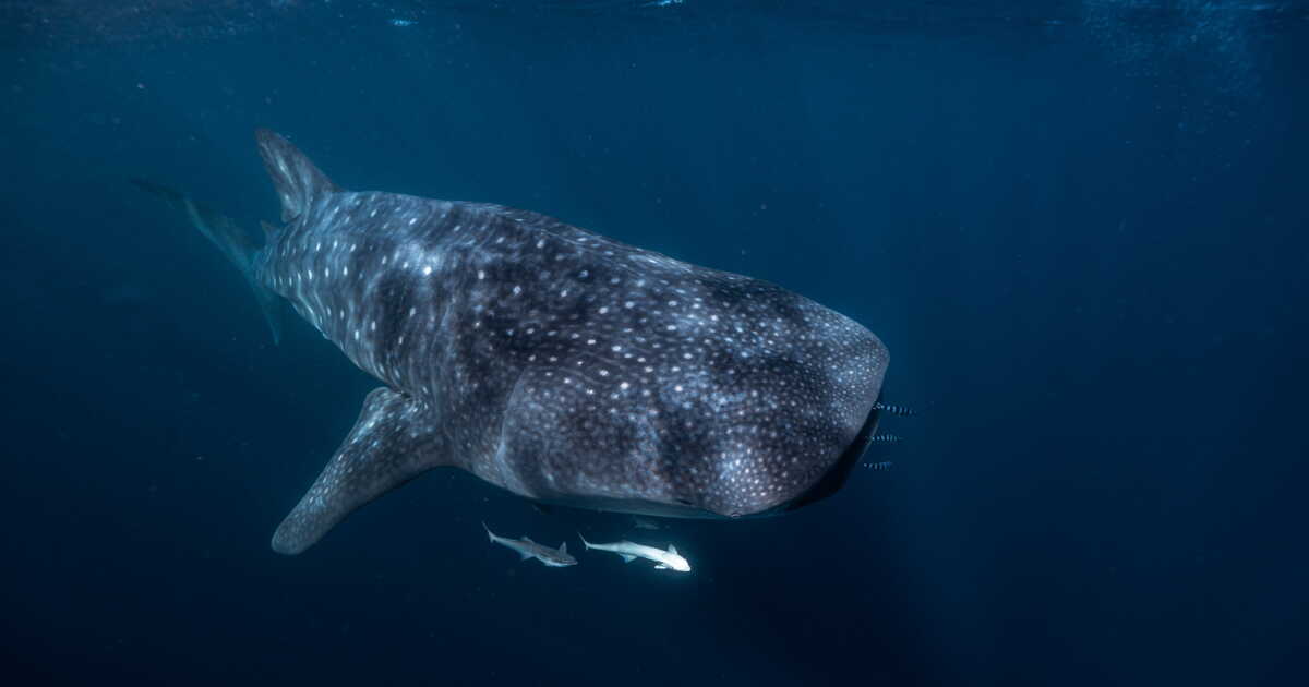
The most famous of these travelers is undoubtedly the whale shark. Each year, after the massive coral spawning period, a substantial amount of food becomes available in the reef waters. From roughly March to July, the world’s largest fish gather there to feed. UNESCO estimates that 300 to 500 whale sharks can gather each year off Ningaloo, which constitutes the largest documented gathering of this species. Most individuals observed at Ningaloo are, however, juveniles or subadults of about six to eight meters, still far from the maximum size (up to 18 meters) that the species can reach.

Despite their impressive size, these giants are perfectly harmless to humans, feeding mainly on plankton and small organisms filtered as they swim with their mouths open. Ningaloo is one of the few places in the world where you can swim with them under highly supervised and ethical conditions. Tours are conducted in small groups, at a regulated distance, never feeding the animals to attract them, so that this encounter does not disturb their natural behavior.

Then, when whale sharks begin to become less numerous, another procession of giants crosses the region. Humpback whales migrate through Ningaloo each year, traveling between their feeding grounds in the southern high latitudes and their northern breeding grounds. These cetaceans of around 15 meters pass through the marine park on their northbound journey, and again on their return south.

Unlike whale sharks, which mainly come to take advantage of a seasonal abundance of food, humpback whales thus use Ningaloo as a waypoint on a much longer route. Depending on the season, you may glimpse moving adults, groups gathering at the surface, or females with their young. From August onward, certain excursions also allow swimming beside them, a similarly well-regulated experience by authorized operators.

And the parade of giants does not stop there. The park also serves as a feeding area for other cetaceans, such as pygmy blue whales, which can reach about twenty meters. Reef manta rays about four meters across also frequent Ningaloo, both in the shallow waters of the lagoon and outside the reef. As for dugongs, these marine herbivores about three meters long and over 400 kg find in the calm and shallow lagoon waters favored feeding grounds. They feed notably on seagrass beds that develop on the sandy bottoms of the lagoon and can also use the area for reproduction, giving birth and raising their young. The coastal and offshore waters also host several dolphin species, including the bottlenose dolphin, the long-beaked dolphin, and the Electre dolphin.

To add to this diversity are several species of marine turtles, notably green, hawksbill and loggerhead turtles, which use the reef and its surroundings at different stages of their life cycles. UNESCO estimates about 10,000 nests laid each year along the coast.

At Ningaloo, the spectacle thus changes with the seasons and the depths: corals, tropical fish, turtles, rays and large animals take turns in a single ecosystem. It is this exceptional concentration of marine life, combined with the beauty of the reef and the landscapes that surround it, that makes the site’s uniqueness.
In Vienna, a One-of-a-Kind Museum Reveals How People Long Imagined the Earth

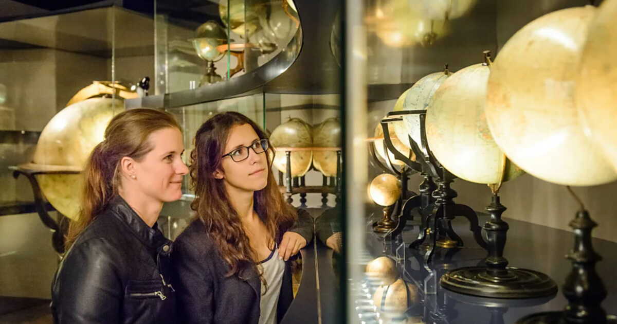
Our view of the world has continually evolved over the centuries, as a quirky museum in Austria attests. In the heart of Vienna, away from the crowds of usual tourist sites, there lies a unique museum on Earth. A gem for history buffs and lovers of maps, and sometimes even of the sky. Located in the Mollard Palace, the Globe Museum is indeed the only public institution wholly devoted to globes.

In this 17th-century setting, more than 220 rare and ancient spheres, most of which were crafted before 1850, are on display. “Globes attest to how our imagining of the planet has evolved. This is the only place in the world where you can see so many gathered together”, explains its director, Nikolaus Schobesberger, to the BBC, on Sunday, August 30.

A true mirror of bygone beliefs

The collection mainly tells how people over time tried to understand a world that remained largely unknown to them. Each globe records what people knew as well as what they did not know at the moment of its creation.

Some 16th-century globes show a North America that is lost among uncharted territories, when California isn’t depicted as an island state, an exaggerated Asia, or an imaginary southern continent in place of Australia and Antarctica. The oceans, meanwhile, are teeming with sea monsters or dragons, not with islands. On celestial globes, Renaissance astronomical observations still sit beside Pegasus, Perseus brandishing Medusa’s severed head, and other mythical creatures or figures.

Colonialism, space conquest…

Other pieces represent a colonial view of the world, with European flags planted on African coasts or caricatured representations of Indigenous peoples, transformed into cannibals. “They reflect the mindset of their time. They are certainly magnificent works of art, but we must also take into account the date of their creation”, notes Nikolaus Schobesberger.

One of the museum’s most fascinating objects is a lunar globe, created in 1961. The visible face of the Moon is meticulously drawn, but its far side is deliberately left white, because it had simply not yet been observed. Two years later, a new globe filled in that unknown portion. It also features a reproduction of the famous Martin Behaim globe, completed in 1492, which immortalizes a world without the Americas, but with an endless ocean separating Europe from Asia.

Initially reserved for princes and wealthy merchants, globes gradually became everyday objects, found in schools and households. In the era of Google Earth, they have not thankfully lost their power to fascinate. “It is not merely a scientific instrument, it is also an object that lets you dream of distant lands”, says the custodian of this place. For him, no other work of art stirs the imagination and the urge to discover distant places as much.

What to Do in Burkina Faso: 5 Ideas for Outings and Activities

Table of Contents


  • 1. Discovering Ouagadougou and the tourist sites


  • 2. Immersion in Bobo-Dioulasso’s history – Tourism in Burkina Faso


  • 3. Exploring the landscapes around Banfora: the Banfora Falls and the Sindou Peaks


  • 4. Visiting the Loropéni Ruins – Tourism in Burkina Faso


  • 5. Encounters with traditions and festivals: a journey through Burkina Faso


  • Is Burkina Faso a good place for tourists?


  • What to do in Burkina Faso when it rains?


  • What to do in Burkina Faso in the evening?


  • What to do in Burkina Faso with family?

Embarking on a journey to Burkina Faso requires thorough information, not only about places to visit but also about the current security situation.

Before any international travel, remember it is useful to consult the travel advice from the French Ministry of Europe and Foreign Affairs to understand security and health risks specific to certain areas, and the administrative steps to take before your trip.

1. Discovering Ouagadougou and the tourist sites

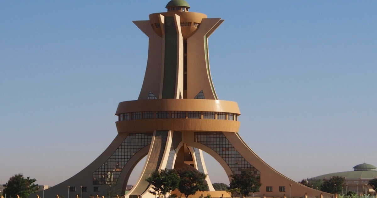
Traveling to the heart of Burkina Faso often begins in its capital, Ouagadougou, a nerve center of culture, history, and commerce. On your Burkina Faso trip, you can visit the National Museum to discover artifacts that reveal the diversity of peoples and traditions. You should also stop by the Music Museum, a living reflection of traditional melodies and heritage instruments.

For a harmonious contrast between nature and art, the site of Laongo offers granite sculptures set in a tranquil landscape. In the urban bustle, stroll through the Grand Market and soak in the vibrant atmosphere, with textiles, bronzes, and handicrafts; the chance to observe artisans’ craftsmanship and buy a memento. This blend of heritage, commerce, and urban life makes Ouagadougou a must for cultural tourism.

2. Immersion in Bobo‑Dioulasso’s history – Tourism in Burkina Faso

The city of Bobo‑Dioulasso, the second-largest in the country, offers a tranquil glimpse into the history and traditional architecture of Burkina Faso. Here you will encounter the Grand Mosque, a fine example of Sudano‑Sahelian architecture, as well as heritage monuments like the old Dioulassoba district, the mausoleum of Princess Guimbi Ouattara, and the railway station with Neo‑Mauresque architecture, vestiges of a richly royal past.

The local Grand Market serves as an ideal entry point to observe crafts, fabrics, and everyday objects, often handmade. However, before heading to the city or hopping on a moto-taxi, stay informed about the current security situation in the region: while Bobo‑Dioulasso is generally stable, conditions can evolve. This vigilance is part of a responsible and serene journey through Burkina Faso. Bobo‑Dioulasso stands as a historical and cultural crossroads, providing visitors with a tangible glimpse of the country’s soul.

3. Exploring the landscapes around Banfora: the Banfora Falls and the Sindou Peaks

In the Banfora region, Burkina Faso’s nature unfolds in all its splendor: the Banfora Falls (Karfiguéla) invite relaxation and contemplation, between rivers, rocks and greenery. Nearby, the Sindou Peaks rise in rock formations carved by erosion—a striking geological spectacle, ideal for hikers and panorama enthusiasts. Further afield, Lake Tengréla allows, aboard a traditional dugout, close observation of the hippopotamuses that inhabit the site.

If you plan another southern route toward Pô, the Nazinga ranch offers a wonderful immersion to observe African elephants. Note that, because of the security situation in the north, trips to the Sahelian zone (notably Gorom-Gorom) are strictly discouraged. Focus your stay on the centered and southwestern zones: Centre and Sud-Ouest.

4. Visiting the Loropéni Ruins – Tourism in Burkina Faso

The Loropéni Ruins constitute a major archaeological treasure of Burkina Faso, UNESCO-listed heritage illustrating the ancient regional trade routes. Located in the southwest of the country, these stone walls testify to a past tied to gold and commerce, offering a window into precolonial West Africa.

When planning this visit, it is advisable to do so as part of a guided excursion, to take into account security and local conditions. It is also wise to consider the rainy season before going there, as some paths and access can become difficult. This step fits perfectly into a balanced itinerary mixing nature, heritage and culture, an essential aspect of sustainable and thoughtful tourism in Burkina Faso.

5. Encounters with traditions and festivals: a journey through Burkina Faso

Burkina Faso is a country animated by its living traditions and cultural events. For cinema enthusiasts, the iconic FESPACO festival in Ouagadougou offers a showcase of African cinema, while the SIAO crafts fair allows discovery of ancestral know-how (textiles, bronzes, jewelry) from across West Africa. These events are an opportunity to reconnect with the country’s artistic, musical and craft roots.

To fully enjoy these moments, it is recommended to stay informed about security conditions, especially in crowded situations. Such events embody Burkina Faso’s spirit of sharing and diversity and represent a key axis for a cultural and engaged trip to Burkina Faso.

In conclusion, Burkina Faso is a destination of choice for those who wish to hear the authentic whisper of West Africa. Its cultural, natural, and historical riches offer a wide range of activities, appealing to the seasoned traveler ready to embark on the adventure with caution. Before departing, learning about the security of the areas you plan to visit remains essential to ensure a positive and safe experience.

Is Burkina Faso a good place for tourists?

Burkina Faso is often seen as a discreet, off-the-beaten-path destination. Yet, for travelers seeking authenticity, cultural encounters, and unique landscapes, this West African country offers surprising riches. From the vibrancy of local markets to the warm welcome of residents, tourism in Burkina Faso charms with its human dimension and simplicity.

The country relies on responsible and community-based tourism, especially in villages around Banfora or Tiébélé. Nevertheless, the security situation remains a variable to consider; check the current situation for your trip.

What to do in Burkina Faso when it rains?

The rainy season, typically extending from May to October, turns the Burkina Faso landscape into a lush, fertile tapestry. During this period, certain outdoor activities may be limited, but other options await visitors. Museums of history and art in Ouagadougou or Bobo-Dioulasso allow immersion in the country’s cultural wealth.

It is also possible to attend workshops with local artisans or enjoy Burkinabè cuisine in covered maquis. The humid climate does not hinder cultural dynamism; in fact, it is a season when nature and traditions reveal themselves in different ways.

What to do in Burkina Faso in the evening?

Evenings in Burkina Faso have a distinctive charm, blending local traditions with a relaxed atmosphere. In Ouagadougou or Bobo-Dioulasso, the nightlife comes alive with concerts, outdoor film screenings, and performances of dance or theater. Maquis, those typical, often lively restaurants, are convivial spaces where people share dishes and conversations. Some cultural centers also host nighttime events, revealing Burkina Faso’s artistic vitality. For those seeking calm, watching the starry sky from rural areas or lodges near the Sindou Peaks remains an unforgettable experience.

What to do in Burkina Faso with family?

Burkina Faso is well suited for family trips, with educational, cultural, and natural activities tailored for children. A visit to the cathedral of Ouagadougou offers an entry into the country’s religious and architectural history. Wildlife parks such as Ziniaré (to be confirmed depending on the current situation) provide a playful approach to local fauna. Walks through markets, meetings with artisans, or discovering traditional housing are enriching moments for both young and old.

This article was written with the help of artificial intelligence, then corrected, expanded, and validated by the journalists of the editorial team.

This Corner of California Was Russian for 30 Years and Is Still Visited Today

Two hours’ drive north of San Francisco, the landscapes along the California coast take on unexpectedly striking features. Between vineyards, cliffs, towering redwoods, and Pacific-beaten beaches, an old fort reminds us that a portion of California was once under Russian rule. Perched on a promontory in Sonoma County, Fort Ross today stands as a singular stop along the coastal road. A detour that invites visitors to discover a largely little-known facet of California’s history and heritage.

A Remarkable Slice of Russia on the Pacific Edge

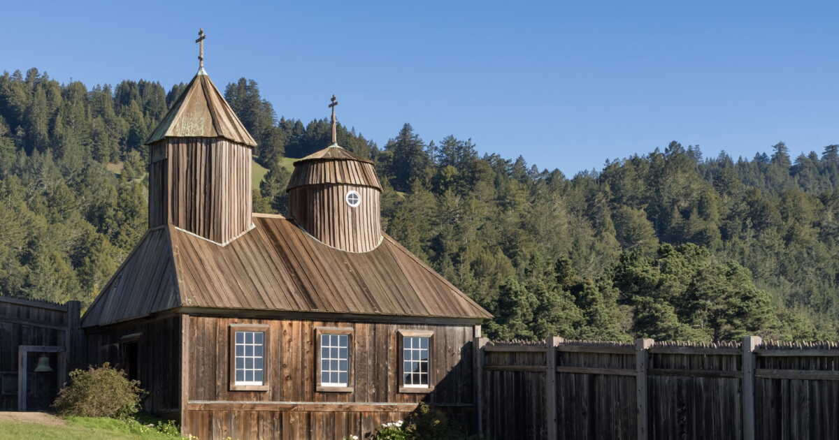
Fort Ross sits roughly 145 kilometers north of San Francisco, within Fort Ross State Historic Park. For travelers taking the famous Pacific Coast Highway, the site offers a pause quite different from the major parks and seaside towns that dot the coast. From the fort’s ruins, the view opens wide to the ocean, while a small Orthodox chapel topped with a cross recalls the Russian origin of the site.

Valais: A Vertical Odyssey

In Valais, we like to remind people that we enjoy an average of 300 sunny days per year. But that isn’t the only record… Here, everything is spectacular. The region sits among Europe’s rooftops, with 45 summits over 4,000 meters (out of 48 across Switzerland). Dazzling with its cascade of steep valleys and its authentic little villages perched on the mountains, this territory is a concentrate of intense emotions. “Our journey quickly took on the air of a grand spectacle,” confirm Lou and Matt, who explored the canton. “From the first hairpins, the air changes,” Lou notes. “We leave the plain to enter a world where verticality reigns. And we loved that!”

The Soul of the Old Chalets

The adventure of Lou and Matt begins in Champéry, at 1,050 meters above sea level. A breathtaking view of the Dents du Midi and the Dents Blanches. Here, a central street lined with chalets and toothed balconies. “The atmosphere is that of a village that has managed to keep its soul,” observe our travelers. The village sits tucked away in the Val d’Illiez and in winter asserts itself as a ski hotspot, part of the Franco-Swiss Portes du Soleil ski area. In the warmer months, it is its bucolic charm that draws visitors. One can find one of the last bell foundries in Switzerland still in operation. Above all, it is a place perfect for experiencing Switzerland in a nature-forward version, thanks to numerous hiking trails.

Heading to the Barme Plateau, an enchanted site, easily accessible, ideal for family outings. “We climbed there in the afternoon. Herds of cows, Hérens breed, typical of Valais, tinkled their bells. A truly unique moment,” remembers Lou. Add to that the stop en route at the Cantine des Dents Blanches, to feast on the quintessential cheese crust. In the evening, another delightful surprise: the night unfolds at the Cantine de Barmaz, another institution in service since 1891. The large wooden chalet sits in the middle of pastures, surrounded by a conifer forest and facing the amphitheater of the high mountains. “Sleeping in a wooden-walled room, with a balcony open to this fabulous setting, watching the stars, is to feel incredibly lucky,” says Matt. The next day, for the return journey, the duo sets off on the Sentier des Contrebandiers. The route winds along the crest toward the Col de Cou, the border with France, and offers dizzying views, notably of the Dents du Midi and their seven sharp summits that seem to tear the sky.

Freshness and Vertigo at the Durnand Gorges

Lower down, toward the plain, it is at the Durnand Gorges, near Martigny, that one cools off. The contrast is striking: after the harsh light of the peaks, here you descend along the sheer walls into a damp and mysterious world, carpeted with mosses and ferns. Walkways, ladders, and wooden paths let you admire fourteen cascades.

On the Vineyard Trail

The Valais holds another, subtler record: as the premier wine producer in Switzerland. Here, the Rhône traverses the valley, lined with terraced vineyards clinging to sunlit slopes, drawing a landscape like no other. Vines stretch endlessly, which you can explore on foot (65 km) or by bike along the Vineyard Trail (82 km). Lou and Matt wandered happily through the hills—“Here you discover how strong Valais’s hospitality tradition is,” they tell us. The “old country,” as locals sometimes call it, has been a throughway for centuries, and you can feel it as soon as you stop at the producers. In Plan-Cerisier, mazots (small wooden granaries) have become places to savor a glass of Petite Arvine while tasting some regional specialties.

Around the town of Sion, you travel through a true oenoparc. Here, a lookout hut perched to offer a magical view; there, cellars with contemporary architecture; further on, magnificent terraces to admire the sunset while sipping a glass. A recommended stop in Saillon for the panorama from Bayart tower. The hill on which this keep stands houses the smallest vineyard in the world: 3 vines on 1,618 m²! The current owner is the Dalai Lama, who was given the land.

Evening holds another unique experience for our explorers: a stop at the Marécottes. Opened in 2024, on three hectares, the place is a hotel, but not only… It is also the highest Alpine zoo in Europe, with the possibility of observing mountain animals, including bears, from one’s room. Magical!

Emotions at Emosson

A new day of vertigo. This time, aboard the red-and-white carriages of the Mont-Blanc Express. An extraordinary line that connects Martigny to Chamonix, crossing the spectacular terrain of the Trient valley. On the Swiss side, the panoramic train dives into wild gorges, skirts raging torrents, and reveals breathtaking landscapes.

The journey continues with the Verticalp Emosson: a vertigo-inducing route combining a funicular — one of the steepest in the world with an 87% slope —, a panoramic miniature train, and a mini-funicular, up to the Emosson dam, suspended between sky and rock.

At 1,965 meters above sea level, the arrival feels unreal. The gaze meets a colossal 180-meter-tall wall, holding back the country’s second-largest reservoir. On this mineral ridge, one proceeds as if balancing on the edge of the void, entranced by the lake’s almost surreal reflections. In clear weather, the view extends to the Mont Blanc Massif. “The kind of place where you feel incredibly small,” confesses Matt.

Zermatt, the Fabulous Theater of the Matterhorn

The next day, another cog railway lifts Lou and Matt to Zermatt, a time-warped resort where the famed Matterhorn towers at 4,478 meters, one of Switzerland’s most iconic postcards. In Zermatt, once a simple alpine village, history shifted in 1865 with Edward Whymper’s ascent of the Matterhorn, propelling the commune into alpine legend. Even today, the absence of cars preserves this mountaineering sanctuary, where silence is only broken by the soft clop of carriages and the discreet glide of electric shuttles. Yet higher still, a new chapter in this journey is written: the Gornergrat Railway. Put into service in 1898, this mountain train—one of Europe’s oldest—has wound its way for over 125 years along the face of peaks to link Zermatt with the heights of the Gornergrat. A true technical achievement for its era, it still offers a timeless voyage, suspended between glaciers and summits, facing the Matterhorn. For Matt and Lou, it’s “the absolute favorite.”

The spectacle unfolds at altitude, Lou and Matt explain. We boarded the Gornergrat train, which lifts visitors to 3,039 meters, delivering a panorama of 29 peaks over 4,000 meters. At their feet, the Gorner Glacier unfurls its blue tongue. “It’s one of Europe’s most sublime settings,” says Lou. “We’re in the heart of a ice amphitheater.” “We had chosen to ascend step by step, to see the landscape in several ways,” recalls Matt. “We first descended one station before the terminus, toward the Riffelsee lake. There, the Matterhorn’s pyramid silhouette reflected itself like in a mirror. And since we rose very early in the morning, the light was magical. Unforgettable!”

A Roman Bath

To recover from such emotions, nothing beats Leukerbad, the largest spa resort in the Alps. The town has been known for it since ancient times. Every day, 3.9 million litres of natural thermal water gush at 51 degrees. Once cooled, the waters feed the baths. Several establishments dot the resort, each with its own style and atmosphere. “Don’t miss the nighttime and outdoor swimming sessions… An experience as unreal as it is enjoyable,” advises Lou.

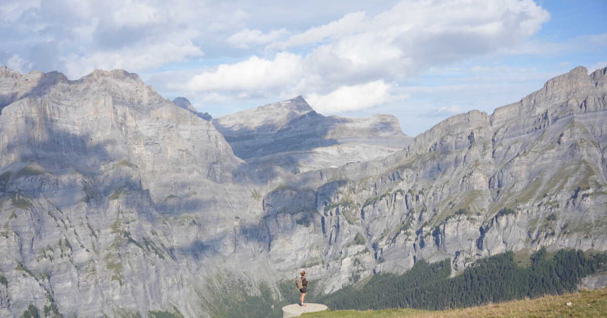
A perfect evening before tackling the journey’s final ascent. Head to the Gemmi Pass, via the Gemmibahn cable car. Up there, at 2,350 meters, the landscape takes on a lunar feel. Silence barely interrupted by the wind’s whistle. A panoramic platform, a true glass balcony cast into the void, again offers a breathtaking view of the Valaisan Alps. A balcony in the land of the giant Alps.

IN PRACTICE.

Planning a trip to Switzerland.

Get informed

https://www.myswitzerland.com/fr and valais.ch

Getting there

TGV Lyria operates daily links between France and Switzerland from Paris Gare de Lyon to Geneva, Lausanne, Basel or Zurich (about 4 hours).tgv-lyria.com

Getting around

By train, with the Swiss Travel Pass. A comprehensive ticket aimed at foreign visitors that opens the doors to Switzerland’s public transport network.

What to Do in Yellowstone: 5 Outings and Activities to Discover

Contents


  • 1. Explore Geothermal Sites


  • 2. Discover the Grand Canyon of Yellowstone


  • 3. Observe Wildlife in the Valleys


  • 4. Hike the Trails


  • 5. Join Guided Activities


  • What is the best time to visit Yellowstone?


  • Where is Yellowstone located?


  • Where to fly into to visit Yellowstone?


  • What to do after Yellowstone?

Yellowstone National Park, the world’s first national park, is a vast expanse of preserved nature spanning the states of Wyoming, Montana, and Idaho. Renowned for its natural beauty that blends geothermal landscapes, canyons, rivers, and diverse wildlife, Yellowstone is a popular destination for lovers of wide-open spaces.

1. Explore Geothermal Sites

Old Faithful

Old Faithful, located in the Upper Geyser Basin, is one of North America’s most iconic geothermal phenomena. This famous geyser offers a chance to observe eruptions at regular intervals, roughly every 100 minutes. The erupted water reaches temperatures near 100°C, expelled up to 56 meters high. Around the site, groomed boardwalks enable safe observation while respecting the distance from wildlife in the area.

In winter, Yellowstone offers a unique spectacle with snow creating a striking contrast around Old Faithful. The geyser is easily accessible from the south entrance or the road from Canyon Village, and visitor centers provide practical, step-by-step guidance to plan the visit. The America the Beautiful Pass is recommended for unrestricted access to the site.

Grand Prismatic Spring

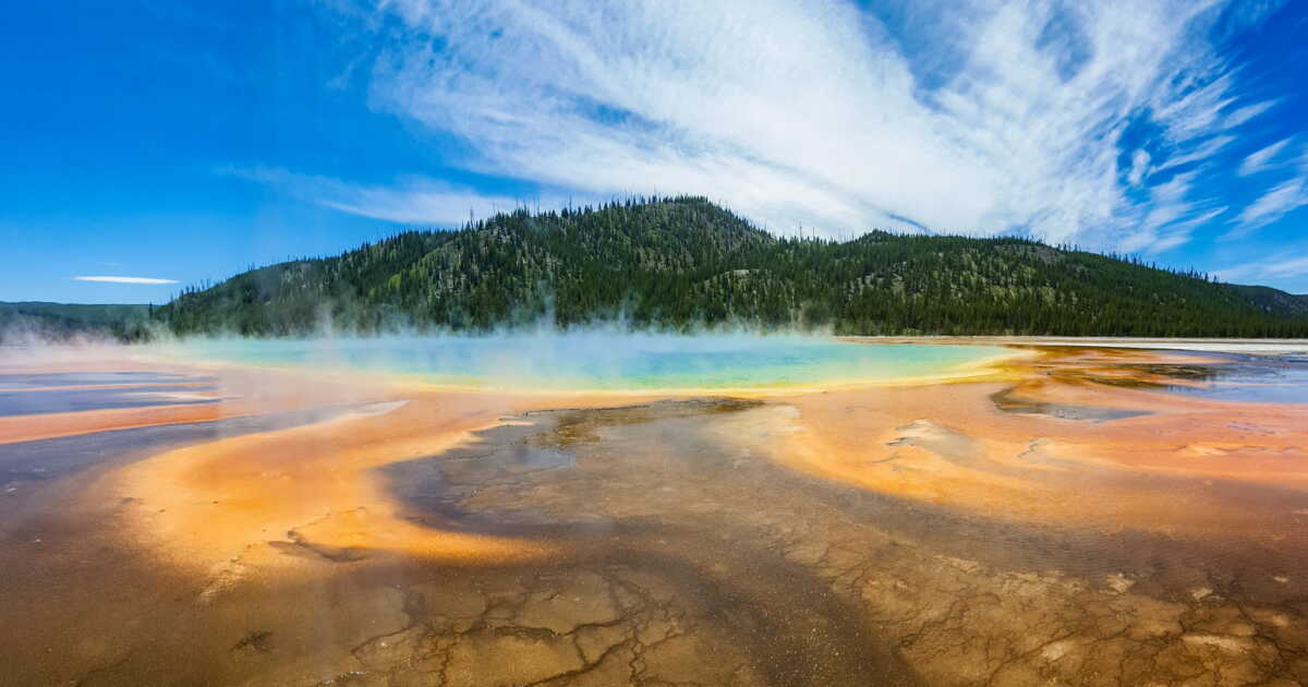
The Grand Prismatic Spring, in the western part of Yellowstone, is a spectacular example of an active geothermal spring, with waters around 70°C and vibrant hues created by thermophilic bacteria. This hot spring, several meters in diameter, features zones of blue, orange, and yellow that vary with the temperature of the sources, forming an almost surreal landscape. The site is accessible on foot via secure boardwalks, and an elevated trail provides a magnificent view of the basin.

By respecting distances from wildlife, visitors can discover a sensitive and active ecosystem. Trail-use guidelines are available at the visitor centers, especially to plan a high-season excursion or a Yellowstone winter visit, when color contrasts with the snow are heightened. A rare chance to observe a unique natural phenomenon located in Midway Geyser Basin.

Mammoth Hot Springs

The Mammoth Hot Springs, accessible from the north side of Yellowstone each year, offer a series of calcium carbonate terraces formed by high-temperature waters, slowly but steadily reshaping the ground. These sections with fragile soils display colors ranging from pure white to reddish-orange, creating a striking visual composition. The Mammoth visitor centers provide guidance on navigating the boardwalks and avoiding sensitive thermal areas.

Buffalo can be seen around Yellowstone, and the presence of elk within the heart of the area highlights the importance of maintaining distance from these animals. Mammoth is also a key stop to discover local wildlife in winter, particularly during a Yellowstone stay, where sighting chances increase in a snowy backdrop. The opening dates for the roads leading there vary by season, except for the route toward Cooke City.

2. Discover the Grand Canyon of Yellowstone

Lower and Upper Falls

The Lower and Upper Falls of the Grand Canyon of Yellowstone illustrate the park’s geological power, with spectacular waterfalls plunging into a canyon about 20 miles long, whose walls are colored by mineral deposits. From developed viewpoints like Artist Point, the stunning view of the cascades reveals the scale of the landscape, situated several hundred meters above the Yellowstone River.

Trails allow access to both falls following practical step-by-step guidance, depending on the level of difficulty and weather conditions. In winter, the site remains accessible only to authorized snow-transport vehicles, via certain roads from Canyon Village or through guided excursions.

The area is conducive to observing local wildlife, including bison in the valley or elk in the park, which should be approached with caution while respecting distance from wildlife. Access to the canyon is recommended via the America the Beautiful Pass, with stops at visitor centers to plan itineraries according to peak season or cold conditions.

3. Observe Wildlife in the Valleys

Lamar Valley and Hayden Valley

The valleys of Lamar Valley and Hayden Valley represent two major areas for observing local wildlife in the park, particularly the Yellowstone bison, elk in the heart, and sometimes wolves. These vast open plains, bathed in the low morning or evening light, offer the best chances to observe wildlife in their natural habitat. By following rangers’ guidance, you can settle along the roadside at strategic spots to maximize your chances while respecting distances to wildlife.

In winter, snow increases the visibility of species and makes them more active at certain times. Access to these valleys can be via Cooke City or from the south entrance, with regular stops for fuel on long distances. The presence of bison in the valley underscores the need for respectful behavior toward iconic local wildlife, while enjoying nearby geothermal phenomena such as the Mud Volcano or the Sulphur Caldron.

4. Emprunter des sentiers de randonnée

Trails and Difficulty Levels

The trails of Yellowstone National Park offer a variety of itineraries suitable for all levels of practice, from easy strolls to the most demanding hikes. Routes such as the one to Mystic Falls or the ascent of Mount Washburn enable exploration of the vast plains, beautiful waterfalls, hot springs, and Yellowstone’s landscapes. The temperatures of these sources can be very high, so precautions should be taken around geothermal phenomena, especially in sections with unstable soils.

In cold periods, snow transforms the trails and can limit access to certain areas. It is recommended to consult the visitor centers for practical step-by-step guidance, check opening dates, and learn about local wildlife, especially the distance to keep from the bisons, elk, or bald eagles. In the Yellowstone center area, around Yellowstone Lake or Canyon Village, each hike can offer a chance to observe nature safely, provided you follow park guidelines.

5. Join Guided Activities

Ranger Programs and Visitor Centers

Ranger programs and the visitor centers of Yellowstone play a key role in scientific and environmental outreach to visitors. Available year-round, including winter, these activities allow exploring the specifics of the local ecosystem, understanding the dynamics of geothermal phenomena, such as at Old Faithful, and obtaining guidance on best visiting practices.

Yellowstone’s visitor centers provide information on the temperature of these plumes, thermophilic bacteria, calcium carbonate deposits, and waters often exceeding 90 °C. They also raise awareness about maintaining distance from wildlife, particularly bison and elk, as well as other iconic American West species. Participating in these guided programs, often recommended by friends, offers a huge opportunity to better understand the environment while benefiting from the best chances of observing wildlife in a safe and informed setting.

Visiting Yellowstone is an immersive experience given the diversity of its landscapes and wildlife. By exploring geothermal sites, canyons, valleys, and hiking trails, you discover a nature full of surprises. Careful planning of your itinerary will help you make the most of your stay, taking into account attractions and activities that match your interests. In addition to park exploration, consider discovering the many natural beauties located nearby to extend your adventure in this fascinating region.

How many days does one need to visit Yellowstone National Park?

It is recommended to dedicate at least three to four days to fully explore Yellowstone, as the park spans thousands of square miles and hosts as many geothermal attractions as wild areas. With this timeframe, you’ll have the opportunity to visit major sites such as Old Faithful, the Grand Prismatic Spring, bison-filled plains, and more remote regions where wildlife viewing chances are higher.

A shorter visit can suffice for an overview, but you may spend most of your time traveling between the vast distances to cover (after all, the roads encircle the park in an eight shape) and the most frequented zones. By planning your itinerary carefully, for example by dividing your lodging between two sectors of the park, you can optimize your days and maximize your chances of wildlife viewing.

Is Yellowstone Worth It?

Yes, visiting Yellowstone offers a tremendous opportunity to discover one of the most spectacular natural landscapes in North America: from hot springs to vast plains populated by bison, to geothermal phenomena such as geysers and multicolored basins, you are at the heart of a unique environment. The fact that Yellowstone attracts millions of visitors each year testifies to its appeal.

Even in winter, when snow blankets the expanses and semi-enclosed areas offer a different ambiance, the experience remains highly valuable. Visitor centers provide usage tips to navigate this vast park, respect the local wildlife, and observe safely, especially bison in the valleys or elk. Provided you carefully plan distances, logistics, and the season, Yellowstone clearly is worth the detour.

What is the best time to visit Yellowstone?

The ideal time to visit Yellowstone is late spring or early autumn, when the weather is mild, road access is complete, and crowds are thinner. In peak season (July–August), while all attractions are accessible, you may face lines at the entrance or congestion near Old Faithful and major zones.

Conversely, in autumn or early June, wildlife viewing opportunities—especially for bisons across the vast plains—are enhanced, and the autumn colors bring a fresh aesthetic to the vibrantly colored soils of the geothermal basins. In winter, the park remains accessible but some roads are closed, limiting itineraries. Choosing the right season helps optimize your visit and enjoy a calmer, more educational atmosphere.

Where is Yellowstone?

Located primarily in the state of Wyoming, with extensions into Montana and Idaho, Yellowstone occupies a central part of the American West and stands as the first protected area of its kind. It sits at the heart of a vast ecosystem, traversed by the Yellowstone River and peppered with sites such as the Grand Canyon of Yellowstone.

As a flagship national park in North America, it welcomes visitors from around the world each year and offers a range of experiences from geysers like Old Faithful to hot springs containing thermophilic bacteria, to wildlife zones. It is important to respect wildlife, monitor distances to these animals, and plan your trip in advance.

Where to fly into to visit Yellowstone?

To visit Yellowstone, it is recommended to fly into a nearby airport, for example West Yellowstone or Bozeman (Montana), then reach the park’s north or west entrance. One advantage of this choice is to minimize driving time before entering the park, which is crucial to maximize the chance of observing key features such as Old Faithful, the valley’s bisons, or the Grand Prismatic. Once inside the park, having a vehicle facilitates exploration along the famous Grand Loop Road. The visitor centers at the entrances provide information on opening dates, road conditions, and offer practical advice to structure your stay.

Que faire après Yellowstone ?

After your visit to Yellowstone, several options are available to extend the experience: you can consider extending to the Grand Teton National Park or further exploring the regions of Montana or Idaho along the park’s border. You can also opt for itineraries more focused on wildlife, photography, or local culture.

Another approach is to devote one or two additional days to revisiting less-visited areas of Yellowstone, which increases your chances of spotting wildlife and lets you observe animals in calmer conditions. In all cases, plan the route, prepare fuel stops, check access via the visitor centers, and follow the advice of friends or local guides to ensure a structured and rewarding transition.

This article was written with the help of artificial intelligence, then revised, expanded, and validated by the newsroom journalists.

Craving Silence While Traveling? The 10 Quietest Countries in the World

What if silence had become one of travel’s new luxuries? Far from megacities, crowded highways, noisy infrastructure, and destinations saturated with visitors, some countries still offer landscapes where human presence seems almost forgotten. A recent ranking by Go2Africa sought to identify places most conducive to this pause, cross-referencing population density, tourist traffic, and infrastructure. The result? The top ten countries in the ranking hold a few surprises and give pride of place to vast wild spaces.

Africa dominates the top spots in the ranking

With six countries among the ten premiers, Africa is by far the best-represented continent in the list. Namibia comes in second, with a tranquility score of 86.69 out of 100. Its vast desert expanse holds only 3.83 inhabitants per square kilometer, while the tourist density stands at just 0.67 visitors per square kilometer. In the Namib Desert, as along the Skeleton Coast, distances and the sparse human presence foster a particularly strong sense of solitude.

Botswana takes third place with 80.86 points. The country has chosen a tourism approach that favors a limited number of visitors and vehicles in certain zones. A strategy that, in particular, makes it possible to observe animals in the Okavango Delta in wide spaces where vehicle gatherings remain limited. Zambia follows closely, with 80.64 points. About 48% of its territory is officially protected, notably in vast wild regions such as South Luangwa and Lower Zambezi. The country has also become known for its walking safaris, a way to explore nature without multiplying vehicles around the animals.

Fifth in the global ranking? Gabon scores 80.61. More than 85% of its territory is covered by equatorial forest, and 13 national parks were created in 2002, covering more than 10% of the country at the time. Among them, Loango National Park is particularly renowned for elephants capable of venturing onto the coastline. Two other African countries also feature in the top 10: Chad, seventh with 79.82 points, and the Central African Republic, eighth with 78.18 points. Their positions are explained largely by a very low density of infrastructure and visitors. Chad has no railway lines, while the Central African Republic counts only 1.56 vehicles per kilometer of road.

Vast spaces across all continents

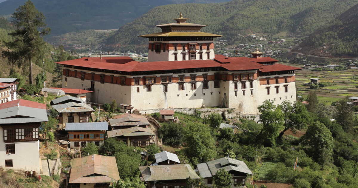
While African countries lead the ranking, the quietest country in the world lies elsewhere. Specifically in Asia. It is Bhutan, at the top with a score of 89.44. Nestled in the eastern Himalayas, the kingdom covers 39,041 square kilometers of forests, mountains, and sparsely populated valleys. Tourist access is also framed, notably through a daily fee intended for sustainable development.

In South America, Venezuela ranks sixth with 80.20 points. More than half of its territory, 54.1%, is under a protected status. The country also receives only 1.4 tourists per square kilometer, leaving vast regions largely untouched by international tourism. Mongolia, ninth with 75.53 points, underscores the weight of scale even more. The country spans roughly 1.5 million square kilometers, but has only 35 airports and 1,810 km of railways. Bolivia, tenth with 75.40 points, shows a population density of just 11.77 inhabitants per square kilometer, despite major cities like La Paz.

The Oceania region appears further down the ranking, with New Zealand in 17th place and Australia in 20th. However, these positions should be viewed with nuance, as several small Pacific island states could not be included in the ranking due to insufficient data. Europe, for its part, remains clearly behind. No European country makes the top 25. Estonia, the European country with the best score, is ranked only 34th, ahead of Finland (39th) and Sweden (40th). A consequence, notably, of population density and the transport networks that characterize the continent.

For Ashley Gerrand, safari specialist at Go2Africa, this search for space corresponds to an evolution in travel expectations: “More and more, our clients are not asking for itineraries that are busier or for more activities. They are looking for more space, where they can avoid the crowds.” And to conclude: “One of the greatest luxuries of travel today is the feeling of having space all to oneself.”.

Dolce Vita in Switzerland

“Il Ticino vi dà il benvenuto!” (“Ticino welcomes you”). Right after passing the Gotthard tunnel, the message is clear: here we speak Italian, live Italian, but we are indeed in Switzerland. For Lou and Matt, this shift in language immediately resonated like a breath of Dolce vita. Ticino is the gateway to the South, where the Alps begin to speak with a sunny accent. “We sometimes forget that Switzerland also has this Latin facet,” Lou continues. “As a result, in this region, it really feels like two journeys rolled into one!”

Locarno, a Cinematic City

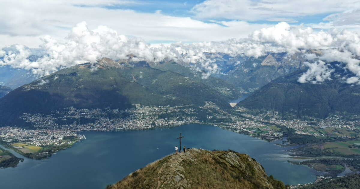
The journey starts in Locarno, on the edge of Lake Maggiore. It looks exactly like a movie set. With its pastel façades and shaded arcades, the town has not lost any of its aristocratic 19th-century elegance. The heartbeat of the town happens on Piazza Grande, a vast open-air salon paved with river pebbles. Every summer, the esplanade becomes the most beautiful cinema hall in the world during the Locarno Film Festival. Meandering through the old town, between Baroque churches and hidden palaces, reveals the rich history of this part of Switzerland that was once under the influence of the Dukes of Milan. Locarno sits on the northern shore of Lake Maggiore, a lake shared with Italy. Also called Verbano, the lake enjoys a microclimate where mountain air blends with Mediterranean influences. Hence, as early summer arrives, temperatures rise higher, and the seaside towns lure visitors seeking to unwind along surprising white-sand beaches or on nicely laid-out lidos.

The Brissago Eden

That Mediterranean-alpine climate also makes the splendid gardens flourish all around. To see it for yourself, nothing beats setting sail. That’s exactly what our two travelers did, boarding for the Brissago Islands. The crossing from Locarno is, in itself, a contemplative experience: the boat cleaves water with metallic reflections, leaving behind the town and the mountains mirrored on the lake’s surface.

At the end of the cruise, another world awaits visitors: the Brissago Islands are a botanical paradise stranded in the middle of Lake Maggiore. Palm trees, bamboo, and exotic plants from around the globe thrive there. A stroll on the Grand Island San Pancrazio (the only one open to visitors) transports Lou and Matt to Asia, to America, to Africa, to Oceania, with more than 2,000 plant species. Its unique character, its isolation in the water, and the refinement of its architectural settings make it one of the finest botanical gardens in Switzerland. On the Small Island (St-Apollinare), the vegetation remains wild, offering a remarkable sanctuary for the local flora. The roots of these refinements lie with a baroness who, in the 19th century, aimed to transform the compact archipelago into an artistic home. A wealthy businessman later completed this aspiration by building a Roman bath, an orangery, and a quay.

The Emerald of the Verzasca Valley

For the second day, a change of scenery. With its emerald river, old stone bridges, and picturesque villages, the Verzasca Valley offers a unique setting for hiking. A stop in Sonogno, the last village in the valley. Here, the architecture is a hymn to granite: houses with limestone slate roofs and narrow lanes seem carved from the mountain. In the square, the Verzasca Museum is worth a visit, as the guardian of farm traditions. Lunch takes place in a Grotto, a Ticinese classic venue. Originally a simple room, often tucked into a cave—which gives it its name—the Grotto used to store food. Today, these spots have become traditional restaurants or meeting places for friends. There you can sample local specialties, have a barbecue, or sip a bianchino in a boccalino—white or red Merlot—still served in a ceramic bowl. On stone tables beneath ancient trees, Lou and Matt savored classic culinary treasures: creamy polenta simmered in a cauldron, accompanied by Alpine cheeses.

After that, it’s time to head to Lavertezzo, another gem of the valley. Perhaps one of Switzerland’s most photographed villages, it sits beside the river and is famous for its unforgettable emerald-water swimming. The village fascinates with its Baroque church and the Ponte dei Salti, a medieval two-arched bridge nicknamed the “Roman bridge,” which arches over the Verzasca.

Between Espresso and Peaks

The last morning opens with a timeless ritual: a strong espresso facing Lake Maggiore. An opportunity to enjoy the view and the terraces. The essence of Ticinese living, in a sentence! Here, taking time is the rule… Then we set off to wander under the sun. More than 200 kilometers of trails await visitors. Among these routes, Lou and Matt chose Monte Gambarogno, one of the finest itineraries. To reach it, you pass through a postcard-perfect landscape, at the heart of a chestnut grove, with villages whose houses glow in bright colors. Added to that is the untouched magic of the Gambarogno Botanical Park, perched on a hillside between Piazzogna and Vairano, where a collection of 450 magnolias, 950 camellias, 400 azaleas and rhododendrons flourishes. And a delicious stop at the magnificent and brand-new Capanna Gambarogno.

And at the summit, 1,734 meters above sea level, the view is incomparable over Ascona, Locarno, the Maggia river delta, and the entire Lake Maggiore region. A grand finale to this journey.

PRACTICAL

Planning your getaway :

https://www.myswitzerland.com/en and on www.ascona-locarno.com or www.ticino.ch.

Getting there :

TC TGV Lyria offers daily connections between France and Switzerland from Paris Gare de Lyon to Geneva, Lausanne, Basel or Zurich (about 4 hours). tgv-lyria.com

Getting around :

By train, thanks to the SwissTravelPass. A comprehensive ticket aimed at international visitors, granting access to the Swiss public transport network.

Note also that visitors staying at least one night in one of the partner accommodations enjoy free public transport in the region and discounted prices on various attractions thanks to the Ticino Ticket.

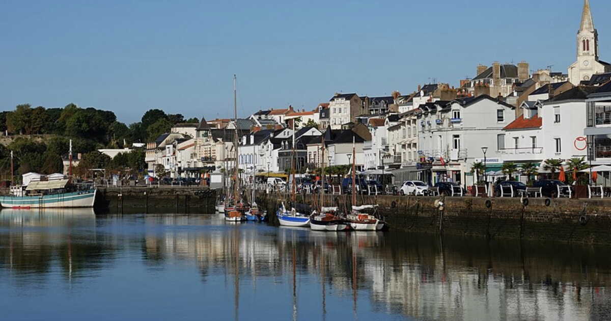
Loire by Bike: From Angers Vineyards to the Estuary’s Sea Spray

Starting from Nantes or Angers, the Loire by bike unfolds into two getaways with distinctly different atmospheres. To the west, the river broadens and heads out toward the Atlantic, weaving through ports, canals, marshes and villages of the Pays de Retz. To the east, around Angers, it winds between wine slopes, islands and characterful villages, up to the hilly landscapes of the Layon. Two loops of a few days each to discover the Loire in a different light, taking the time to depart from the main route and venture into the countryside.

Soybeans: Five Millennia of History Behind a Seed That Became Essential

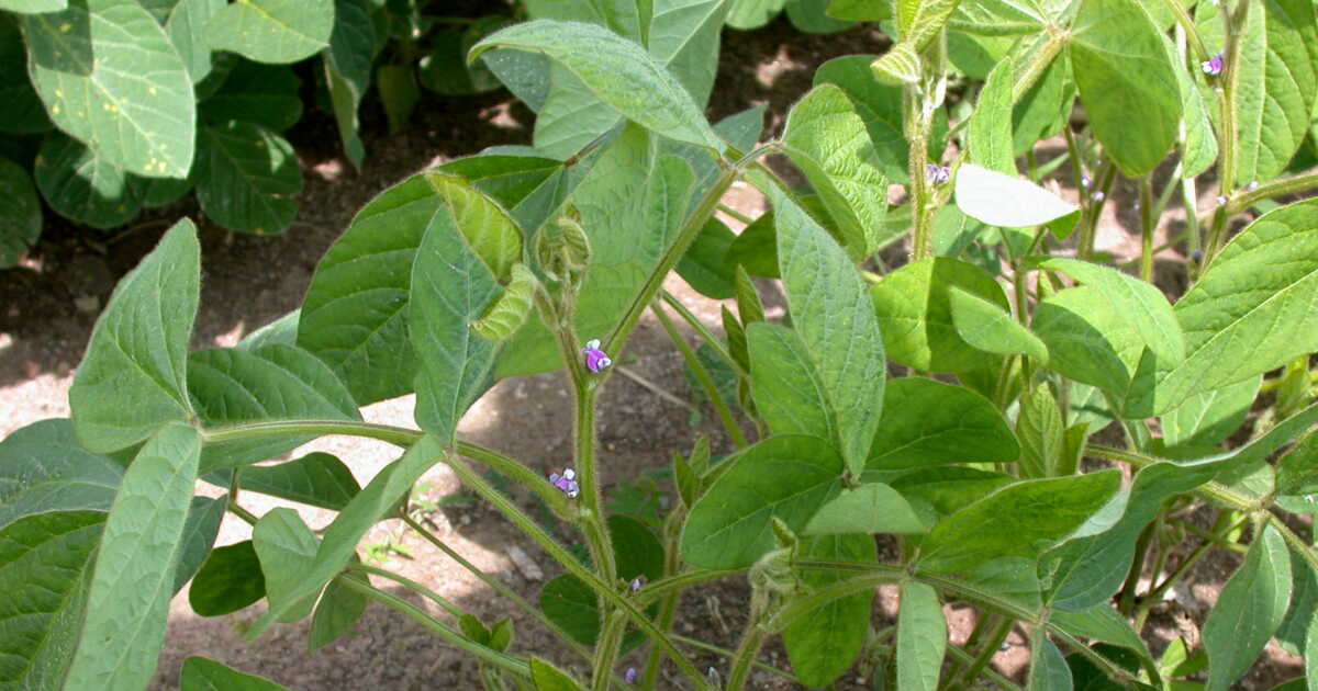
Soy oil, soy milk, tofu… It is consumed in a thousand forms. More importantly, 70% of the world’s soybean harvest is destined to feed livestock. The plant is also used to manufacture biofuels, ink, candle wax, and foams for car seats! A decidedly prosaic fate for a legume whose cradle is China, where it has been cultivated for five millennia and was long regarded as one of the five sacred grains, alongside rice, wheat, barley, and millet. The Middle Kingdom saw its status as the leading producer of soy in the world stolen in the 20th century by the Americas (the United States, Brazil…), where the plant was introduced in the 18th century by an Englishman, and it must now import it.