Edgar Suites, the real estate operator, has just completed a full restructuring of an old youth hostel to establish its new Paris address.
Spread over 780 m² within a Haussmannian-style building, this project marks a new milestone in Edgar Suites’ development strategy.
The rehabilitation works were carried out with the aim of integrating the establishment into the heart of Folie‑Méricourt, a neighbourhood in the 11th arrondissement known for its dynamism, creative galleries and independent shops.
Located near Canal Saint-Martin, Place de la République and the Haut-Marais, the residence offers, from some of its apartments, views of the leafy Jules-Ferry square, the Paris rooftops, as well as on monuments such as the Eiffel Tower or the Sacré-Cœur.
« With the Jules Ferry Residence, we continue our ambition to reinvent urban hospitality through places of stay designed to meet the new patterns of travel », explains Xavier O’Quin, president and co-founder of Edgar Suites.
« This first implantation in the 11th arrondissement (…) also illustrates our will to transform existing buildings to create addresses fully integrated into their environment. »
Beyond heritage enhancement, this opening is accompanied by an environmental approach: the residence aims to obtain the international Green Key label.
When Contemporary Design Meets Art: the AMCA Oval Signature
The visual identity of the address was developed jointly by Edgar Suites’ interior design team and the AMCA Oval studio, founded by Alexis Martial and Adrien Caillaudaud.
The layout draws inspiration from the clean lines of Constantin Brancusi’s style, combining wood, metal and ceramic.
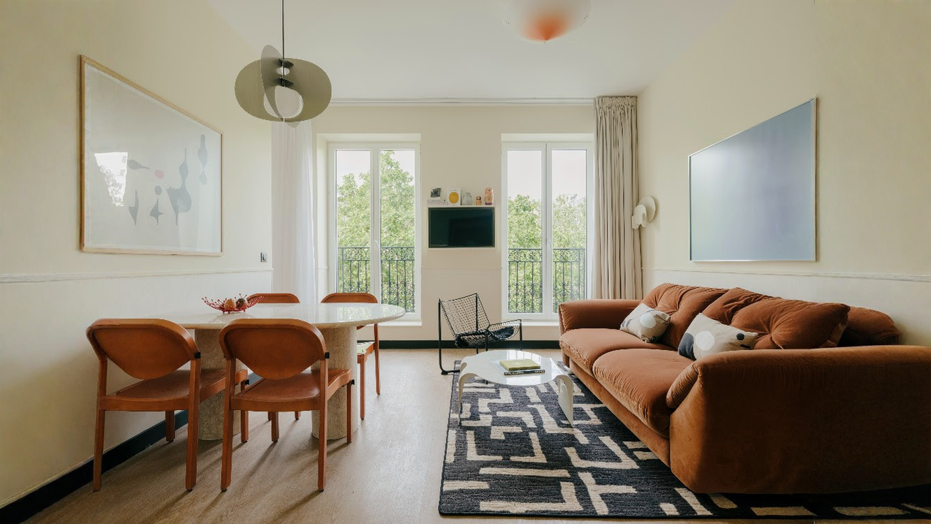
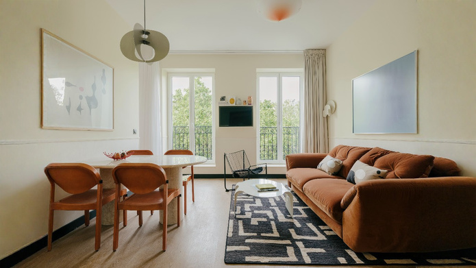
In the living rooms, the furniture comprises velvet sofas from the Edgar x AMPM collaboration, carpets with black-and-white geometric patterns, and a selection of vintage pieces.
AMCA Oval designed several series of bespoke objects for this address: oval-shaped lacquered coffee tables, orange-tinted conical light fixtures, ivory-colored Aurora wall sconces from the range, as well as cushions in Italian jacquard named “Vibrations.” The design duo also signs all the paintings and photographs on display.
In the bedrooms, the decor is more minimalist. They feature dark red lacquered headboards with integrated reading lamps, and showcase a painting on aluminum support from the collection “Neo-Vibrations.”
Finally, the bathrooms adopt a matte, solid color treatment, offered in terracotta pink or olive green, and are equipped with silkscreened mirrors by the AMCA Oval studio.
To read: Edgar Suites: a new hotel residence in Clichy
Located about a ten-minute walk from the Croisette and the Palais des Festivals et des Congrès, this former standard aparthotel has undergone a complete overhaul to erase traces of its past.
Classified as four stars, the establishment now offers 72 rooms distributed across five categories (Classic, Comfort, Superior, Family, and Family Superior) capable of accommodating up to 6 people.
All the rooms are air-conditioned and equipped with NUXE welcome products, a TV with Chromecast, and optimal comfort for short or long stays. Pets (up to 15 kg) are also welcome, with special attention.
A Contemporary Reinterpretation of the Belle Époque
The interior architecture, entrusted to Marie-Paule Clout (founder of the Noir Nuance agency), unifies the historic neo-classical main façade with the more recent extensions from the 1990s around a timeless identity.
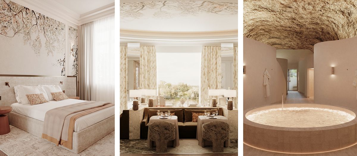
The decoration relies on a palette of natural tones (warm sand, light stone, saline hues) and noble materials such as parquet, walnut, wicker, stone, and linen.
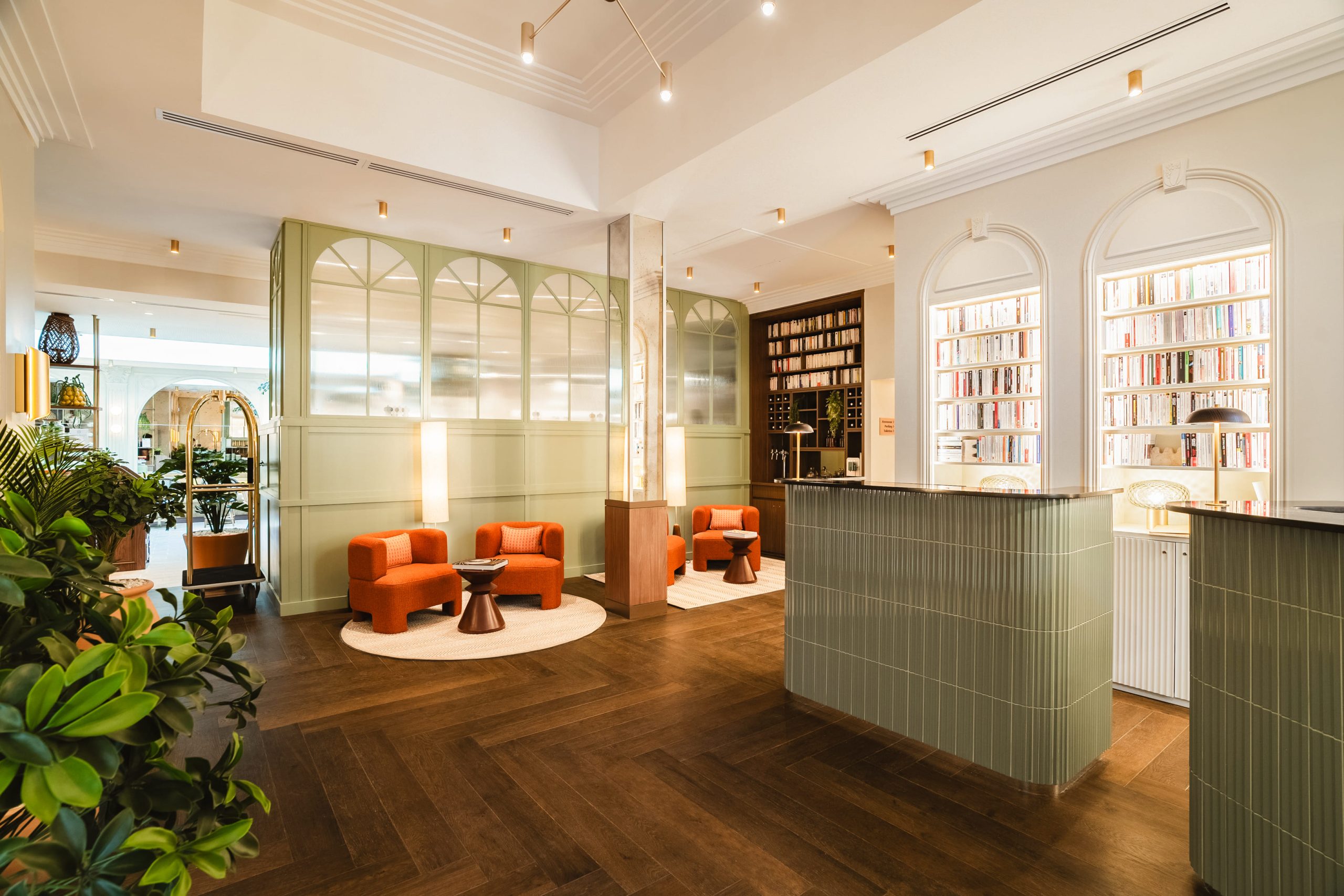
From the Belle Époque-inspired welcome, the tone is set with a graphic parquet floor and elegant moldings. The breakfast area was designed beneath a wide glass roof, like a winter garden, incorporating an orange tree and a lemon tree kept in place.
The hotel also integrates a wellness space featuring an indoor pool, loungers, and a herbal tea bar, completed by a fully equipped fitness room.
A Clear-Cut Eco-Friendly Approach
In line with the policy of the Assas Hotels group, the Lepoussin Hotel implements concrete everyday actions to reduce its environmental impact.
The emphasis is on waste management and weighing, reducing food waste, and transparency about the local origin of breakfast products.
For the upkeep of the premises, the establishment has banned nearly all chemical products in favor of an ozone water system. The hotel aims for a comprehensive assessment via the FairScore audit by 2027. The site finally features a private parking lot equipped with electric charging stations.
Valentin Villatte, Operations Director
Valentin Villatte, the operations director, holds a bachelor’s degree from the Institute Vatel. He climbed the ranks of the hotel industry by serving as Executive Housekeeper at the National des Arts et Métiers in Paris, then as Director of Housekeeping during the opening of the Belle Plage hotel in Cannes.
After managerial stints at the Gray d’Albion Barrière in Cannes and at L’Îlot du Golf in Mandelieu-la-Napoule, he takes the helm of this new address of the Assas group.
Frédéric Jousset unveils the Relais d’Amboise, his new five‑star address affiliated with The Leading Hotels of the World.
Situated at the foot of the Royal Château d’Amboise and near Clos Lucé, this 63‑room and suite establishment reimagines a exceptional historic site.
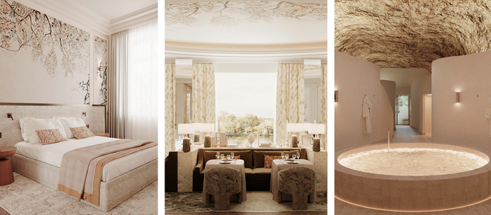
It notably integrates troglodyte spaces recorded as historic monuments, a Clarins mineral spa and myBlend, as well as the city’s first rooftop bar, offering a panoramic view of the Loire.
The architectural design, orchestrated by the LBBA agency and Roque Interiors studio, under the artistic direction of Joséphine Fossey, highlights the tuffeau stone and the Loire Valley identity.
The 63 rooms and suites occupy fully restored historic buildings, some offering private terraces with views of the river or the castle towers.
Relais d’Amboise : a troglodyte space dedicated to art and culture
On the gastronomy front, the Le Choiseul restaurant will offer contemporary French cuisine crafted by Michelin‑starred chef Nicolas Aubry and executive chef Vincent Léger Blanchard.
In parallel, the Le Turner bar, perched on the roof of the establishment, will constitute Amboise’s only rooftop. For wellness, the Spa des Roches will be housed in the heart of former troglodyte caves, complemented by a heated outdoor pool and a yoga space.
Read: 6 slow walks in Centre‑Val de Loire
The Relais d’Amboise also stands out for its cultural dimension.
The Greniers de César, vast underground galleries in tuffeau stone, will host an artistic program throughout the year, event spaces, and a tasting cave devoted to regional wines.
The site will notably participate in the artistic itinerary dedicated to sculptor Bernar Venet, in resonance with the Clos Lucé château and the Royal Château of Amboise.
An Opening Spectacle: Costumes, Horses, and Eagles
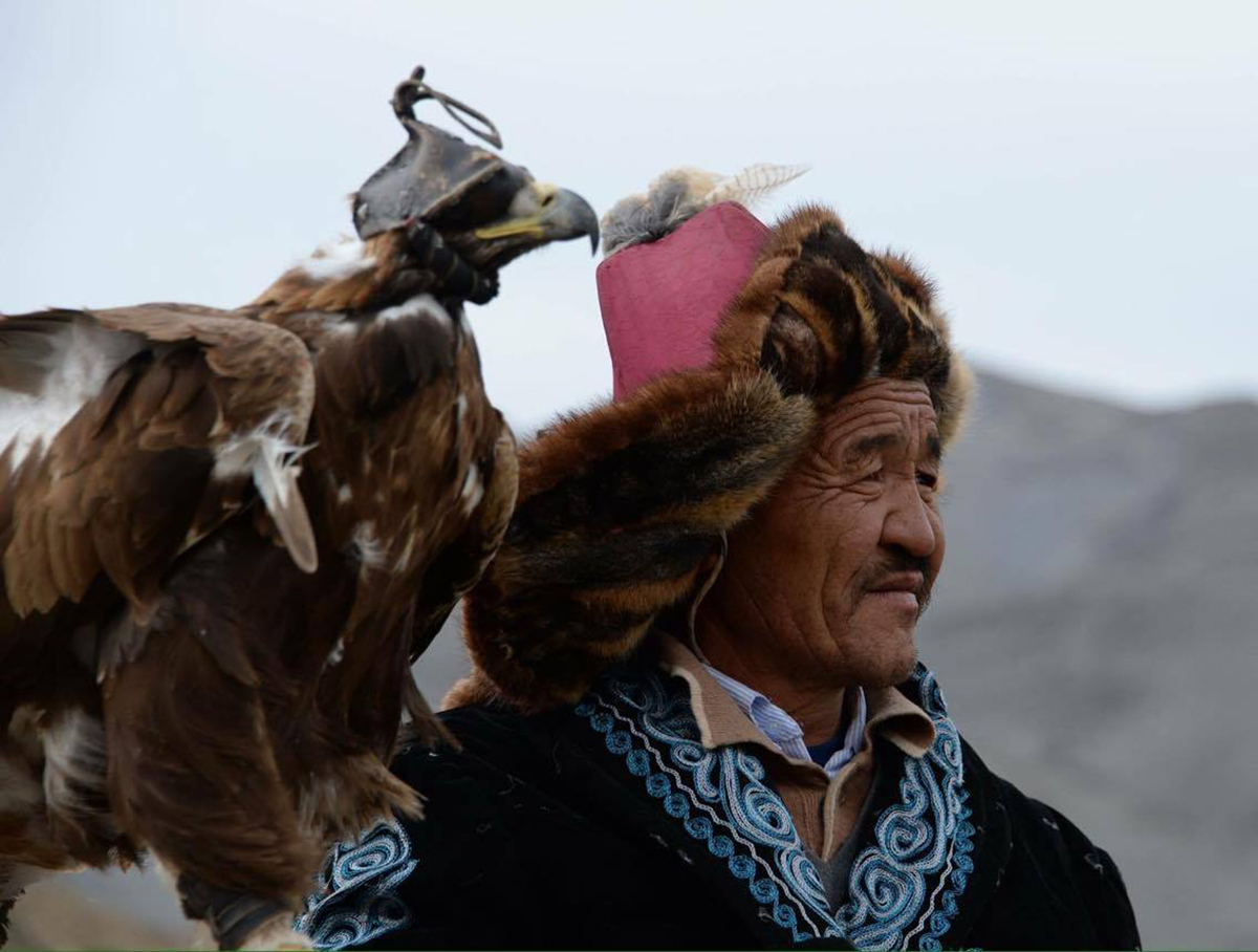
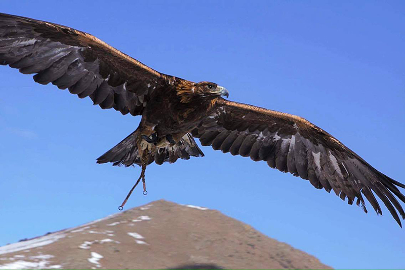
The festival begins with a vibrant parade. The hunters, dressed in sumptuous traditional embroidered cloaks and crowned with fur hats, advance on horseback, the regal eagle perched proudly on their arm. The horses, specially trained to navigate mountainous terrain, play a crucial role in this impressive staging.
During the opening ceremony, attention is focused as much on the elegance of the costumes as on the quality of the gear and the presence of the riders. The harmony between the hunter, his horse, and his eagle is observed with care. This solemn moment transcends a mere competition: it is a true celebration of identity for the Kazakh community.
The heart of the festival then centers on simulated hunting trials. The judges observe the relationship between the eagle and its master, the bird’s obedience and responsiveness, as well as the precision and power of its flight. These demonstrations highlight the patience, discipline, and mastery required by this ancient practice.
In the past, some competitions used live animals to test the eagles’ aptitudes. This practice was abandoned to meet visitors’ ethical expectations and to preserve the festival’s responsible image. Today, demonstrations take place in a more respectful setting, while maintaining their intensity and authenticity.
A Comprehensive Cultural Immersion
The Eagle Festival is not limited to competitions. It also offers visitors a glimpse into traditional Kazakh games, notably:
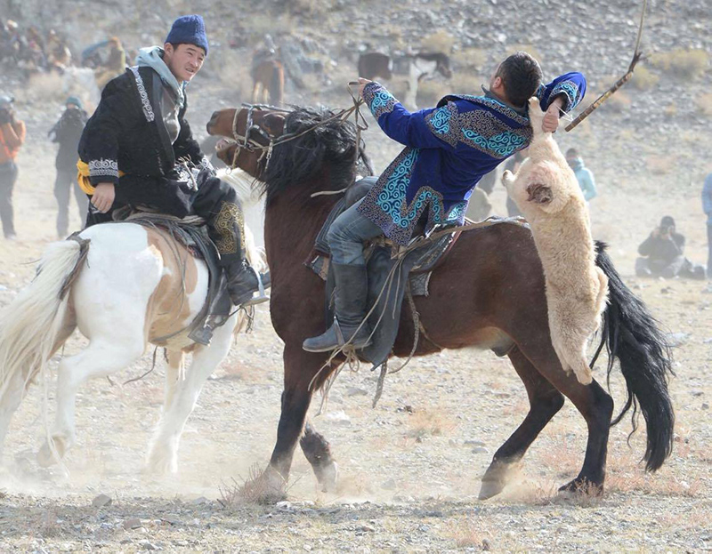
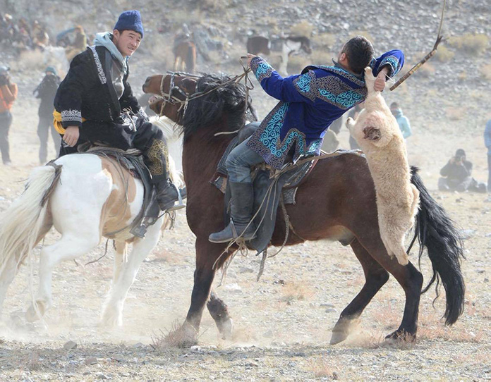
● Kökpar, an impressive equestrian game in which riders contend for a goat carcass
● The horseback collection of pieces from the ground, a spectacular display of dexterity and balance
These moments provide a rare glimpse into the nomadic lifestyle, where riding skill and community cohesion are central.
But beyond the spectacle, it is especially the encounter with the Kazakh people that leaves a lasting impression. Hospitable and proud of their culture, the locals welcome visitors in a warm atmosphere, often around milk tea or a traditional dish shared under the yurt.
An Event Not to Be Missed
Over the years, the Eagle Festival has established itself as one of the most iconic highlights on Mongolia’s tourist calendar. Photographers, filmmakers, and curious travelers come here to seek powerful images, but also to experience something sincere, far from the usual circuits.
Nevertheless, the festival is not just a show for visitors. For Kazakh families, it represents primarily a means of keeping a practice alive, handed down from generation to generation. Eagle hunting is not a staged performance created for tourism; it is part of the daily life and identity of this community settled in the country’s west.
One hunter also said:
“The eagle is not merely a bird for us. It is part of our family. Through the festival, our children take an interest in this tradition, and we can share it with those who come to discover it.”
A One-of-a-Kind Experience
Attending the Eagle Festival means taking the time to observe a rare relationship between humans and animals, set in a spectacular natural backdrop. It is also an opportunity to discover a region that remains preserved and to interact with a community proud of its roots.
More than a simple event, the festival often leaves a lasting impression: the sense of having drawn near to a living culture still deeply connected to its environment.
Your contact: Unubold NAVCHAA at DMD Mongolia [email protected] +976 7011 5534 and -976 8813 5541 www.dmd-mongolie.com >> DMD Mongolia in the DESTIMAG Directory
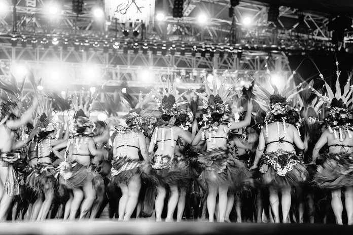
Across a patchwork of major events, from Tahiti to the Marquesas, the Polynesian people rekindle their spiritual strength: Mana. More than a simple festive calendar, these gatherings are acts of cultural resistance, moments of pure transmission where dance, sport, the sacred, and craftsmanship fuse to affirm a multifaceted identity. It is the time of year when neighborhoods empty out for rehearsals, when families gather around the crafts of weaving, and when the scent of tipanier and the tiare pervades every commune. It is a journey where every gesture, every war cry, and every song becomes a living word addressed to the ancestors. The Ma’ohi heritage is not a relic, it is a breath that never fades.
Heiva i Tahiti: The Fury and the Grace
The Heiva doesn’t begin under To’atā’s lights; its roots reach back months earlier, in the shadowed neighborhoods, where bodies wear themselves out during nocturnal rehearsals after long days of work. There, between sips of water and Tahitian jokes, the group becomes a family. There, they prepare the “rebirth”: that of a culture that nearly vanished and now explodes into a discipline that reads like military training.
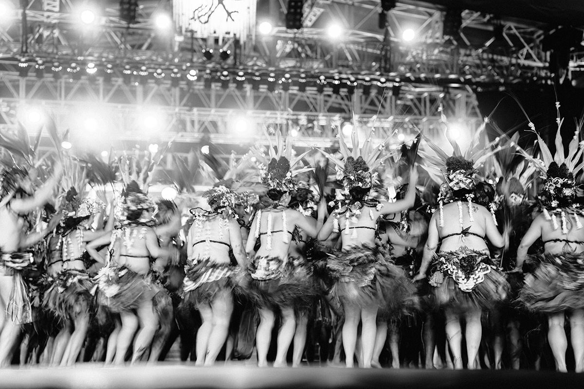
On the night of the competition, backstage is a furnace of green. The monumental headdresses are adjusted, the bark skirts that weigh on the hips are tightened, and the skin is coated with oil to gleam under the lights. Then, silence falls. From the first strike on the to’ere, energy takes on a different nature. It is no longer merely dance; it is a dialogue with the unseen. The percussion erupts, the hymene voices rise in powerful surges that send shivers down your spine, and suddenly one understands that every hip swirl and every foot stomp is a signature: “We are here, we stand, and our land is alive.” It is this pure thrill, this identity that cannot be explained yet is felt in the heart, that one experiences at the Heiva.
The Heiva’s Satellite Events
The Umu Ti, the pact with fire
For those seeking contact with the unseen, walking on fire unsettles certainties. It isn’t a show; it’s a communion. Over forty-eight hours, a vast blaze consumes the air. Basalt stones store heat that can reach 600°C. Under the guidance of the Tahua (priest), armed with protective Auti leaves, participants cross the flames barefoot. It is raw proof that Mana, invoked with humility, can transcend the laws of matter.
The Tu’aro Ma’ohi :
The ancient Polynesian athleticism has its own Olympic Games. Here, the vital gestures of old become athletic feats: climbing a coconut tree at staggering speed, hurling a javelin (Patia Fa) at a coconut perched nine meters high, or even shelling coconuts. The most spectacular remains the fruit-bearer race, where athletes sprint with 30 to 50 kg on their shoulders. This elevated physical vigor is elevated to the rank of national art.
The Heiva Va’a Matai’eina’a :
The ballet of the Va’a canoes is the umbilical cord that ties the Polynesians to their ancestral navigators. Far from modern technology, this Heiva esteems pure gesture. The rowers, in pareo and plant-based adornments, turn the lagoon into a living tableau. Whether racing in single-outrigger or crews of sixteen, every paddle stroke honors the cohesion of a water-loving people.
The Heiva Rima’i: When matter comes to life
One cannot truly understand the Heiva costumes without witnessing the titan’s craft behind them. At the Heiva Rima’i pavilion, craft is not a tourist souvenir; it is the realm of the “golden hands.” It is here that the richness of each archipelago is grasped: the astonishing weave of Rurutu, the strength of rosewood carved in the Marquesas, or the glow of the Tuamotu’s mother-of-pearl. To see these creators turn a simple plant fiber into a royal adornment is to understand that every object is a piece of history held in the hands.
The Tuifara at the Marae Arahurahu: The awakening of the sacred
If To’atā is the temple of spectacle, Paea’s Marae Arahurahu is the temple of the soul. Here, with the Tuifara festival, the glare of spotlights gives way to pure spirituality. Imagine the voices of pupu hīmene resounding against the high basalt walls… the acoustics are natural, almost mystical. On this sacred site, dancers aren’t on a wooden stage; they make the very earth tremble with the power of their ancestors. It is a moment outside time, a meeting between past and present in a theatre of greenery.
Matavaa o te Fenua Enata: The Awakening of the Land of Men
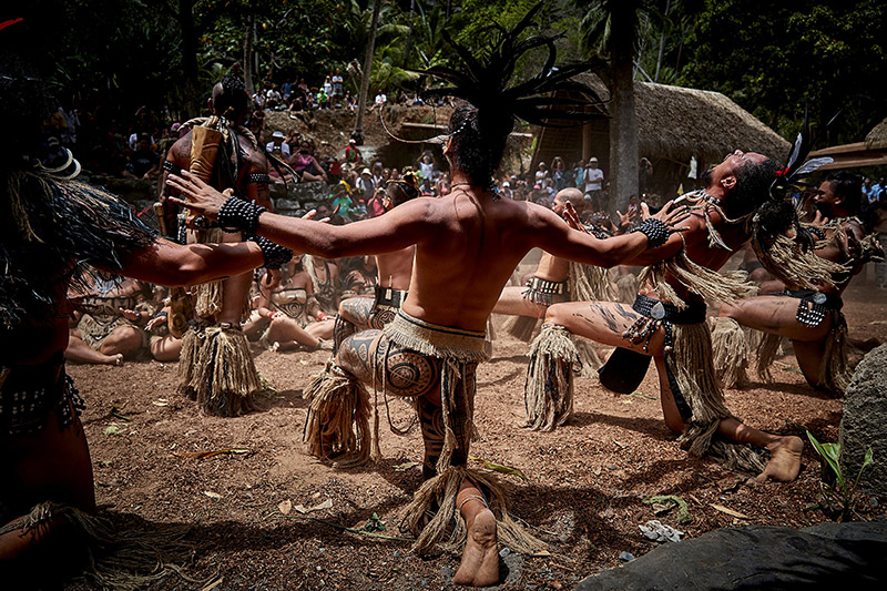
Born out of a vital urgency, Matavaa did not arise from a simple desire to entertain, but from a need to survive. In the 1970s, the Marquesas archipelago faced a frightening cultural decline. It was under the impulse of the Motu Haka association, in 1986 at Ua Pou, that this rallying cry rang out. Today, the festival marks 40 years of identity reconquest. Its strength lies in its itinerant nature: every two years, it travels between Nuku Hiva, Hiva Oa, and Ua Pou, while mini-festivals keep the flame alive on the more isolated islands like Fatu Hiva or Ua Huka.
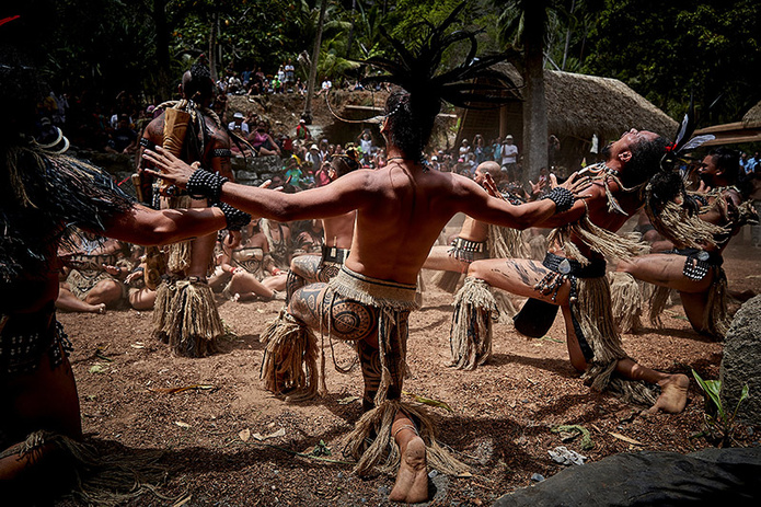
The raw basalt energy, whose aesthetics sharply break from Tahitian gentleness. The setting is that of stone cathedrals and deep valleys. The performances unfold on the Tohu’a, these vast stone plazas. Under the muffled beat of the Pahu Nui, the ground seems to tremble. The festival deploys warrior dances of unprecedented intensity, such as Maha’u (the pig dance) with its powerful breaths, or the Haka where the fixed gaze asserts the clan’s vigor.
Tattooing, or Patutiki, is central there. It is not ornament, but a writing on the skin telling a genealogy. The carved-wood decorations and rooster-feather adornments complete this look of elegant yet solemn “savagery.”
A collective victory with no single winner: the Matavaa’s hallmark is the complete absence of competition. People come for the Me’ae, for sharing. For several days, modern life stops: Ka’aku is prepared and foods are cooked in enormous Umu (underground ovens). It is the triumph of unity across a proud archipelago, proving that the Mana of the Land of Men is among the Pacific’s most indomitable.
Source: Destination Marquises
Travel with Moana Voyages: Your Gateway to Authenticity
Experiencing the Heiva or the Matavaa is not merely ticking a box on a vacation itinerary; it means letting yourself be transformed by the Fenua’s energy. These moments of grace, when time stands still to make way for the sacred, require a travel approach that is respectful and profound.
At Moana Voyages, our mission is to open the doors to this vibrant Polynesia for you. As experts based in the heart of these archipelagos, we do not simply organize getaways: we weave connections between you, this land, and its people. Whether you wish to move to the beat of To’atā drums or tread the mystical basalt of the Marquesas, we will accompany you so that your immersion is total, fair, and unforgettable.
Since 2017, Voyages d’Exception has been developing a distinctive offering on European rivers: cruises where music is not merely a soul-soothing addition, but the guiding thread of the journey.
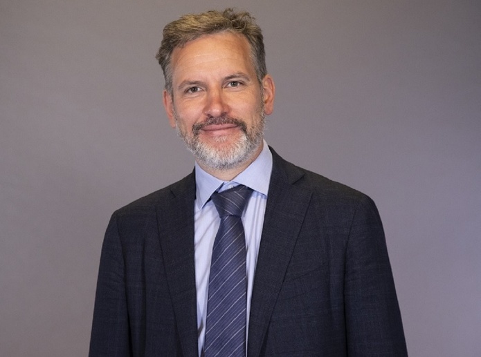
The idea came from Lionel Rabiet, founder of the tour operator. «At the time, musical cruises were mainly designed for the sea. He quickly perceived the potential of river cruising», explains Mathieu Ramus, Voyages d’Exception’s marketing director.
This potential first lies in geography. The Danube, the Rhine, the Moselle, or the Rhône cross cities and regions where a portion of European musical history has been written.
« Performing a work as close as possible to the region where it originated gives it a particular resonance. The river was not a backdrop, but a thread », he continues.
A Renowned Violinist as Conductor
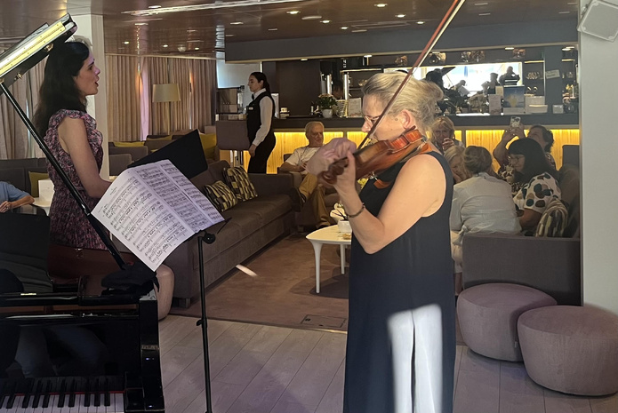
To give substance to this ambition, Voyages d’Exception has relied for nearly ten years on Sophie Lemonnier-Wallez, a violinist and the artistic director of these programs.
Her role is central: she designs the line-ups, brings together the artists, imagines the ensembles and selects concert venues, from Baroque churches to historic theatres.
On board, the size of riverboats also enables an unusually close proximity between passengers and performers. Travelers attend concerts, and sometimes even rehearsals. They interact with the musicians, discover the works through talks, and extend the experience during stops.
Tested and Approved by TourMag
TourMaG had the opportunity to observe this in June 2025, aboard CroisiEurope’s Douce France, chartered by Voyages d’Exception on the Danube.
From Vienna to Budapest, via Bratislava, the concerts by pianist Paul Beynet, mezzo-soprano Maria Mirante, and Sophie Lemonnier-Wallez offered a different perspective on the regions traversed.
Among the highlights: a concert in the Baroque church of Dürnstein, or a recital in Franz Liszt’s apartment in Budapest.
“The river offers above all what no other format truly allows: a slow pace that gives time to listening, and a human scale. Our ships host about a hundred travelers, recreating the conditions of a chamber music salon.”, sums up Mathieu Ramus.
The product naturally attracts seasoned music lovers, but not only. Voyages d’Exception also appeals to curious travelers who are sensitive to music without being specialists. The Francophone guidance, talks and contextualization of the works help make the program accessible.“You don’t need to be a connoisseur to enjoy them.”, insists Mathieu Ramus.
An Ambitious 2027 Season
In 2027, Voyages d’Exception unveils its most ambitious musical program to date, featuring five river cruises, including three new ones: Symphonies Along the Flanders and the Netherlands in June, The Danube Musical: from Budapest to the Black Sea, also in June, and Cruise Art & Music on the Rhône from Lyon to Arles in October.
The season will also include two engagements already identified by the tour operator’s clientele: Romantic Rhine Cruise with Franck Ferrand in September, and a Musical New Year’s Eve on the Seine in December.
Across all departures, Voyages d’Exception keeps the same signature: programs crafted specifically for each voyage, blending seasoned soloists and rising talents, under the artistic direction of Sophie Lemonnier-Wallez.
The musical cruise also helps to build a loyal following among discerning, cultured travelers, often seniors, but not closed to first-time cruisers. For river travel has another advantage: it provides reassurance. No rolling seas, no overnight at sea, stops in the heart of cities, and a gentler pace. For a traveler drawn to music but still hesitant about the cruise world, this is an ideal entry.
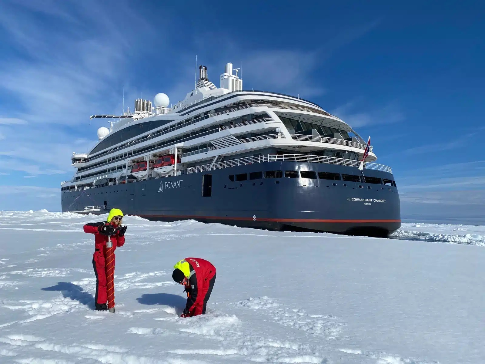
On board the Commandant Charcot, exploration goes beyond landscapes. At the start of May, during a crossing from Brest to Reykjavik, passengers witnessed a series of scientific talks held in the ship’s theater. Climate, biodiversity, plastic pollution, marine mammals, or Arctic sea-ice dynamics: a range of topics that complemented the field experience.
Among the speakers were notably François Galgani, a specialist in plastic pollution, Olive Andrews, an expert on marine mammals, Aymeric Houstin, a conservation ecology researcher, or Vito Vitale, associate research director at the Institute of Polar Sciences.
The stated ambition is clear: to make the expedition not only an observational journey but also a tool for understanding the territories traversed.
A floating laboratory at the heart of polar regions
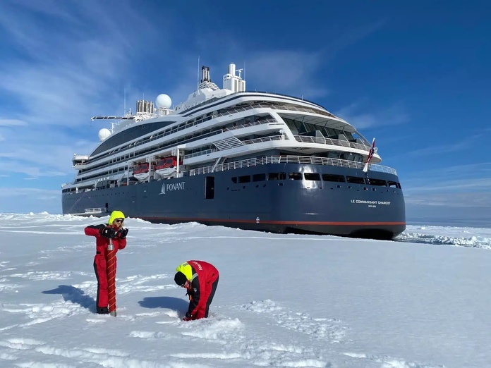
Launched in 2021 under the leadership of Megan Clampitt, the Ponant Sciences program relies primarily on the Commandant Charcot, described as the first luxury polar exploration ship designed from the outset to host scientific activities.
Behind the talks offered to passengers, the Commandant Charcot operates as a genuine scientific platform.
On board, several laboratories host researchers. It is up to the scientists to obtain the necessary permits to carry out their work.
Among the equipment deployed is an oceanographic rosette equipped with Niskin bottles, enabling water sampling at different depths – up to 1,000 meters depending on missions – while recording parameters such as temperature, salinity, or depth.
The data collected are then shared by the scientific community. More than one hundred projects have already been hosted since the program’s launch, yielding around ten scientific publications.
The ‘Science Officers’, New Knowledge Facilitators
Selon Ponant, plus de 150 chercheurs ont déjà participé à une soixantaine de projets scientifiques depuis le lancement du programme. Les données récoltées alimentent ensuite des travaux partagés avec la communauté scientifique internationale.
Pour faire le lien entre recherche et expérience client, la compagnie a créé un rôle spécifique : celui de science officer.
À mi-chemin entre coordinateur scientifique et médiateur, ce professionnel accompagne les protocoles de recherche, supervise les équipements embarqués et traduit les travaux menés à bord en contenus accessibles aux voyageurs : conférences, présentations ou échanges informels.
The Swap2Zero project on the 2030 horizon
Cette logique dépasse aujourd’hui le seul Commandant Charcot. Sur d’autres navires d’expédition de la flotte, des naturalistes, glaciologues ou spécialistes de la biodiversité interviennent régulièrement lors des itinéraires polaires ou tropicaux.
En Polynésie française, le Paul Gauguin participe également à plusieurs initiatives de sensibilisation autour des écosystèmes marins et des récifs coralliens.
Ponant prépare enfin l’étape suivante avec son projet Swap2Zero, un futur voilier transocéanique à propulsion vélique et piles à combustible, annoncé pour l’horizon 2030 et pensé comme une plateforme ouverte aux travaux sur la décarbonation maritime.
Dans un marché de l’expédition où l’accès aux destinations reculées tend à se banaliser, la science devient progressivement un argument de différenciation.
Published by Laurent Guéna Journalist – TourMaG.com See all articles by Laurent Guéna
On the roads of Cantal, everyone knows that slender figure with a determined stride, a walking stick in hand, a black beret crowned with a small cow on the head. Each day, Brother François, with a youthful look beneath his white hair, goes from farm to farm to help milk the cows, cut the hay, or repair the fences. François Cassingena-Trévedy, by his civil name, is a regional figure, known far beyond his village of Sainte-Anastasie, reaching Murat and even Aurillac. This affable 66-year-old man defines himself as a peasant monk. An Alsatian, a Normalien, a theology professor, a translator of Virgil, he is also a poet and writer, author of 25 books. One of them (Cantique de l’infinistère, ed. Desclée de Brouwer, 2016) speaks of his love for Auvergne by recounting a walk through the volcanoes that changed his life.
“C’est un pays rude, austère, raboteux, mais aussi sensuel, dit-il depuis les plateaux herbeux qui dominent son village. Un bout du monde infini, où les montagnes sont comme de grandes houles de lave solidifiée. C’est en marchant que j’ai décidé de quitter mon monastère pour me dédier à cette terre et à ses habitants.”
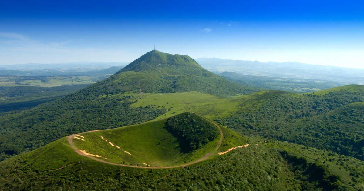
To feel, like him, this telluric summons, nothing beats setting one foot in front of the other on the volcanic bedrock of Auvergne — basalt, phonolite, Volvic stone, pozzolana… — while contemplating the conical mountains and the valleys that lie ahead on the horizon. And why not undertake the Grande Traversée des Volcans d’Auvergne (GTVA)?
The Great Volcanic Crossing
This new itinerary, created in 2024 and spanning the départements of Puy-de-Dôme and Cantal, invites you to discover the natural heritage of the region, from the iconic Puy de Dôme (1,465 m) to the Plomb du Cantal (1,855 m), passing through the Sancy massif, the Cézallier plateau and the valleys of Puy Mary. Open to all, it stretches 210 kilometers and can be completed in one go in eleven days for the bravest, but one can of course choose only a portion. Arriving in Cantal, some travelers may cross Brother François along the last third of the route. “We imagined this itinerary as a condensate of the region’s beauties – peaks, plateaus, rivers, lakes, villages – using the already existing GR [long-distance hiking trails], explains Michel Faure, local head of the French Hiking Federation, who designed the 98 kilometers of the route in the Puy-de-Dôme.
The zero-kilometer point of the GTVA lies on the heights of Chamalières, in the greater suburb of Clermont-Ferrand. On the information panel, there is a map, some basics of geology and safety instructions. The Massif central may often be thought of as a “mountain of cows,” but it is still a real mountain, with its dangers and its changing climate. And to tackle the 8,500 meters of positive elevation, good shoes and off-road clothing are essential.
Volcanic Scoria Screeches Underfoot
From the first stage (fifteen kilometers between Chamalières and Laschamps), the trail stubbornly climbs through woods and pastures. We trek on a ground studded with pouzzolanic rocks (volcanic scoria) that screech underfoot. Then comes the steeper climb toward the Puy de Dôme. The many hikers who ascend it each year often forget that this merely sleeping volcano is of the peléan type, meaning dangerously explosive, with pyroclastic flows, while the other volcanoes of the Puys chain — also dormant — are strombolian, with regular eruptions of scoria and lava. At the summit, the cool wind, which can surprise in any season, pleases paragliders. The Puy de Dôme, a young volcano with its last eruption dating back 11,000 years, may owe its name to its shape (dumio, Gaulish for hill). Up there, one discovers the imposing remains of a IInd-century Gallo-Roman temple dedicated to Mercury, god of commerce, thieves, and travel, but also a meteorological observatory and a small station for those who prefer a cog railway. This belvedere offers a splendid view of what awaits hikers: 80 craters aligned along about 35 kilometers, inherited from a sequence of telluric cataclysms dating from 200,000 to 11,000 years ago.
In this epic universe of sharp cones, rounded domes, and high-altitude lakes, the crossing continues. In the darkness of beech and conifer forests, on the exposed slope of the summits where herds of cows graze, skirting the hills and following the ridge lines, the GTVA offers a great diversity of landscapes. The trail, located mostly above 1,000 meters, sometimes intrudes on pastures, with the farmers’ permission. At the top of the Puy de Dôme, one is amazed: 80 craters aligned along 35 kilometers, heirs to a sequence of telluric cataclysms dating from 200,000 to 11,000 years ago.
Beside the Valley, Heaven Lies in Saint-Nectaire
It is in this epic universe of sharp cones, rounded domes, and high-altitude lakes that the crossing continues. In the darkness of beech and resinous forests, on the exposed slope of the summits where cattle roam, circumventing the hills and following the ridgelines, the GTVA offers a rich variety of landscapes. The trail, mostly above 1,000 meters, sometimes edges onto pastures with farmers’ consent.
About halfway through the second stage (between Laschamps and Lake Servières), one admires the village of Orcival and its impressive walls of andesite (a volcanic stone), before slipping to the west of the trail to reach the paradise of Saint-Nectaire. The Planchettes farm, perched on the hillside and active for two centuries, hides a treasure. In 1946, the owners discovered a well 18 meters deep. For two and a half years they dug with pickaxe a 100-meter gallery to tap the water. The result: the place, with its constant humidity (90%) and 10 °C, became an ideal cellar where a thousand farm-produced AOP cheeses mature — they produce 70 each day. “There are only a few dozen Saint-Nectaire producers left who, like us, age the cheese on the farm”, notes Marlène Gratadeix, 44, from a farming family for six generations.
A Breath of Fresh Air in the Heart of the “Diagonale du vide”
At the end of the second stage, just a stone’s throw from Lake Servières, Café du Lac offers lodging and meals (including a famous blueberry tart) at the crossroads of GR 30, GR 441, GTVA and the Grande Traversée du Massif Central, a MTB route. “I’d been coming to this refuge for forty years, it was very rustic, and when I had the chance to buy it in 2017, I didn’t hesitate!” recounts its owner, Michel Fabre, 63, a hiker since always. “A lot of people tell me it’s the finest section of the GTVA, with wide open spaces, a view of the Puys chain and the Sancy massif.” On the exposed plateau of Lake Servières, grassy mounds mark old transhumance trails, or burons-trous, shelters built by medieval peasants for aging cheese. “These open mountains, easy to approach but of great beauty, with volcanoes as a guiding thread, are attracting more and more hikers since Covid-19,” notes Michel.
“I especially notice a return to bivouacking among young people.”
Six kilometers to the south, the trail runs along Lake Guéry, the highest lake in Auvergne (1,244 m), sparkling at the heart of the Dore mountains. In the distance, the Puy de Sancy, the highest point in the Massif Central (1,885 m), rises. Nathalie Duquesne, 63, has fallen in love with this horizon, with the calm and the starkness of the places. This great traveler, “on motorbike, by boat, on foot…,” she has settled here and took over the Auberge du Lac de Guéry and the adjacent farm ten years ago. She dreams of opening an artist residency in her barn. Summer concerts have already taken place there, drawing dozens of curious visitors, a breath of fresh air in this region situated on the heart of the “diagonal of emptiness.”
A hiker steps over a stream in the Fontaine Salée cirque, one of the Sancy massif valleys located in a nature reserve.
The third stage ends at Mont-Dore. The place hosted France’s third ski resort in 1937. It even earned the nickname “Petit Cham” (in reference to Chamonix), because people practice ice-climbing, skiing, snowshoes… Patou Vergnol, 56, knows this high Dordogne valley by heart where she works as a ski instructor in winter and a hiking guide for horses in summer. Always with the Sancy on the horizon. “I love this accessible mountain, not stark but grassy and gentle to the eye,” she says. “On these wide expanses, you see far. On horseback, the sense of being in a new world is total.” For her, all four seasons are beautiful here: “Spring flowers, a very green summer, autumn colors, then the white breath of winter.” She also explains what “pleige” is, that uncertain mix of rain and snow, and a “ébouriffée,” a sudden gust that can tilt you into winter. We still have about 40 more kilometers to reach Égliseneuve-d’Entraigues, the gateway to Cézallier, at the border between Puy-de-Dôme and Cantal. One feels far away, very far, as one discovers this “little French Mongolia.” If one strays a bit from the itinerary, one encounters barren hills, lost burons, out-of-season hamlets, life at a standstill.
Field report by Olivier Joly, photographer and journalist
Facing the ruggedness of volcanic landscapes and the vastness of the sky, our reporter has “sometimes felt as though I were in lands farther away I have roamed a lot, Patagonia or Iceland, where powerful nature sits alongside a living ancestral tradition of livestock farming. Nights spent at the buron, wrapped in the silence of desolate plateaus, have further reinforced this sense of retreat from the world, in a region that is nevertheless so close and accessible.”
A crossroads of commerce and a land of refuge
Here is a land steeped in transhumance history, the most numerous cattle in France. “The Cézallier is a peaceful yet powerful place, a link between the Sancy and the Cantal, a place to recharge,” says Philippe Glaize, 73, whose family has lived on the plateau since the 17th century. “It is a cattle-raising land for 4,500 years, a migration land since the Middle Ages, when peasants went to sell their hemp and merchants from the North and the Vosges came to trade. It is finally a land of refuge, having welcomed Spanish Republicans, Jewish children, and 5,000 starving youngsters from Marseille during World War II.”
After Cézallier, the Grande Traversée des Volcans d’Auvergne continues to thread southward, with Cantal as the goal. Crossing the Limon plateau brings you to Puy de Niermont (1,620 m), which offers a formidable vantage on this stratovolcano, the largest visible one in Europe, which gave its name to the department. One can also climb Puy Mary (1,783 m), classified as a Grand Site of France, whose panorama justifies the climb. From there, the valleys of Claux, Falgoux, and Mandailles fan out like spokes, each stretching its own singular beauty. “The Mandailles Valley is my favorite for its preserved, green landscape and the jagged horizon shaped by the great summits along the central volcanic ridge,” comments Pascal Saint-Jean, 60, mountain guide.
Knowing how to distinguish Salers, Aubracs, and Ferrandaises
The final stage allows you to travel it before reaching the Plomb du Cantal, the terminus of the GTVA, in three and a half hours of walking from the Lioran ski station (or ten minutes by cable car). From this old basalt dome, the 360-degree view embraces the traversed landscapes, the Sancy, the Cézallier, the Cantal and opens to the Aubrac and the Margeride, at the far edge of Auvergne.
As Pascal notes, those who have wandered these landscapes for decades are unanimous: never has hiking in the Puy-de-Dôme and Cantal (with more than 7,000 kilometers of marked trails) been so popular. Each stage is a source of wonder, with its precious plant species (gentian, narcissus, meadow anemone, sphagnum moss…), its large raptors (kites, falcons…), its chamois and mouflons. We also learn day by day to recognize the cattle: Salers in a mahogany color, Aubracs with eyes rimmed in black, and Ferrandaises, rarer, with lyre-shaped horns and a red-and-white coat… Trekking these sleeping but vibrantly alive volcanoes of Auvergne gives a renewed hope: nature and people can live in harmony.
They helped us with this report
Chamina Voyages, a Massif Central-based agency since 1981, specializes in walking, cycling, and snowshoe itineraries in Auvergne as well as across France and Europe. With flexible or guided group options, it prioritizes nature circuits and authenticity, and favors charming accommodations.
To prepare your stay. Various tourism organizations offer a wealth of ideas for visits, accommodations, hikes, experiences… https://www.auvergnerhonealpes-tourisme.com, Cantal Destination: https://www.cantal-destination.com, Hautes Terres Tourisme: https://www.hautesterrestourisme.fr, Puy-de-Dôme Tourisme: https://www.puydedome-tourisme.com, Val de Sioule Tourisme: https://www.valdesioule.com
➤ Article published in GEO magazine no. 569, “Recharging in Auvergne,” July 2026.
➤ Do you love GEO? Then to miss nothing, discover our subscription plans to receive GEO every month at home with ease.
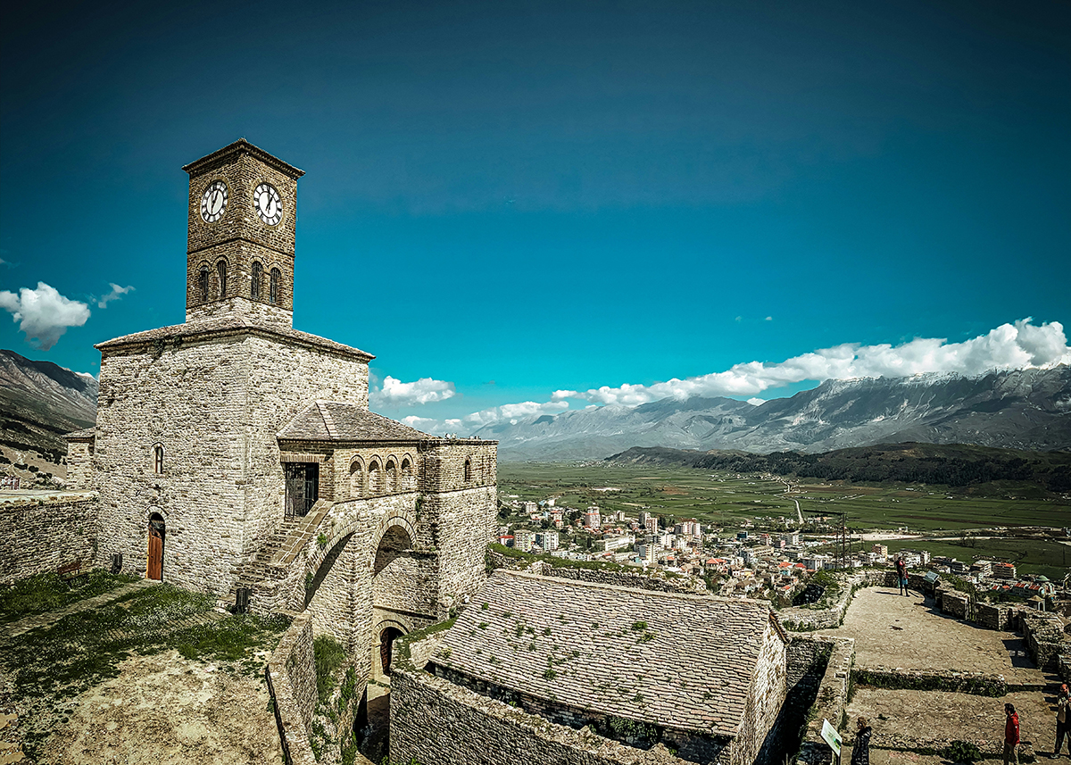
Gjirokastra and Berat: two UNESCO treasures Europe has not yet discovered
Përmet, the Nivica Gorges, and the Zagori Valley: Albania unseen by most
Between the historic towns and the coast, there exists an Albania that very few travelers take the time to explore. The Përmet region and its surroundings — the Zagori valley, the Lengarica gorges, the Nivica canyon — is probably the most pristine part of the country.
Përmet is a small town perched on the Vjosa, one of the last great wild rivers in Europe, recently protected as a national park. The Vjosa flows freely from its Greek source to the Adriatic, with not a single dam along its course. Its waters are unexpectedly clear.
Around the town, the trails of the Zagori valley traverse ancient beech forests, villages almost deserted perched at 800 meters, meadows where shepherds work according to ancestral methods. The Sheper hike toward Përmet, with a 1,200-meter descent, is among the most beautiful we recommend.
The Nivica Gorges
In the depths of a canyon carved at the edge of the Butrint National Park, the Nivica Gorges are among those places you wonder how they managed to stay so confidential. The limestone walls plunge into a turquoise river; the rock corridors seem carved to measure. In spring, the current is powerful and spectacular. In summer, natural pools form in the hollows.
The number of visitors remains low. That is precisely what makes it worth the detour.
✦ Our Team’s View Arrive early in the morning to take advantage of the low-angle light on the walls and to maximize your chances of being alone. In April or May, the gorges are at their most spectacular: vigorous current, lush vegetation, colors changing with the hour.
The Prespa Lake: at the crossroads of three countries
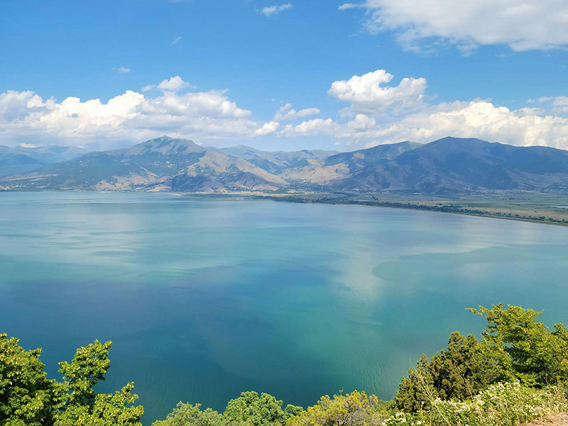
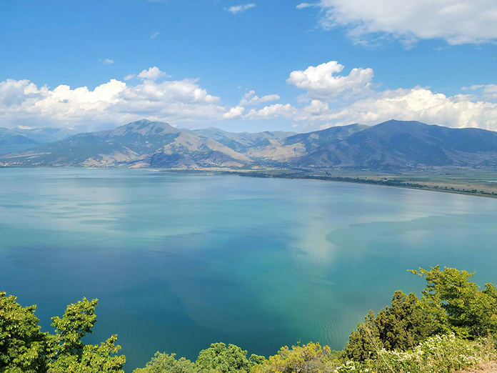
At the eastern edge of the territory, where Albania, Greece, and North Macedonia meet, Prespa Lake stretches its waters across a landscape from another era. Inscribed on UNESCO’s heritage list for its transboundary dimension, the site houses a troglodyte church carved into the rock, decorated with remarkable frescoes, accessible after an easy walk. A view of the island of Golem Grad, distant mountains, and a lake that almost no tour itineraries mention.
Local fishermen work with techniques handed down from generation to generation. The region is designated a nature reserve. Few places in Europe are as silent.
The besa: hospitality as a moral commitment
Travelers returning from Albania almost always speak of the same thing — and it isn’t always what they had imagined before leaving.
The Albanian hospitality.
This isn’t a tourism mechanism. It is the besa: an ancient moral principle, inscribed in the Kanun code that governed Albanian society for centuries. Besa means keeping one’s word, but in concrete terms it implies this: welcoming a stranger under your roof is a sacred duty. Refusing hospitality would be a shame. Causing harm would be an unforgivable fault.
Concretely, this translates into gestures that confuse European travelers: a stranger stopping you in a alley to offer you coffee, a mountain family inviting you to lunch when you were just asking for directions, an old man in a bazaar who spends twenty minutes telling you the history of his town, with nothing to sell or promote.
✦ Our Team’s View Always accept. It’s the fundamental rule. Declining a coffee, a raki, or an invitation to sit can be seen as an offense, not out of hostility but out of misunderstanding. Playing the besa game means agreeing to slow down, to sit down for no reason, to listen without urgency. It’s often there that the journey really begins.
At RevAmerica Tours, a California-based DMC, we have specialized in tailor-made journeys to the United States for nearly twenty years.
Our on-the-ground expertise allows us to build stays: transfers, accommodations, visits, exclusive access — we manage every detail so that your clients experience an adventure they will remember for a long time.
And this year, California offers a unique opportunity: hosting the FIFA World Cup 2026™.
Two California stadiums are at the heart of the event. In Los Angeles, the SoFi Stadium in Inglewood will host no fewer than eight matches, including the highly anticipated opening match of the United States against Paraguay on June 12, followed by USA vs. Turkey on June 25, two Round of 16 games and a Quarterfinal on July 10.
In the Bay Area, the Levi’s Stadium in Santa Clara (renamed the San Francisco Bay Area Stadium for the occasion) will host six matches from June 13 to July 1, including Qatar vs. Switzerland, Austria vs. Jordan, and Paraguay vs. Australia.
For the first time in the 94-year history of the tournament, the competition is taking place across three host countries — the United States, Canada and Mexico — with a record 48 participating nations and 104 matches on the schedule. California is therefore far more than a stopover: it is one of the epicenters of the competition.
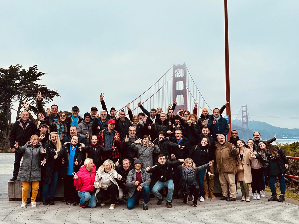
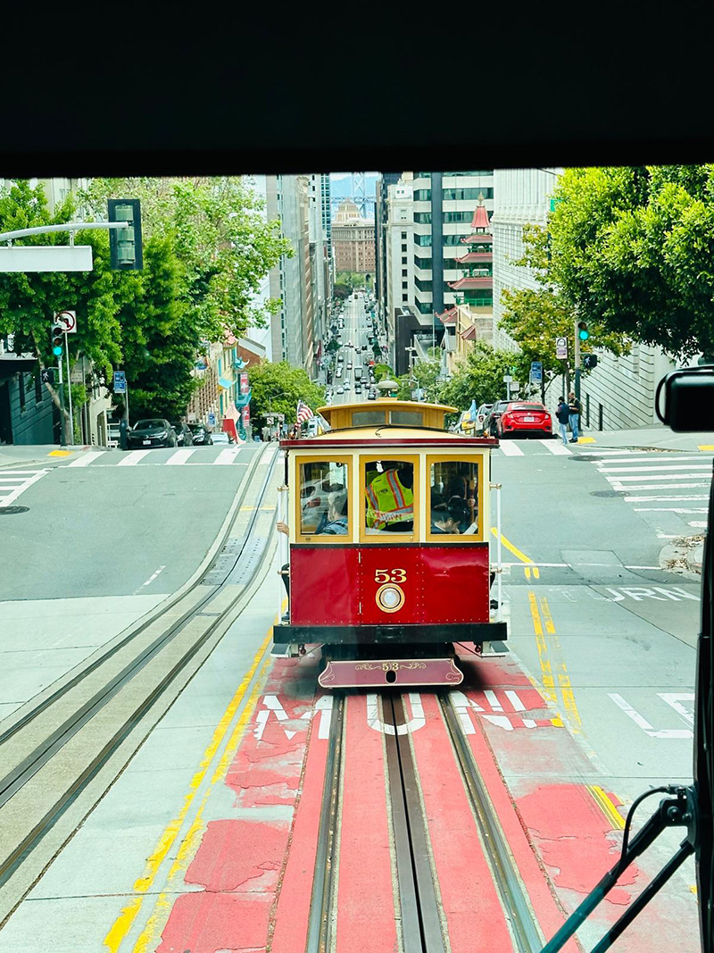
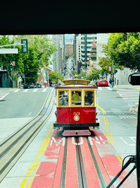
Our programs combine the stadium experience with exploring the region: strolls along Venice Beach, a visit to the Golden Gate, a road trip along Route 1, an evening in Napa Valley’s wineries, or immersion in San Francisco’s iconic neighborhoods. The World Cup is the perfect pretext for an unforgettable California trip.
Contact us to build together the ideal itinerary for your clients:
Revamerica Tours, a US-based incoming DMC, is committed to meeting the needs of agencies and tour operators by offering high-quality products at accessible prices to reveal to travelers the positive emotions and the finest travel memories.

















 To give substance to this ambition, Voyages d’Exception has relied for nearly ten years on Sophie Lemonnier-Wallez, a violinist and the artistic director of these programs.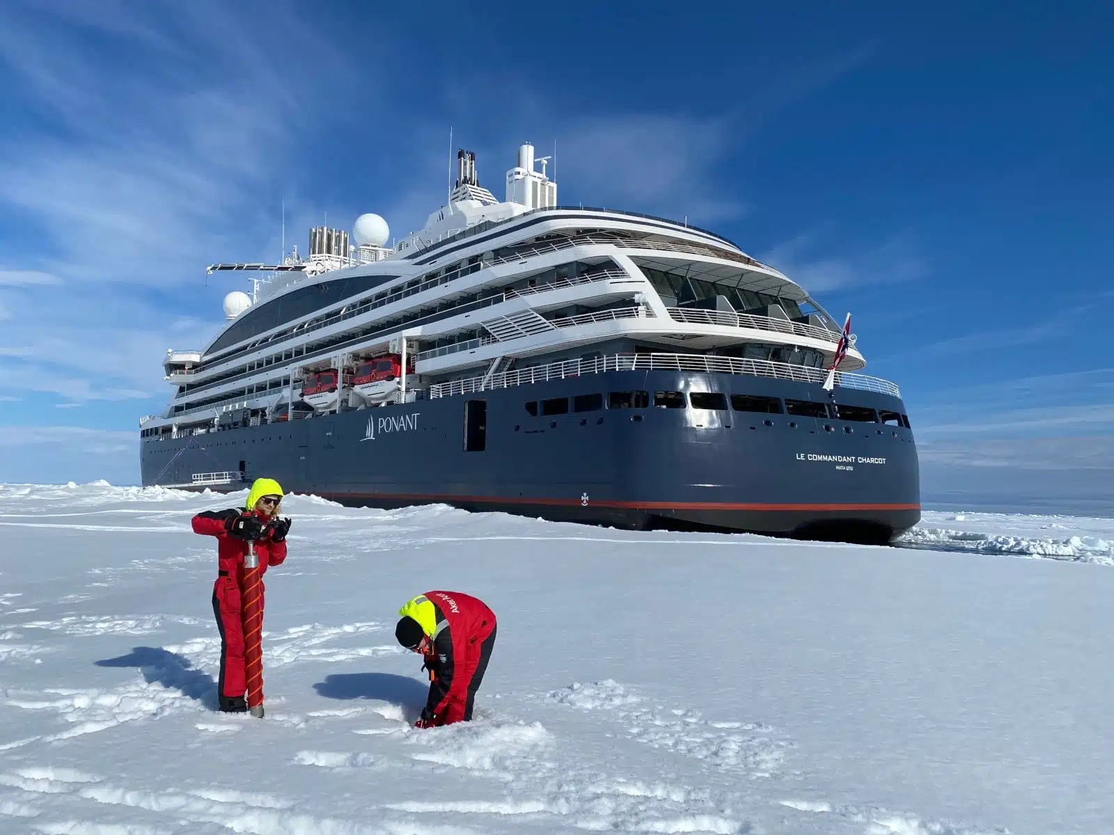



 Published by Laurent Guéna